The rtd method of determining the result of arbitrary coordinate system based on ntrip
A technology of coordinate system and target coordinate system, which is applied in the field of geodetic surveying and satellite navigation, and can solve the problems of high user quality requirements, large field workload, and inappropriate RTD.
- Summary
- Abstract
- Description
- Claims
- Application Information
AI Technical Summary
Problems solved by technology
Method used
Image
Examples
Embodiment Construction
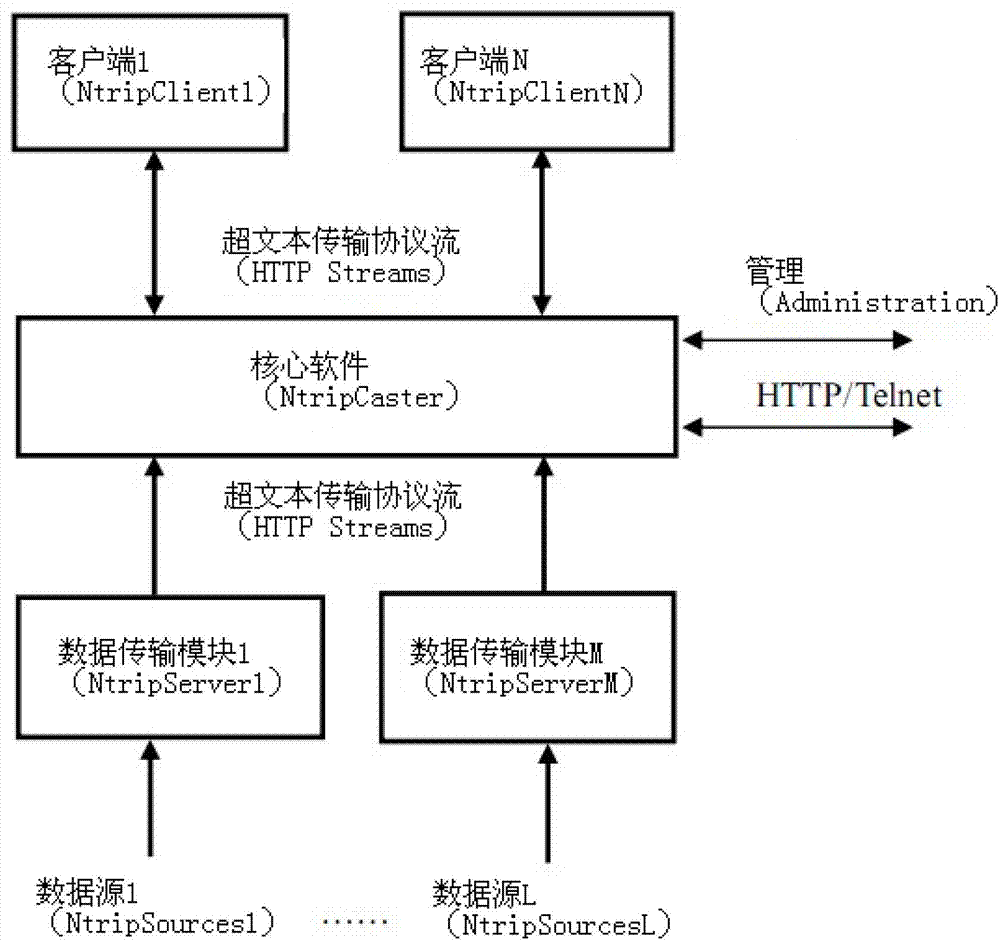
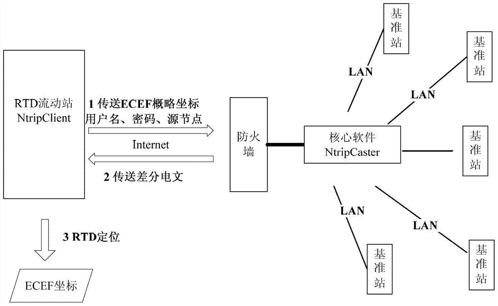
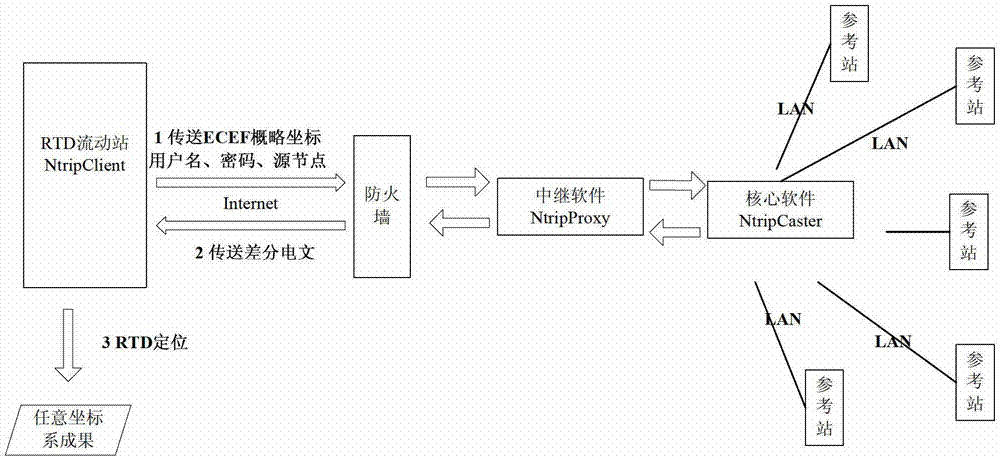
[0075] The arbitrary coordinate system described in the present invention includes arbitrary ECEF (such as WGS84, ITRS, PE-90, CGCS2000, etc.), arbitrary ginseng coordinate system (such as 1954 Beijing coordinate system, 1980 Xi'an coordinate system, new 1954 Beijing coordinate system, etc.) and Any elevation system (such as Baltic Sea elevation, Wusong elevation system, Guangzhou elevation, Pearl River elevation, 1956 Yellow Sea elevation system, 1985 national elevation datum, geodetic height, etc.) is implemented in the same way. The technical solution of the present invention will be described in detail below in conjunction with the drawings and embodiments.
[0076] In the example, a certain province has established a CORS system with 100 reference stations. NtripCaster uses the GPSNet software developed by Trimble, and the directly measured coordinates belong to WGS84, and the conversion parameters from WGS84 to ginseng coordinate system coordinates are top secret. The ce...
PUM
 Abstract
Description
Claims
Application Information
 - R&D
- Intellectual Property
- Life Sciences
- Materials
- Tech Scout
- Unparalleled Data Quality
- Higher Quality Content
- 60% Fewer Hallucinations
Browse by: Latest US Patents, China's latest patents, Technical Efficacy Thesaurus, Application Domain, Technology Topic, Popular Technical Reports.
© 2025 PatSnap. All rights reserved.Legal|Privacy policy|Modern Slavery Act Transparency Statement|Sitemap|About US| Contact US: help@patsnap.com


