
A Local Decryption and Restoration Method of GIS Vector Data

A technology of vector data and recovery method, which is applied in the field of geographic information security, and can solve problems such as difficult to satisfy precise transformation of control points, uniform asymptotic transformation, and tight support of deformed regions

Inactive Publication Date: 2017-01-25
NANJING NORMAL UNIVERSITY
View PDF3 Cites 0 Cited by
  • Summary
  • Abstract
  • Description
  • Claims
  • Application Information

AI Technical Summary

Problems solved by technology

Existing local decryption models usually use a block model, which divides a large-scale map into small areas, and then uses polynomial or rubber-sheet transformation models for local processing. Generally, it is difficult to meet the requirements of precise transformation of control points, uniform asymptotic transformation and deformed regions. Tightly support three requirements

Method used


Image

  • A Local Decryption and Restoration Method of GIS Vector Data
  • A Local Decryption and Restoration Method of GIS Vector Data
  • A Local Decryption and Restoration Method of GIS Vector Data

Examples


Embodiment Construction

[0055] The present invention will be described in further detail below in conjunction with the accompanying drawings and embodiments.

[0056] In this embodiment, the shapefile format vector data is selected, and the data is read, decrypted and restored, and the present invention is further described in detail. This embodiment selects the shapefile surface layer data (such as Figure 4 ) as the original vector data.

[0057] (1) Key generation process

[0058] Step 11: Determine the decryption range, input the minimum circumscribed rectangle RECTANGLE of the decryption area, the coordinates of the lower left corner of RECTANGLE are (164417.097000, 162667.721400), the coordinates of the upper right corner are (171415.635650, 167846.074000), and the length of the data in the X direction XL = 6998.53865m, Y direction Length YL=5178.3526m;

[0059] Step 12: Input 6 sets of source control points and target control points;

[0060] Step 13: Determine the influence radius R of ea...


PUM


Abstract

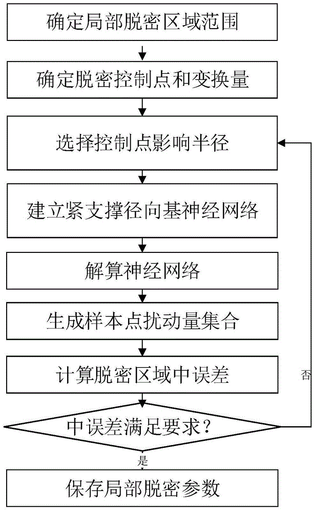
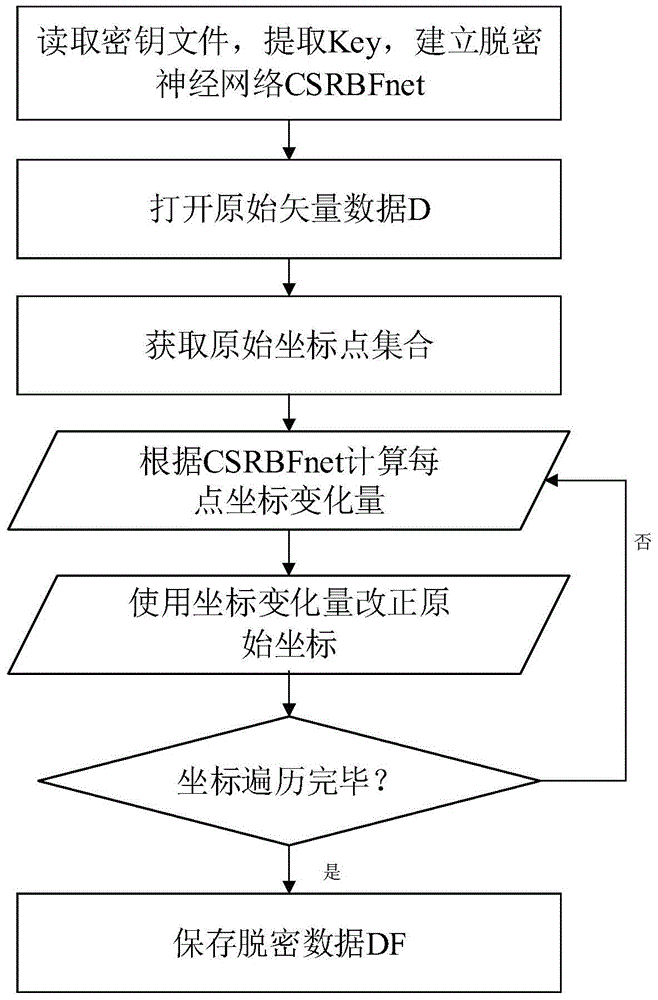
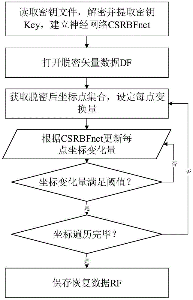
The invention discloses a graphic information system (GIS) vector data local decryption and restoring method which includes the following process: (1) calculating decryption parameters through a local decryption control point and iterating the parameters to control errors in a decryption area; (2) conducting decryption on local elements according to local decryption parameters; (3) restoring the decrypted local elements through the local decryption parameters. The method has the advantages of gradual local decryption transformation, accurate transformation of the decryption control point and decryption area close support, and can meet the requirement for GIS vector data local decryption processing for external issuing and use.

Description

technical field [0001] The invention belongs to the field of geographic information security, and in particular relates to a local decryption and restoration method of GIS vector data. Background technique [0002] "Regulations on the Scope of State Secrets in Surveying and Mapping Management", "Supplementary Regulations on the Display of Public Map Contents (Trial)" and "Regulations on the Public Display of Basic Geographic Information (Trial)" on the restrictions and confidentiality of public maps and geographic information Provisions have been made, and special emphasis has been placed on the confidentiality of the spatial location accuracy of basic geographic information and related elements. [0003] Ordinary facilities and sensitive facilities have different point accuracy index requirements. The local geometric accuracy declassification of local sensitive elements needs to be precisely declassified to the target position to meet the point accuracy requirements. In a...

Claims


Application Information

Patent Timeline
Patent Type & Authority Patents(China)
IPC IPC(8): G06F21/60
CPCG06F21/6209
Inventor 周卫储征伟李彬彬
Owner NANJING NORMAL UNIVERSITY
Learn More