
Design method for enhancing seismic waves to stimulate illumination
A design method and excitation lighting technology, applied in the direction of seismic signal processing, etc., can solve the problem of not substantially improving the lighting energy of the target geological body
- Summary
- Abstract
- Description
- Claims
- Application Information
AI Technical Summary
Problems solved by technology
Method used
Image


Examples
Embodiment Construction
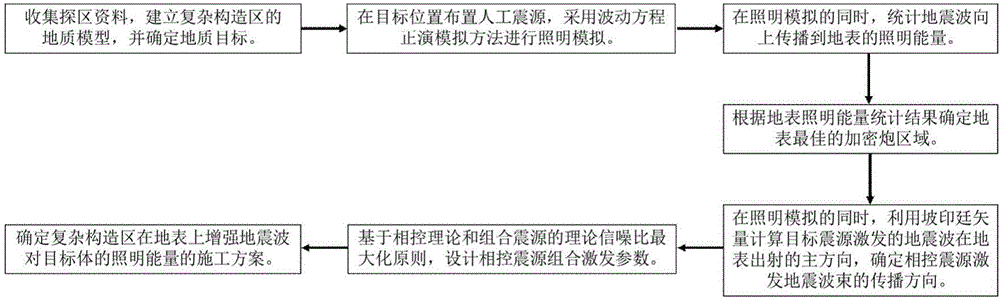
[0045] Such as figure 1 As shown in Fig. 1, a design method for enhancing seismic wave excitation illumination, using phase control theory and the principle of maximizing the theoretical signal-to-noise ratio of combined sources as the design criteria for source combination parameters, that is, the design criteria for the group distance and the number of sources, and other The improved optimal design standard belongs to the same series of this method; it is not limited to the situation of horizontal surface, and can be applied to areas with complex surface and complex structure; the specific steps are as follows:
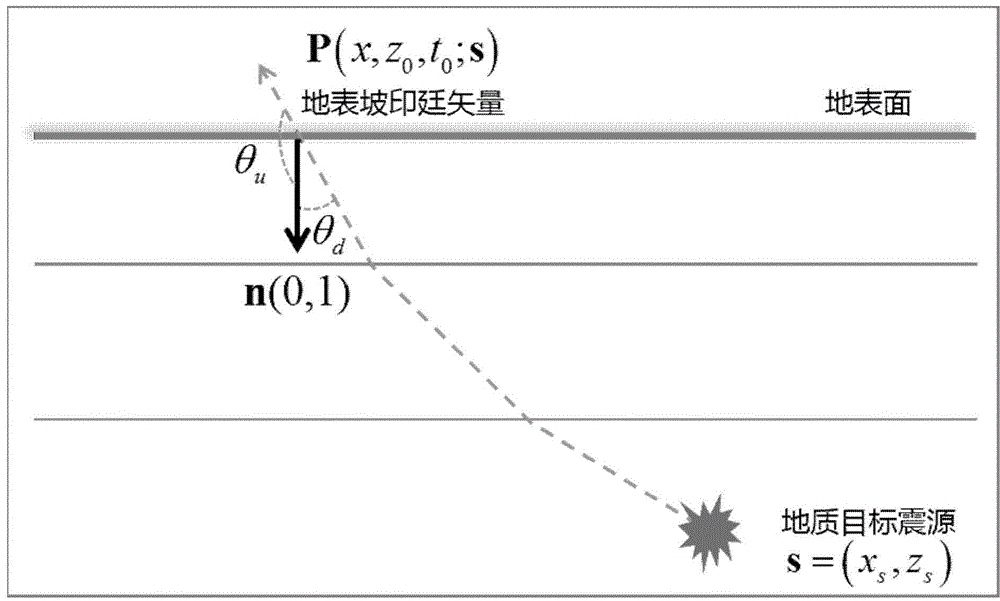
[0046] A. Based on the existing data, establish the forward modeling geological model of the complex structural area, and determine the geological target; collect the geological data, seismic data, logging and drilling data of the work area, and synthesize the known interpretation results and geological understanding, through The modeling software establishes an acc...
PUM
 Abstract
Description
Claims
Application Information