
Non-stationary multi-point geostatistical modeling method based on anisotropy

A geostatistical and anisotropic technology, applied in the field of ASNSIM, a non-stationary multi-point geostatistical modeling method, can solve problems such as large differences in zoning

Inactive Publication Date: 2019-03-26
YANGTZE UNIVERSITY
View PDF2 Cites 0 Cited by
  • Summary
  • Abstract
  • Description
  • Claims
  • Application Information

AI Technical Summary

Problems solved by technology

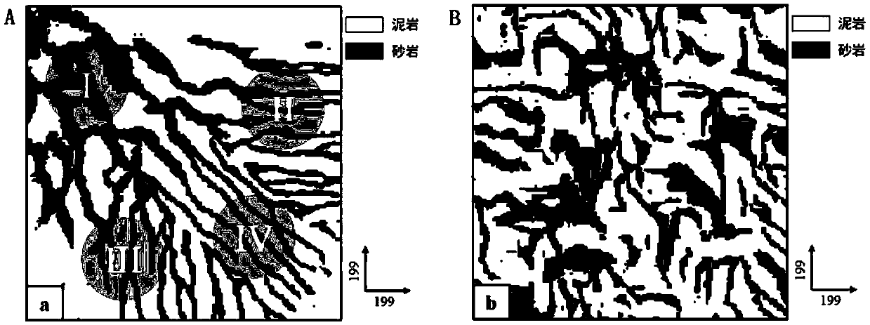
This method solves the problem that "non-stationary training images are difficult to directly perform multi-point geological statistical modeling". The proposed method can automatically partition the non-stationary area. Region-specific simulation

Method used


Image

  • Non-stationary multi-point geostatistical modeling method based on anisotropy
  • Non-stationary multi-point geostatistical modeling method based on anisotropy
  • Non-stationary multi-point geostatistical modeling method based on anisotropy

Examples


Embodiment Construction

[0050] In order to better explain the present invention, the main content of the present invention is further clarified below in conjunction with specific examples, but the content of the present invention is not limited to the following examples.

[0051] In order to understand the present invention well, relevant terms are explained below:

[0052]1. Grid unit (C-Cell): a rectangular cubic unit with a specified length (ISize), width (JSize), and height (KSize) along the X, Y, and Z directions. The grid unit stores specific numerical representations its properties.

[0053] 2. Grid (G-Grid): A three-dimensional structure composed of many grid units C. The dimensions in the X direction, Y direction and Z direction are I×J×K, and the essence is a three-dimensional matrix. The meaning of G(i, j, k) is the grid unit whose index in the X direction is equal to i, the index in the Y direction is equal to j, and the index in the Z direction is equal to k.

[0054] 3. Training image...


PUM


Abstract

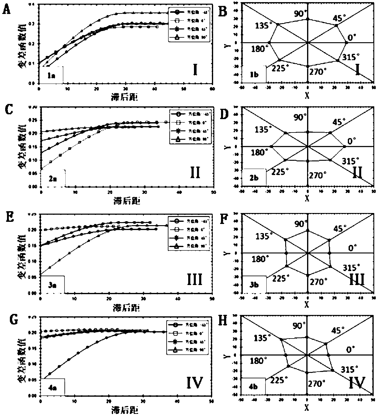
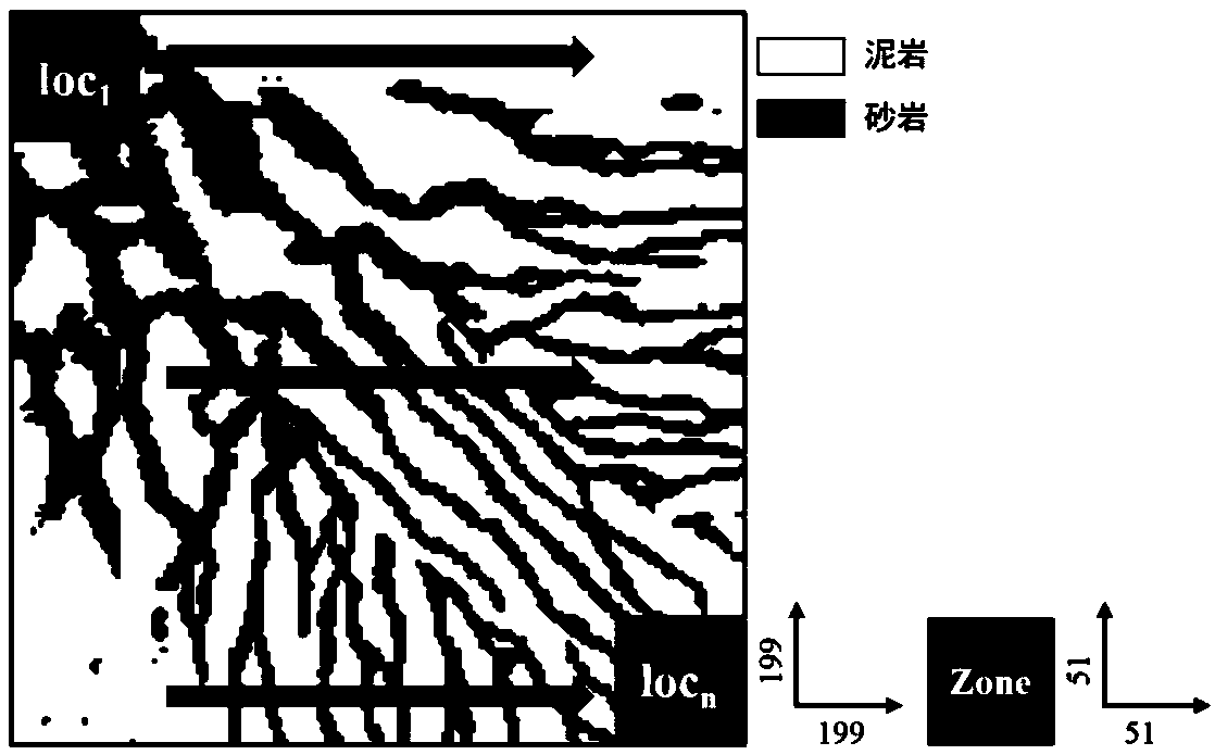
The invention discloses a non-stationary modeling method based on anisotropy, which quantitatively characterizes the local anisotropy of the training image by using the rose diagram of the range combination of variogram functions in different directions, and combines classical multidimensional scale analysis and K-means aggregation The class analysis automatically partitions the non-stationary training image, and each sub-region is independent of each other. The traditional stationary multi-point modeling algorithm is used to simulate the partition, and the non-stationary modeling is finally realized. Therefore, compared with the SIMPAT algorithm, the present invention can make good use of non-stationary training images for multi-point geostatistical modeling.

Description

technical field [0001] The present invention relates to the field of multi-point geostatistics, in particular to ASNSIM (Non-stationary Simulation based on Segmentation using Anisotropy), an anisotropy-based non-stationary multi-point geostatistical modeling method. Background technique [0002] The theoretical basis of geostatistics is the assumption of stationarity, that is, the mean and variance of regionalized variables satisfy spatial stationarity and have nothing to do with location. The training images based on the stationarity assumption should be stable, i.e. the spatial variability is independent of the spatial position. However, in the actual nature, due to changes in structure, water advance / retreat, and provenance, the sedimentary system develops in a non-stationary direction. Typical types of non-stationary sedimentary facies include alluvial fans and braided river delta depositional systems. [0003] Multi-point geostatistics is a popular geostatistical model...

Claims


Application Information

Patent Timeline
Patent Type & Authority Patents(China)
IPC IPC(8): G06F17/50G06K9/62G06T7/00
CPCG06F30/20G06F18/22G06F18/214
Inventor 喻思羽李少华段太忠王鸣川
Owner YANGTZE UNIVERSITY
Learn More