A 3D surface deformation monitoring and calculation method for industrial and mining areas fused with multi-source SAR images

A technology of surface deformation and imaging, applied in the direction of measuring devices, radio wave measuring systems, instruments, etc., can solve the problems of impact decoherence, exceeding the monitoring ability, etc., achieve measures to prevent geological disasters, reduce costs and technical limitations, and broaden application prospects Effect

Active Publication Date: 2018-09-25
SHANDONG UNIV OF SCI & TECH
View PDF4 Cites 0 Cited by
  • Summary
  • Abstract
  • Description
  • Claims
  • Application Information

AI Technical Summary

Problems solved by technology

However, affected by parameters such as SAR image wavelength, incident angle, and ground resolution, InSAR technology only has the ability to monitor deformation within a certain range of deformation gradients.
As the surface of industrial and mining areas undergoes different degrees of surface deformation as mining progresses, it may reach the meter level in a short period of time, which seriously exceeds the monitoring capability of conventional InSAR technology based on differential interferometric phase information, resulting in SAR impact decoherence
Secondly, InSAR technology can only obtain one-dimensional or two-dimensional surface deformation information, rather than a three-dimensional deformation field that directly and comprehensively reflects the characteristics of surface deformation.

Method used


Image

  • A 3D surface deformation monitoring and calculation method for industrial and mining areas fused with multi-source SAR images
  • A 3D surface deformation monitoring and calculation method for industrial and mining areas fused with multi-source SAR images
  • A 3D surface deformation monitoring and calculation method for industrial and mining areas fused with multi-source SAR images

Examples


Embodiment Construction

[0065] Basic principle of the present invention is:

[0066] By using a variety of InSAR technologies to process multi-source SAR images covering the same research area, the multiple InSAR technologies are fused to obtain multi-directional surface deformation information in the area, and the multi-source monitoring results are further fused to solve the three-dimensional surface deformation.

[0067] Below in conjunction with accompanying drawing and specific embodiment the present invention is described in further detail:

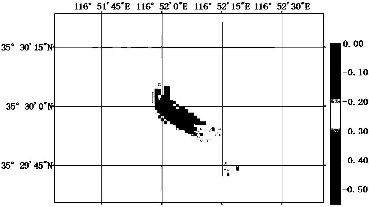
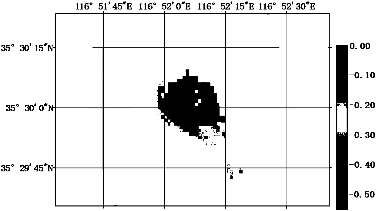
[0068] combine figure 1 As shown, a method for monitoring and solving three-dimensional surface deformation in industrial and mining areas fused with multi-source SAR images includes the following steps:

[0069] a Obtain the coherence map of the interferometric pair of multi-source SAR images. The specific method of obtaining is:

[0070] After performing imaging and multi-view processing on the collected multi-source SAR images covering the research a...


PUM


Abstract

The invention discloses a method for monitoring and calculating three-dimensional surface deformation of an industrial and mining area fused with multi-source SAR images. Based on the SAR image data of different orbits before and after deformation, the method obtains the deformation information of different radar satellite line-of-sight upwards by integrating D-InSAR technology and Offset-tracking technology, and obtains the deformation information of different radar satellites in azimuth direction by integrating MAI technology and Offset-tracking technology , on this basis, considering the difference in monitoring accuracy of deformation information in the line of sight and azimuth direction, the weight is determined by means of Helmert variance component estimation, and the three-dimensional surface deformation conversion model is established and solved to obtain the three-dimensional deformation field of the industrial and mining area. The invention can solve the problem that the InSAR technology is easily limited by factors such as loss of coherence and small deformation gradient when monitoring the surface deformation in industrial and mining areas; secondly, the real deformation of the ground surface can be more comprehensively monitored through multi-source SAR images.

Description

technical field [0001] The invention relates to a monitoring and solving method for three-dimensional surface deformation in an industrial and mining area fused with multi-source SAR images. Background technique [0002] Surface deformation in industrial and mining areas seriously endangers ground construction facilities and the natural environment, and affects human living environment, life and property safety, and local economic development. Comprehensive monitoring of surface deformation in mining areas and in-depth study of deformation formation mechanism and change law are of great significance for rational exploitation of underground mineral resources and control of sustainable development of industrial and mining areas. [0003] The traditional geodetic leveling and GPS monitoring of the surface deformation of the mining area all obtain the deformation information of a point. With the development of surveying and mapping methods and the further expansion of the applic...

Claims


Application Information

Patent Timeline
Patent Type & Authority Patents(China)
IPC IPC(8): G01S13/90
CPCG01S13/9023
Inventor 王志伟于胜文陶秋香刘国林高腾飞
Owner SHANDONG UNIV OF SCI & TECH
Why Eureka
Try Eureka