Method for annotating electronic map through photograph collection having position information

A position information and electronic map technology, which is applied in the direction of electronic digital data processing, special data processing applications, instruments, etc., can solve the problems of poor modifiability of marked objects, weak sense of position of electronic maps, and confusing positions of marked objects. Intuitive process, strong generalization, and the effect of eliminating errors

Active Publication Date: 2009-07-15
BEIJING BAIDU NETCOM SCI & TECH CO LTD
View PDF3 Cites 0 Cited by
  • Summary
  • Abstract
  • Description
  • Claims
  • Application Information

AI Technical Summary

Problems solved by technology

[0003] The existing electronic map labeling method is: select a certain position on the electronic map, and input the labeling object information for labeling. If the disadvantages are: 1) the original electronic map has a weak sense of location, and it is difficult for users to find the location on the map. Position and mark the exact position of the marked object. If the user wants to mark the main entrance of Pudong Software Park on Guoshoujing Road between Jinke Road and Juli Road, the user can only roughly locate a certain position; 2) due to The location of the marked object represents the position of the actual object on the electronic map. There is a certain positional relationship between the marked objects, and the behavior of the post-marker is affected by the previous mark-up behavior. For example, the main entrance of the software park has been marked 1), other users know that the location of Keyuan Sub-branch of Zhangjiang Sub-branch of China Construction Bank (mark 2) is diagonally opposite to the main entrance of the software park, that is, the location on the right is closer to Jinke Road. Put it on the right side of Mark 1. If the position of Mark 1 is wrong, it will affect the position of Mark 2. In particular, when there are many marked positions on the same street, it will cause obvious marking errors. In addition, assuming that the user When marking other marked objects, if you do not refer to the position of the aforementioned marked objects, each user will have a different grasp of the position sense, which will cause the position of the marked object to be confused. For example, mark 3 is originally between mark 1 and mark 2. The map becomes a place far away from the mark 1 and mark 2; 3) The modifiability of the marked object is poor. After marking on the map, if it is found that the position of a certain marked object is incorrect, when modifying it, It is necessary to correct other markings made by other users referring to the wrong marking position, the workload is huge, cumbersome and not operable

Method used


Image

  • Method for annotating electronic map through photograph collection having position information
  • Method for annotating electronic map through photograph collection having position information
  • Method for annotating electronic map through photograph collection having position information

Examples


Embodiment Construction

[0018] specific implementation plan

[0019] In order to make the technical means, creative features, goals and effects achieved by the present invention easy to understand, the present invention will be further described below in conjunction with specific embodiments.

[0020] The present invention is a method for marking an electronic map through a picture set with location information. Interference, facilitate the promotion of labeling, so as to develop the electronic map information base, so that network users can query the data they care about more conveniently and quickly.

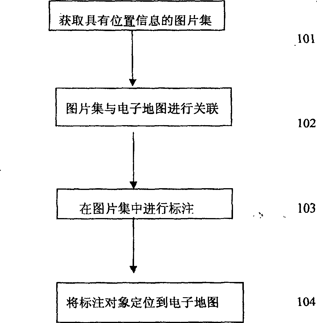
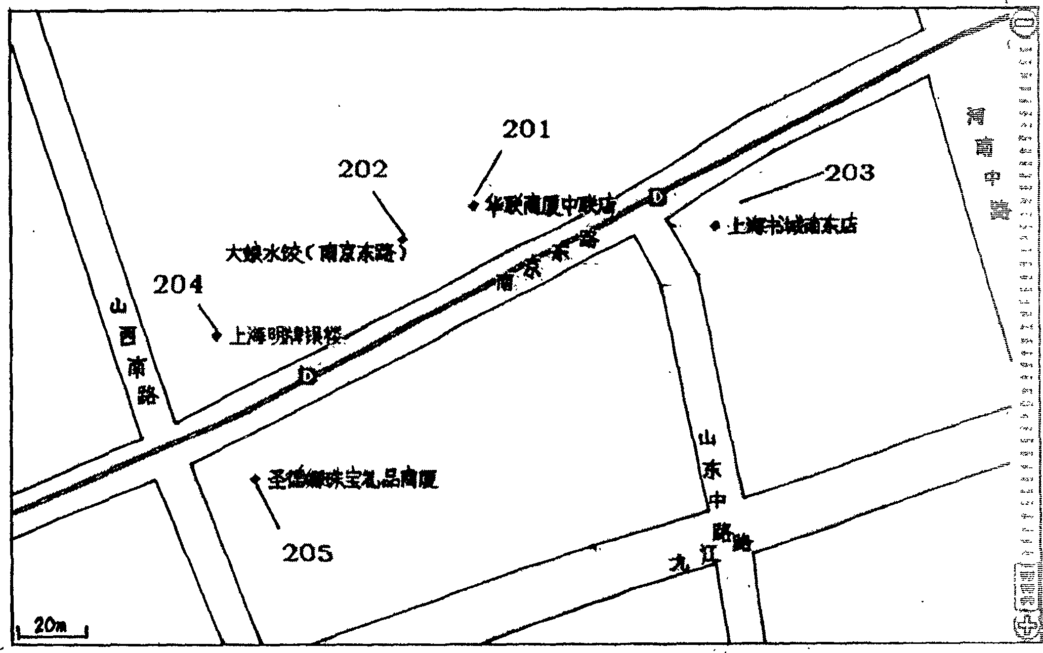
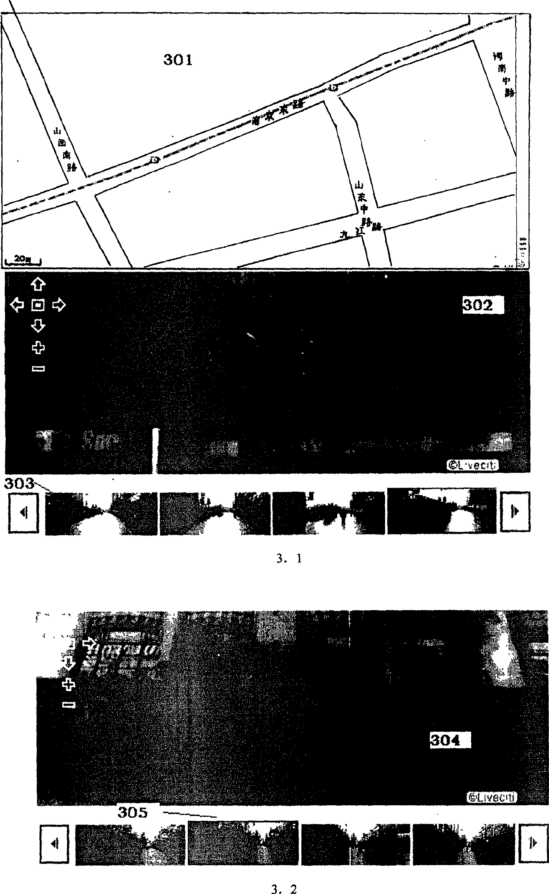
[0021] figure 1 The main flow diagram of the present invention is given. Among them, 101 is to obtain a collection of pictures with location information. The pictures reflect the real environment represented by the map. The sources of the pictures include but are not limited to photos collected by cameras, images or continuous pictures collected by cameras, and pictures or videos collected by speci...


PUM


Abstract

The invention discloses and provides a method for marking an electronic map through a picture set with location information, comprising the following steps: obtaining a picture set with location information, and associating the picture set with the electronic map through the position information of the pictures in the picture set ; Find the object to be marked in the picture set and make a mark; locate the marked object in the electronic map. The invention of labeling on the picture in the present invention enables the user to find the object to be labelled very intuitively and label it, and associate it with the electronic map through the location information, thereby eliminating labeling errors caused by directly labeling on the electronic map , which greatly reduces the threshold and difficulty of labeling and facilitates promotion.

Description

technical field [0001] The invention relates to a method for marking related information on an electronic map, in particular to a method for marking an electronic map through a picture set with position information. Background technique [0002] In the past one or two years, electronic maps, especially map search services, have become a popular search service recently. Traditional search service giants such as google, msn, yahoo, sina, and baidu have all launched their own electronic map search services. The core is electronic map data, such as the location of restaurants, shopping malls, hospitals and other living facilities, telephone numbers, related information, etc., because this part of the data does not have geographic information, it is difficult to locate it directly on the electronic map through programs. An existing A better solution is to disclose the relevant interfaces of the electronic map, and develop the majority of network users to mark their familiar livin...

Claims


Application Information

Patent Timeline
Patent Type & Authority Patents(China)
IPC IPC(8): G06F17/30
Inventor 刘小华
Owner BEIJING BAIDU NETCOM SCI & TECH CO LTD
Why Eureka
Try Eureka