A network RTK instantaneous positioning method based on the combination of Beidou three-bandwidth lanes
A positioning method and network technology, applied in the field of global navigation satellite system satellite positioning, can solve problems affecting the timeliness and continuity of network RTK positioning, unable to be fixed for a long time, and long initialization time of the user terminal, etc.
- Summary
- Abstract
- Description
- Claims
- Application Information
AI Technical Summary
Problems solved by technology
Method used
Image
Examples
Embodiment
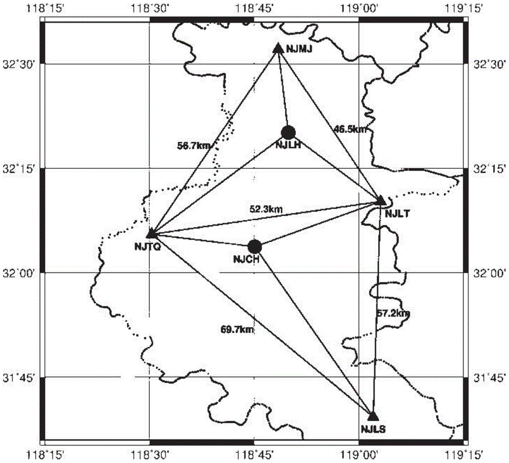
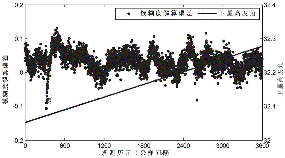
[0060] Example: such as figure 2 The network diagram of reference stations shown is based on the observation data of 6 reference stations in the first phase of the Beidou ground-based augmentation system project in Jiangsu Province at 1:00-2:00 UTC on May 6, 2014 for experimental calculation. The reference stations all contain BDS / GPS / GLONASS three-system data and the Beidou system contains three frequency point data. In the experimental calculation, the four stations NJMJ, NJTQ, NJLS and NJLT are used as reference stations to form two triangular calculation units, and the two stations NJLH and NJCH are used as user stations to conduct dynamic calculation experiments. The experiment adopts network RTK technology The commonly used VRS mode in There are 9 Beidou satellites available in this period, and the C09 satellite with the largest average elevation angle in the period is used as the reference satellite.
[0061] (0,-1,1) and (1,-1,0) combined ambiguities of two user sta...
PUM
 Abstract
Description
Claims
Application Information
 - R&D
- Intellectual Property
- Life Sciences
- Materials
- Tech Scout
- Unparalleled Data Quality
- Higher Quality Content
- 60% Fewer Hallucinations
Browse by: Latest US Patents, China's latest patents, Technical Efficacy Thesaurus, Application Domain, Technology Topic, Popular Technical Reports.
© 2025 PatSnap. All rights reserved.Legal|Privacy policy|Modern Slavery Act Transparency Statement|Sitemap|About US| Contact US: help@patsnap.com


