
Method and system of navigation

A navigation method and technology of a navigation system, applied in the application field of electronic maps, can solve the problems of users being unable to determine the actual direction of the current location, trouble, and weak sense of direction, and achieve the effect of fast and accurate navigation services and high application value.

Active Publication Date: 2016-02-24
GUANGDONG OPPO MOBILE TELECOMM CORP LTD
View PDF7 Cites 5 Cited by
  • Summary
  • Abstract
  • Description
  • Claims
  • Application Information

AI Technical Summary

Problems solved by technology

[0003] Although most of the current electronic maps have navigation functions, they can only plan the route and provide the direction of the route. The user cannot determine the actual direction of the current location, and must repeatedly find the correct direction according to the position of the map. Strong users are even more challenging, so there are still many problems when using the navigation function of the existing electronic map

Method used


Image

  • Method and system of navigation
  • Method and system of navigation
  • Method and system of navigation

Examples


Embodiment Construction

[0023] The content of the present invention will be further described in detail below in conjunction with preferred embodiments and accompanying drawings. Apparently, the embodiments described below are only used to explain the present invention, not to limit the present invention. Based on the embodiments of the present invention, all other embodiments obtained by persons of ordinary skill in the art without making creative efforts belong to the protection scope of the present invention. It should be noted that the navigation devices described in the embodiments of the present invention may include: mobile phones and tablet computers equipped with electronic maps, etc. The above navigation devices are only examples, not exhaustive, including but not limited to the above navigation devices. In addition, it should be noted that, for the convenience of description, only parts related to the present invention are shown in the drawings but not all content.

[0024] figure 1 It i...


PUM


Abstract

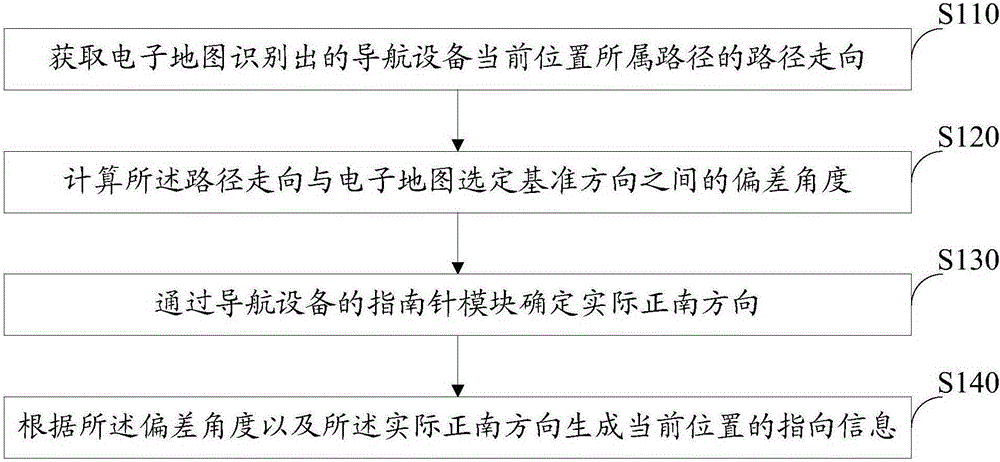
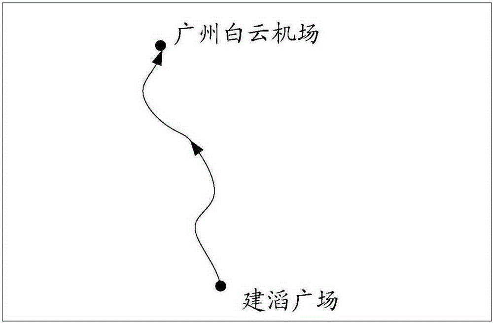
The invention relates to a method and system of navigation. The method comprises: obtaining the direction of the path which belongs to a current position of a navigation device recognized by an electronic map; calculating the path from a start point to a destination point and generating the path direction according to the information of the start point and destination point by the electronic map; calculating a deviation angle between the path direction and the reference direction selected by the electronic map; determining the real due south direction by a compass module of the navigation device; and generating the directional information at present position according to the deviation angle and the real due south direction. The method and system of navigation can fully use the path of the present electronic map and the calculating function of the path direction, determine the real due south direction by the compass module, effectively combine the electronic map and the function of the compass module to obtain the real direction, provide the rapid and accurate navigation service for the users, save time of finding the real direction repeatedly according to the electronic map by the users, and have great benefit for the users having poor direction-sense especially.

Description

technical field [0001] The invention relates to the application field of electronic maps, in particular to a navigation method and system. Background technique [0002] Electronic map (Electronic map), that is, digital map, is a map that is stored and consulted digitally using computer technology. The method of storing information in electronic maps generally uses vector image storage. The scale of the map can be enlarged, reduced or rotated without affecting the display effect. In the early days, bitmap storage was used, and the scale of the map cannot be enlarged or reduced. Modern electronic map software generally uses geographical information systems to store and transmit map data, and other information systems. Electronic maps can be used to find various places and locations, and can also find some travel routes and realize navigation through the map. Navigation is the method of guiding a device from one point to another on a specified course. With the development of...

Claims


Application Information

Patent Timeline
Patent Type & Authority Applications(China)
IPC IPC(8): G01C21/00
CPCG01C21/005
Inventor 伏奎
Owner GUANGDONG OPPO MOBILE TELECOMM CORP LTD
Learn More