

Urban greening quantity digital map manufacturing and displaying method
A technology of urban green quantity and digital map, which is applied in electronic digital data processing, still image data in vector format, structured data retrieval, etc., to achieve the effects of reducing manual calculation workload, realizing visual monitoring management, and improving work efficiency
- Summary
- Abstract
- Description
- Claims
- Application Information
AI Technical Summary
Problems solved by technology
Method used
Image

Examples
Embodiment Construction
[0045] The present invention will be further explained below in conjunction with the accompanying drawings and specific embodiments. It should be understood that these embodiments are only used to illustrate the present invention and are not intended to limit the scope of the present invention. After reading the present invention, those skilled in the art all fall into the appended claims of the present application to the amendments of various equivalent forms of the present invention limited range.
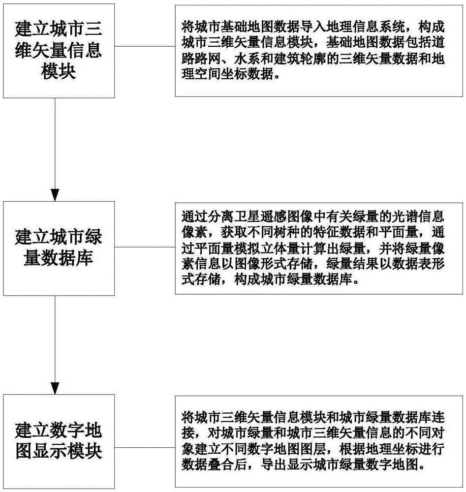
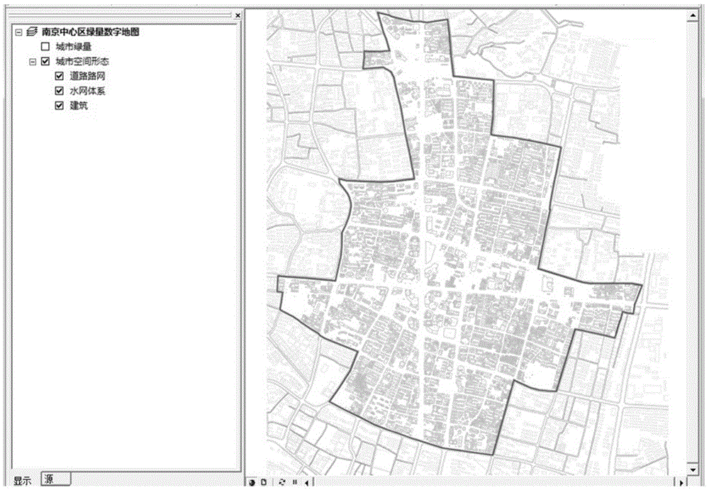
[0046] Such as figure 1 As shown, a method for making and displaying a digital map of urban green quantity disclosed in an embodiment of the present invention mainly includes the following steps:
[0047] 1) Establish a three-dimensional vector information module for the city.
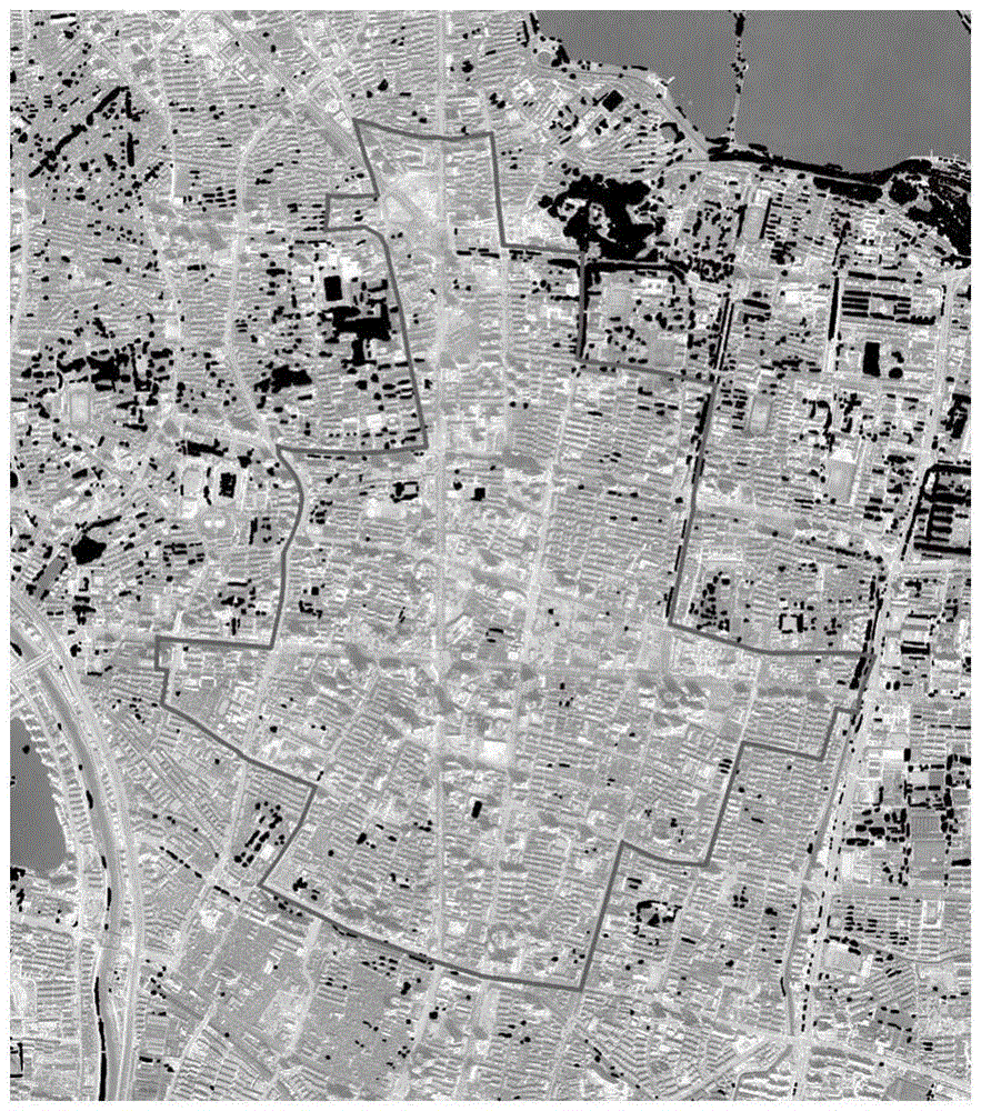
[0048] The basic map data of the city is imported into the geographic information system to form a three-dimensional vector information module of the city. The basic map data here includes three-dimension...
PUM
 Abstract
Description
Claims
Application Information