

Method and device for mapping a delivery area
A technology of area and location, applied in data processing applications, instruments, maps/plans/charts, etc., can solve problems such as low efficiency, poor accuracy, and high labor costs
- Summary
- Abstract
- Description
- Claims
- Application Information
AI Technical Summary
Problems solved by technology
Method used
Image

Examples
Embodiment Construction
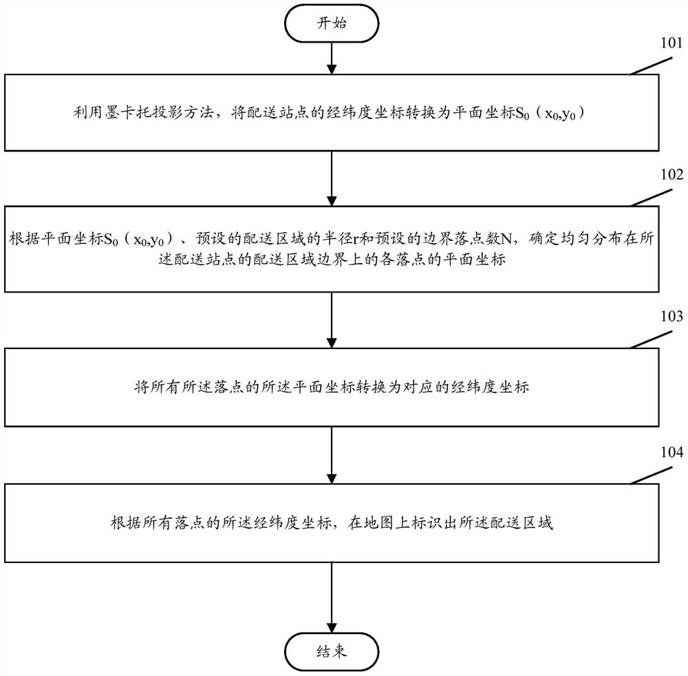
[0021] In order to make the purpose, technical solution and advantages of the present invention clearer, the present invention will be further described in detail below in conjunction with the accompanying drawings and specific embodiments.
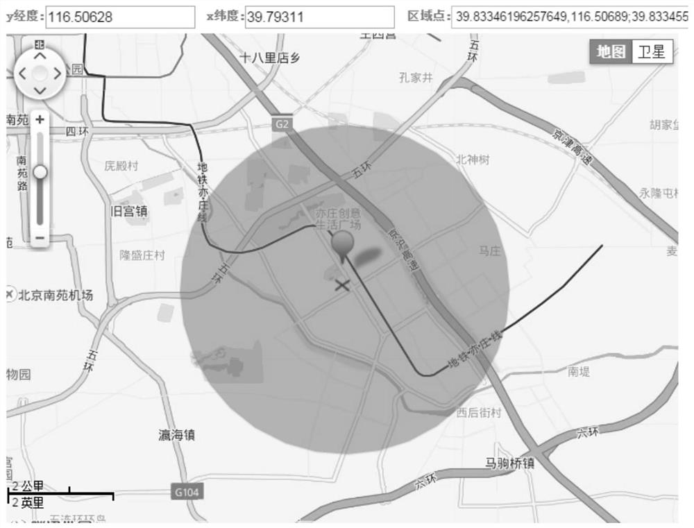
[0022] The core idea of the present invention is: based on the longitude and latitude coordinates of the delivery site and the radius of the configuration area, the Mercator projection method is used to obtain the plane coordinates of each drop point on the boundary of the corresponding delivery area, and then these plane coordinates are converted into corresponding The longitude and latitude coordinates, according to the obtained longitude and latitude coordinates of each drop point, the boundary of the delivery area and the area within the boundary range can be marked on the map. In this way, the delivery area of the delivery site can be drawn automatically, efficiently and accurately.
[0023] figure 1 It is a schematic flow diagr...
PUM
 Abstract
Description
Claims
Application Information