A Ship Operation Map Projection System for Combat Navigation Plotting

A projection system and plotting technology, applied in the field of nautical plotting, can solve the problems of less target information, poor intuition of the movement of enemies and friends, information reliability, and untimely update, etc. simple structure

Active Publication Date: 2019-02-05
TIANJIN NAVIGATION INSTR RES INST
View PDF4 Cites 0 Cited by
  • Summary
  • Abstract
  • Description
  • Claims
  • Application Information

AI Technical Summary

Problems solved by technology

Due to the lack of information reliability and untimely update of electronic charts (navigation workbench) compared with paper charts, there is little target information on the ship control chart, which cannot well reflect the maneuvering situation of the ship, and the intuitive comparison of judging the movement of the enemy and us Poor, cannot effectively support combat navigation operations

Method used


Image

  • A Ship Operation Map Projection System for Combat Navigation Plotting
  • A Ship Operation Map Projection System for Combat Navigation Plotting
  • A Ship Operation Map Projection System for Combat Navigation Plotting

Examples


Embodiment Construction

[0013] Embodiments of the present invention are described in further detail below in conjunction with the accompanying drawings:

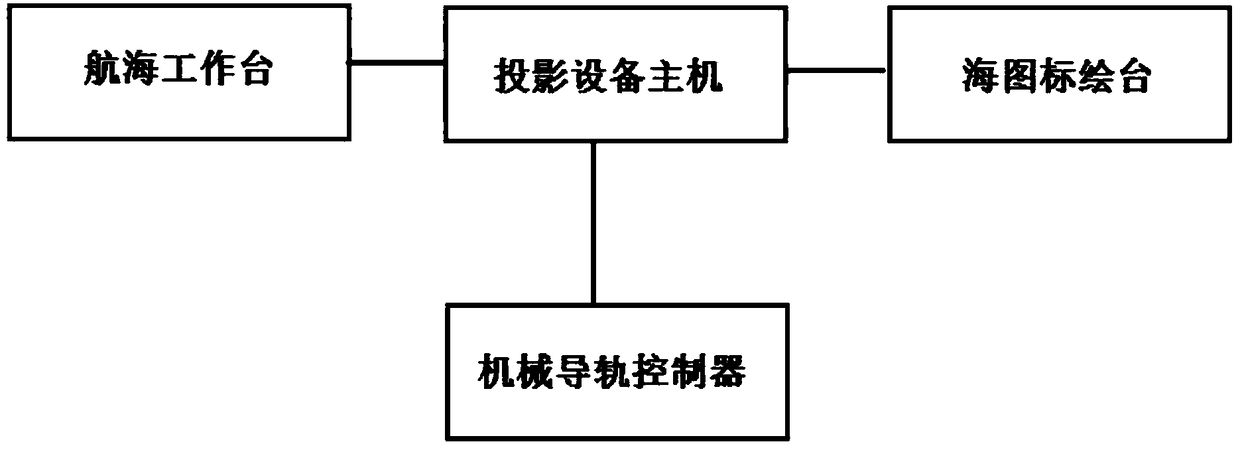
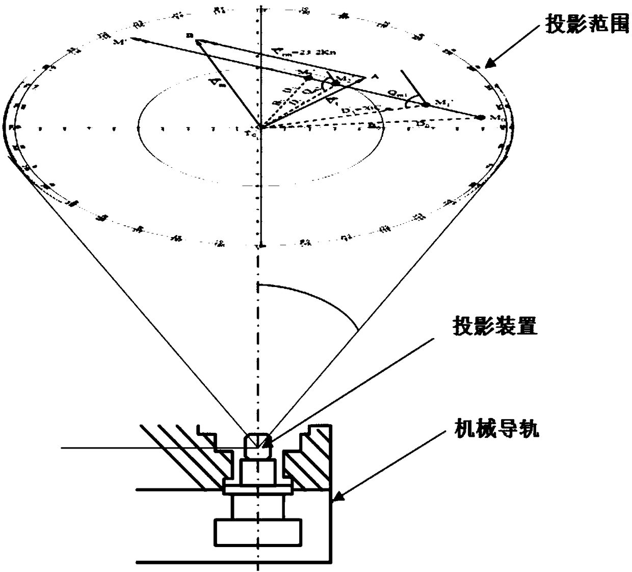
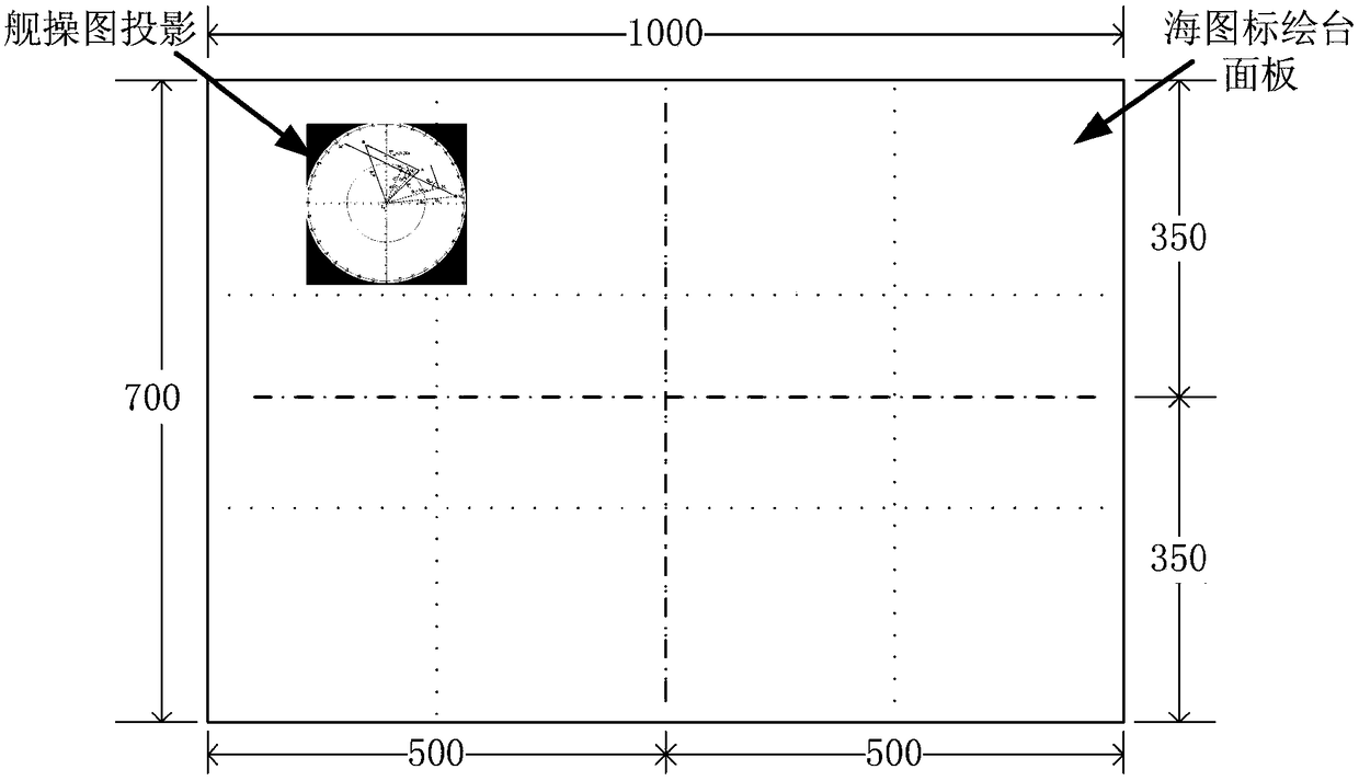
[0014] A warship chart projection system oriented to combat navigation plotting, such as figure 1 and figure 2 As shown, it includes the host of the projection device, the projection device, the mechanical rail, and the mechanical rail controller. The host computer of the projection device is connected with the nautical workbench through an Ethernet interface to receive the ship operation map and position information sent by the nautical workbench; It is controlled by connecting with the mechanical rail controller through the I / O interface. The projection device is installed on the mechanical guide rail below the chart drawing table, and the projection device moves on the mechanical guide rail under the control of the mechanical guide rail controller, so that the projection device can effectively project to any area (1000mm×700mm) specified abov...


PUM


Abstract

The invention relates to a navigation operation drawing projection system for battle navigation plotting, and the system is technically characterized in that the system comprises a projection device main unit, a projection device, a mechanical guide rail, and a mechanical guide rail controller; the projection device main unit is connected with a navigation workbench, and is used for receiving a navigation operation drawing and position information transmitted by the navigation workbench; the projection device main unit is connected with a sea chart plotting platform, and is connected with the mechanical guide rail controller, and controls the mechanical guide rail controller; the projection device is installed on the mechanical guide rail below the sea chart plotting platform, and the projection device is controlled by the mechanical guide rail controller to move on the mechanical guide rail, and enables a ship operation chart to be projected to a paper sea chart. The optical projection technology is used for projecting the ship operation chart to the paper sea chart, and the system obtains the moving conditions of two sides of a battle through multiple targets on the paper sea chart, achieves the target plotting function for the battle navigation operation, improves the practicality of ship operation through the paper sea chart, is simple in structure, and is greatly improves the usability.

Description

technical field [0001] The invention belongs to the technical field of navigation plotting, in particular to a warship maneuvering chart projection system for combat navigation plotting. Background technique [0002] The ship maneuver chart is one of the main tools for navigators to draw calculations related to ship maneuvering. It consists of several equally spaced concentric circles and radial lines drawn from the center of the circle. In addition, when performing radar plotting during ship collision avoidance, Also extensive use of ship maneuvering charts. At present, the Chinese Navy mainly completes the ship operation map through the navigation workbench. Its advantages are simple and fast drawing and calculation, and the small area of ​​the map is easy to use on the command platform. Due to the lack of information reliability and untimely update of electronic charts (navigation workbench) compared with paper charts, there is little target information on the ship contr...

Claims


Application Information

Patent Timeline
Patent Type & Authority Patents(China)
IPC IPC(8): G03B21/00
CPCG03B21/00
Inventor 蔡俊华马若顺翟晓婧刘真晖韩建朝
Owner TIANJIN NAVIGATION INSTR RES INST
Why Eureka
Try Eureka