Canopy spatial statistics quantitative estimation method based on remote sensing image with fine spatial resolution

A high-spatial-resolution, remote-sensing image technology, applied in the field of forest canopy quantitative estimation

Inactive Publication Date: 2007-07-11
RES INST OF FOREST RESOURCE INFORMATION TECHN CHINESE ACADEMY OF FORESTRY
View PDF0 Cites 11 Cited by
  • Summary
  • Abstract
  • Description
  • Claims
  • Application Information

AI Technical Summary

Problems solved by technology

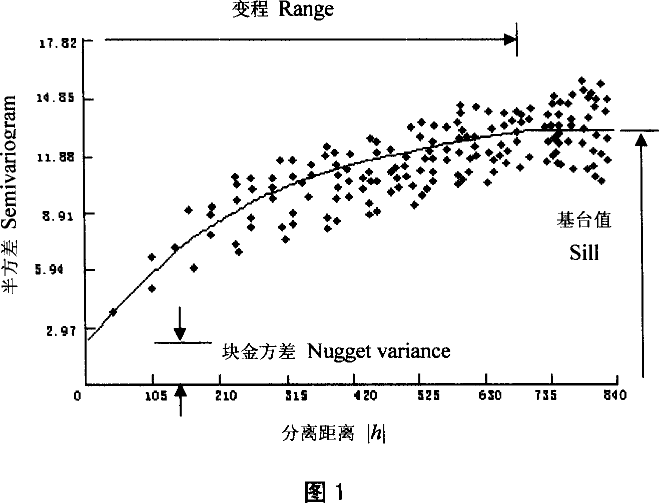
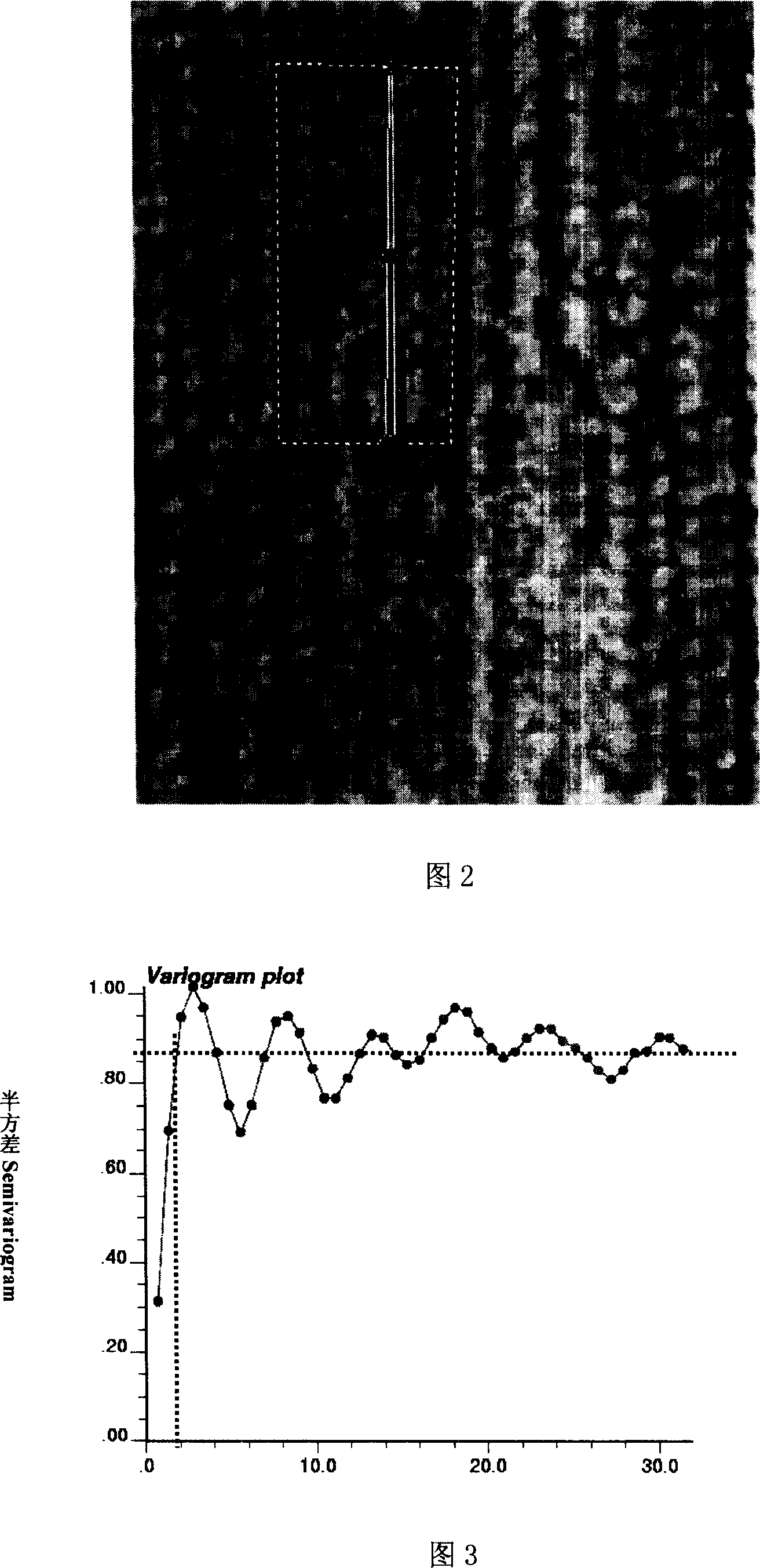
[0006] The purpose of the present invention is to address the shortcomings of existing canopy identification methods, and propose a statistical quantitative estimation method for canopy space based on high-spatial resolution remote sensing images, focusing on dividing the entire forest into objects and using high-spatial resolution remote sensing Using imagery as a data source and using spatial statistics methods, it can solve the problem of quantitative estimation of forest canopy with high canopy density, and form a corresponding software for quantitative estimation of forest canopy

Method used


Image

  • Canopy spatial statistics quantitative estimation method based on remote sensing image with fine spatial resolution
  • Canopy spatial statistics quantitative estimation method based on remote sensing image with fine spatial resolution
  • Canopy spatial statistics quantitative estimation method based on remote sensing image with fine spatial resolution

Examples


Embodiment Construction

[0034] The specific steps of a typical embodiment of the present invention are as follows:

[0035] 1) Data acquisition:

[0036] (A) Image data acquisition: Obtain high spatial resolution remote sensing images of forest stands in the growing season (spatial resolution should be better than 2.5m), which can be aerial charge-coupled device image sensor (CCD) digital images, satellite images such as fast Quickbird panchromatic, IKNOS panchromatic, SPOT5 panchromatic and other image data;

[0037] (B) Digitized 1:10,000 topographic map;

[0038] (C) Digital forestry map;

[0039] (D) Field differential global positioning system (GPS) high-precision control point data, etc.

[0040] 2) Remote sensing image preprocessing:

[0041]Using the 1:10,000 digital topographic map, combined with the high-precision GPS control point data in the field, the obtained high-spatial-resolution remote sensing images are orthorectified. The purpose of orthorectification is to correct the image ...


PUM


Abstract

The canopy space statistics quantitative estimation for remote image with high spatial resolution, canopy parameter extraction image testing half variance function aeolotropy analysis, computing the half variance function value in four different directions, judging the significance of the variance through special software, deciding the canopy width value in three conditions, such as the unobvious, obvious and obvious but only demanding the average canopy range. Solving higher canopy density, it can not tell the canopy range estimate directly from the image.

Description

technical field [0001] The invention relates to a method for quantitatively estimating forest canopy space statistics based on high-spatial-resolution remote sensing images. Based on the high-spatial-resolution remote sensing images, the method adopts the theory of spatial statistics to perform quantitative estimation of forest canopy width. This method extracts the structural features (such as geometric shape, size, and spatial pattern) shown in remote sensing images, and establishes the relationship between the spatial structural features of the stand crown and the structural features of the image. Since the size of the canopy is closely related to the growth of trees, and the stand crown width is highly correlated with the diameter at breast height, the stand volume can be quantitatively estimated from the stand crown width. The method can greatly improve the efficiency of forest resource investigation, obtain forest resource information timely and accurately, save a lot of...

Claims


Application Information

Patent Timeline
Patent Type & Authority Applications(China)
IPC IPC(8): G01S7/48G01S17/89G06K9/00
Inventor 冯益明李增元邓广庞勇覃先林赵峰
Owner RES INST OF FOREST RESOURCE INFORMATION TECHN CHINESE ACADEMY OF FORESTRY
Why Eureka
Try Eureka