

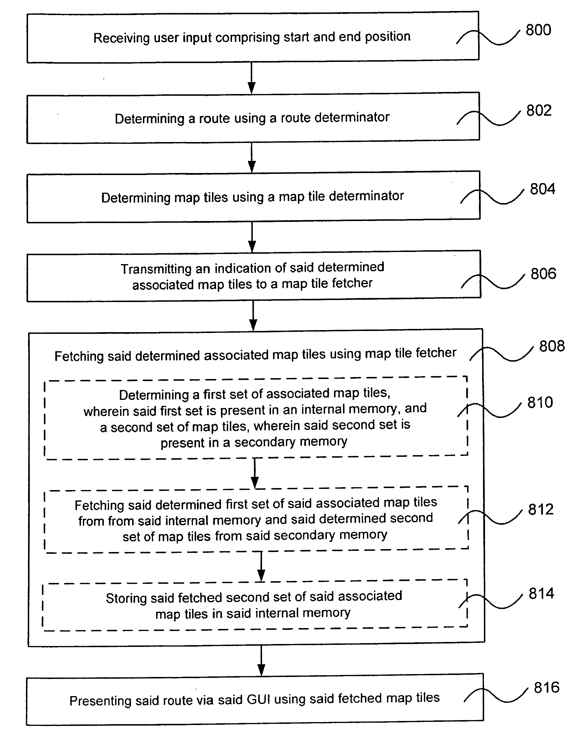
Pre-fetching navigation maps
a navigation map and map technology, applied in navigation instruments, maps/plans/charts, maps, etc., can solve problems such as jerky zooming, and achieve the effect of efficient memory handling
- Summary
- Abstract
- Description
- Claims
- Application Information
AI Technical Summary
Benefits of technology
Problems solved by technology
Method used
Image

Examples
Embodiment Construction
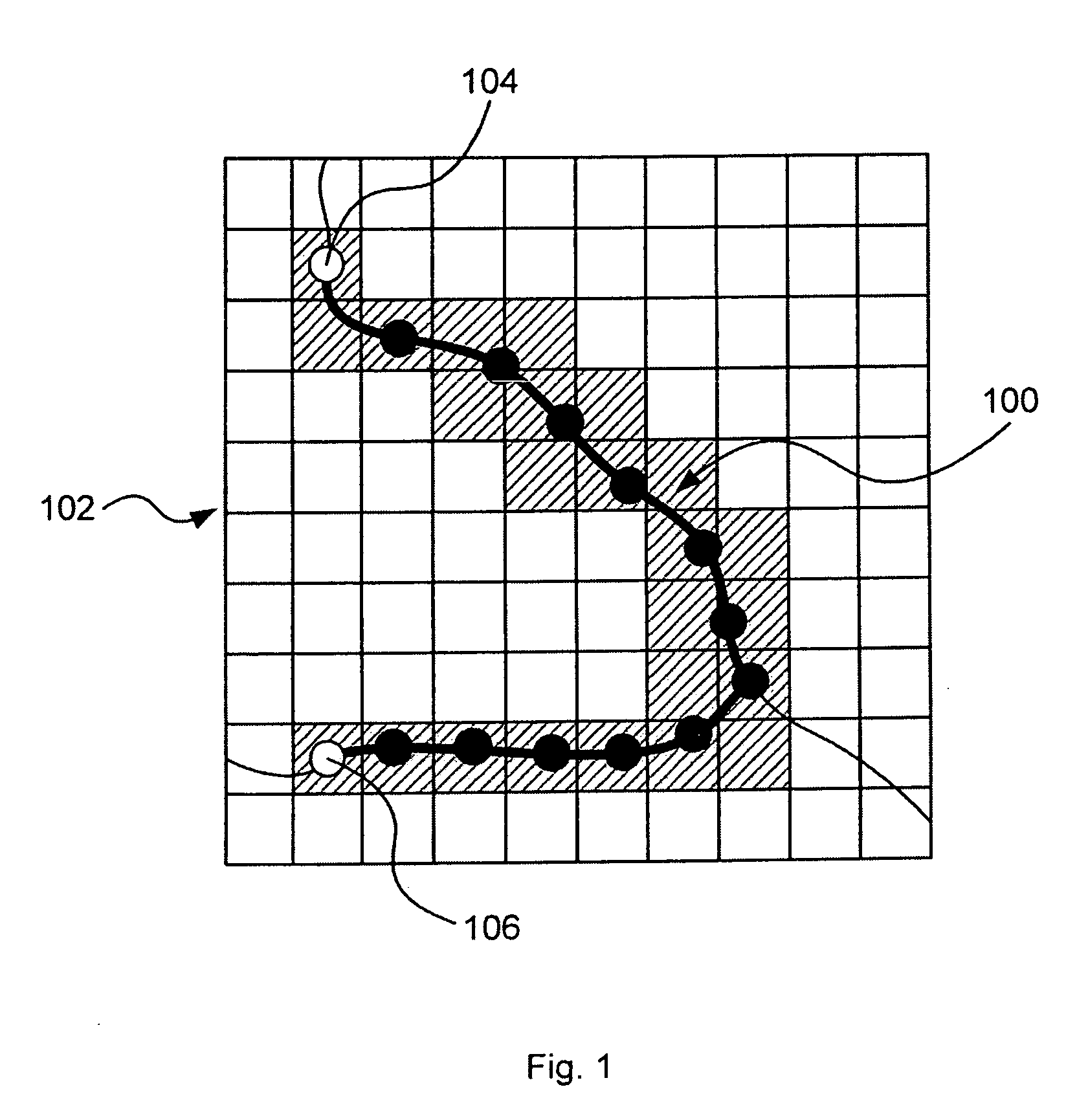
[0052]FIG. 1 is a schematic illustration of a route 100 presented via a graphical user interface 102, e.g. a display. The route is defined on the map between a start position 104 and an end position 106 and consists of route segments, which may be associated to a detail level or a speed limit. A map tile determinator determines which map tiles that correspond to the route, illustrated with shadowed map tiles in FIG. 1. The size of the map tiles may depend on set detail level.
[0053]The map may have different map layers showing different kind of information, which can be independent of each other and can be turned on or off during navigation. Possible map layers may be “map” data, which is the basic map data showing water areas, land areas, roads, parks, etc. Other map layers may be “Point of interests” i.e. icons for restaurants, hotels, gas stations, tourist attractions, etc. Further, “routes” may be of interest, which includes the geometry of the route. An additional map layer can ...
PUM
 Abstract
Description
Claims
Application Information