Point cloud azimuth calibration system and method for underground space scanning
An orientation calibration, underground space technology, applied in the field of information processing, can solve the problem of point cloud orientation deviation, etc., and achieve the effect of solving deviation
- Summary
- Abstract
- Description
- Claims
- Application Information
AI Technical Summary
Problems solved by technology
Method used
Image
Examples
Embodiment Construction
[0030] The specific implementation manners of the present invention will be further described in detail below in conjunction with the accompanying drawings and embodiments. The following examples are used to illustrate the present invention, but are not intended to limit the scope of the present invention.
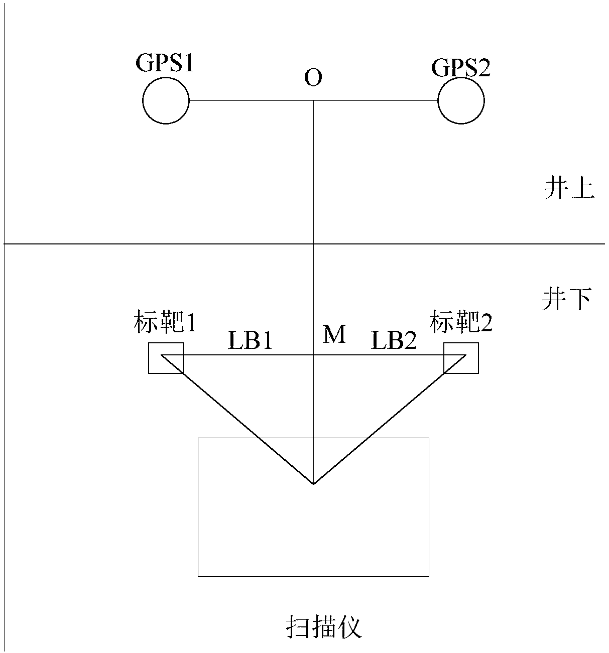
[0031] figure 1 It shows that an embodiment of the present invention provides a point cloud orientation calibration system for underground space scanning, including a scanner and two targets (target 1 and target 2) set in the underground space, and a space set on the ground The two antennas (GPS1 and GPS2) and the positioning device, as well as the calibration device, where the two targets and the two antennas are located on the same vertical plane and the connection line between the two targets is parallel to that between the two antennas connection;
[0032] The scanner is used to scan the underground space to obtain a point cloud set, wherein the point cloud set inclu...
PUM
 Abstract
Description
Claims
Application Information
 - Generate Ideas
- Intellectual Property
- Life Sciences
- Materials
- Tech Scout
- Unparalleled Data Quality
- Higher Quality Content
- 60% Fewer Hallucinations
Browse by: Latest US Patents, China's latest patents, Technical Efficacy Thesaurus, Application Domain, Technology Topic, Popular Technical Reports.
© 2025 PatSnap. All rights reserved.Legal|Privacy policy|Modern Slavery Act Transparency Statement|Sitemap|About US| Contact US: help@patsnap.com

