

Image matching in support of mobile navigation
a mobile navigation and image matching technology, applied in the field of navigation methods and systems, can solve the problems of growing the database from which such images may be drawn, and achieve the effect of better orienting
- Summary
- Abstract
- Description
- Claims
- Application Information
AI Technical Summary
Benefits of technology
Problems solved by technology
Method used
Image

Examples
Embodiment Construction
[0001]1. Field of the Invention
[0002]This invention generally relates to methods and systems for navigation and, more particularly, to use of mobile devices for navigation. This invention also generally relates to image databases and, more particularly to search of image databases.
[0003]2. Background of the Invention
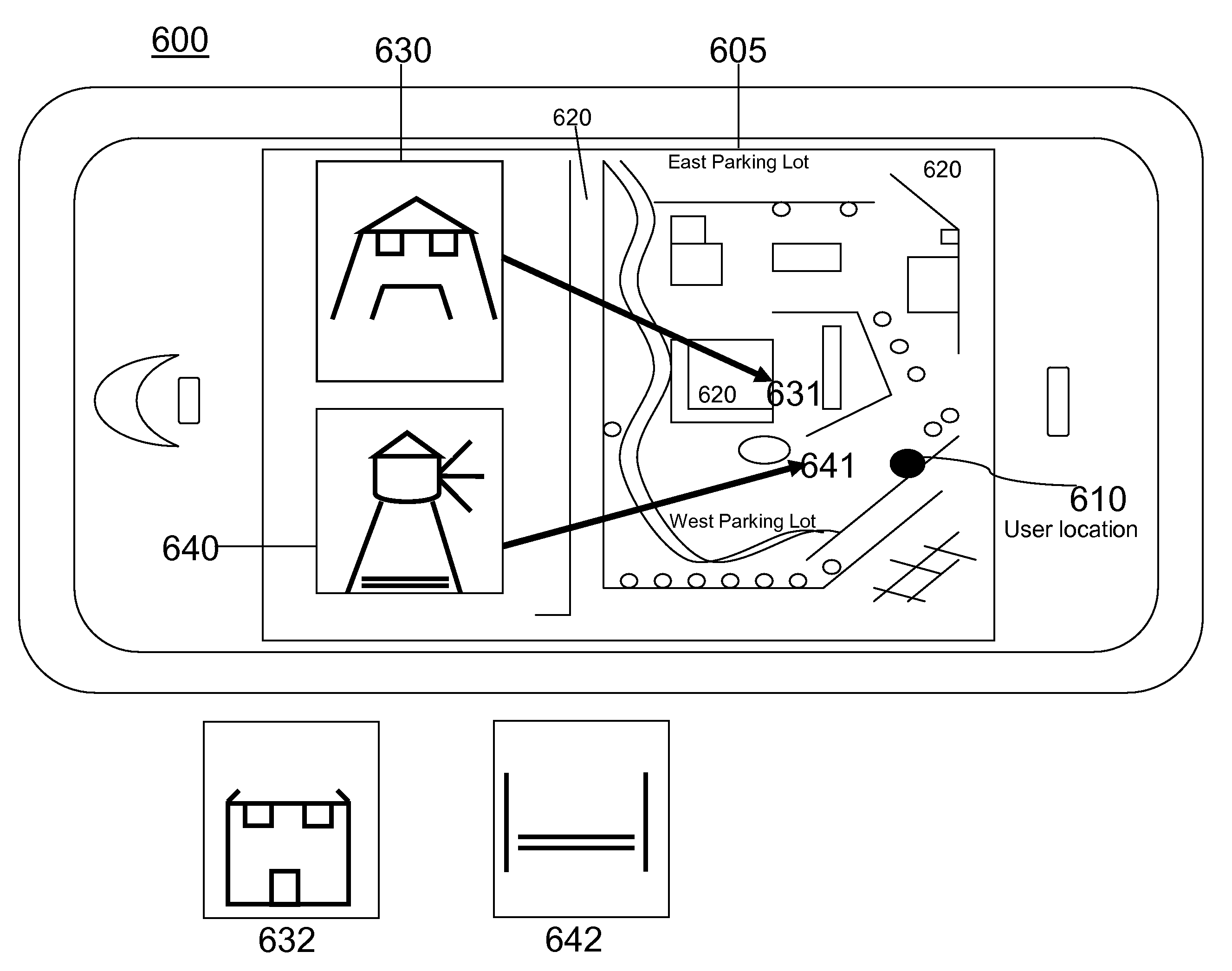
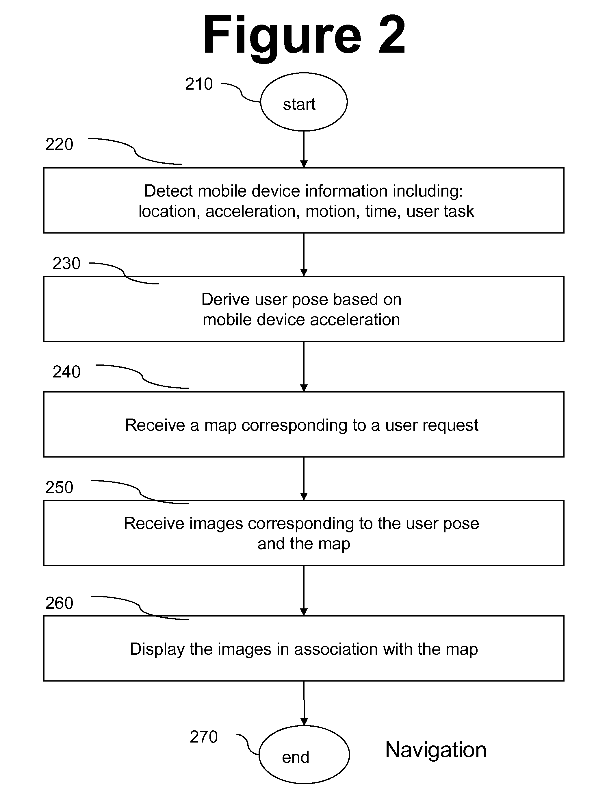
[0004]Navigating unknown streets and cities is a common problem addressed by several types of domains such as map searching software on personal computers, automobile navigations systems and handheld navigation systems. Networked mobile devices are well suited to address the navigation issue because of their ability to retrieve and display maps and information related to a user's current location and his planned destination.
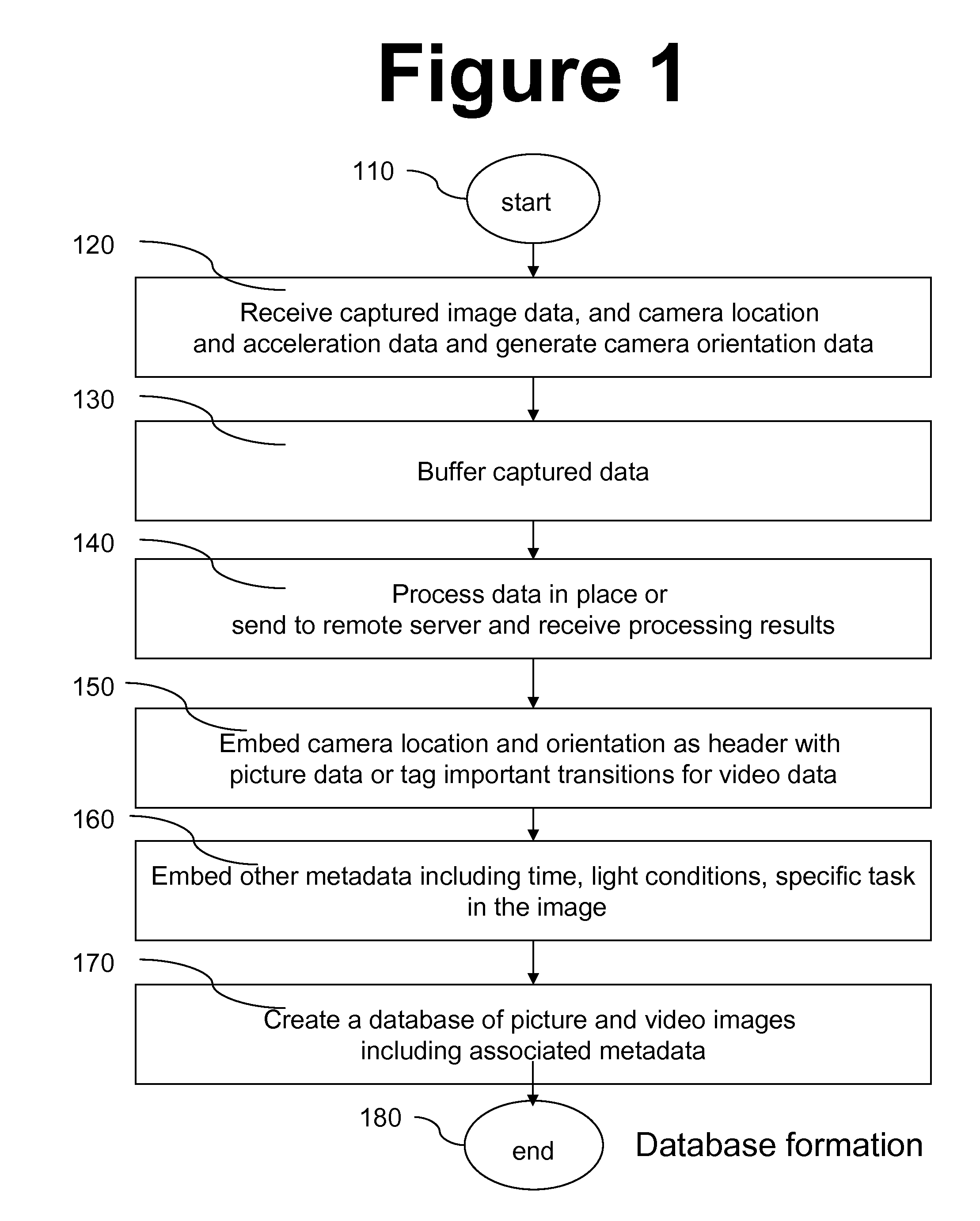
[0005]In an unrelated field of endeavor, creating an image diary has become easier due to proliferation of digital cameras and camera phones. At the same time, the large number of images, available in an image diary, has required more advanced methods...
PUM
 Abstract
Description
Claims
Application Information