Image matching in support of mobile navigation

a mobile navigation and image matching technology, applied in the field of navigation methods and systems, can solve the problems of growing the database from which such images may be drawn, and achieve the effect of better orienting

Active Publication Date: 2017-06-20
FUJIFILM BUSINESS INNOVATION CORP
View PDF20 Cites 2 Cited by
  • Summary
  • Abstract
  • Description
  • Claims
  • Application Information

AI Technical Summary

Benefits of technology

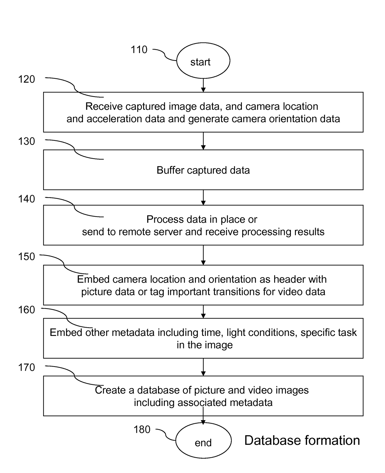
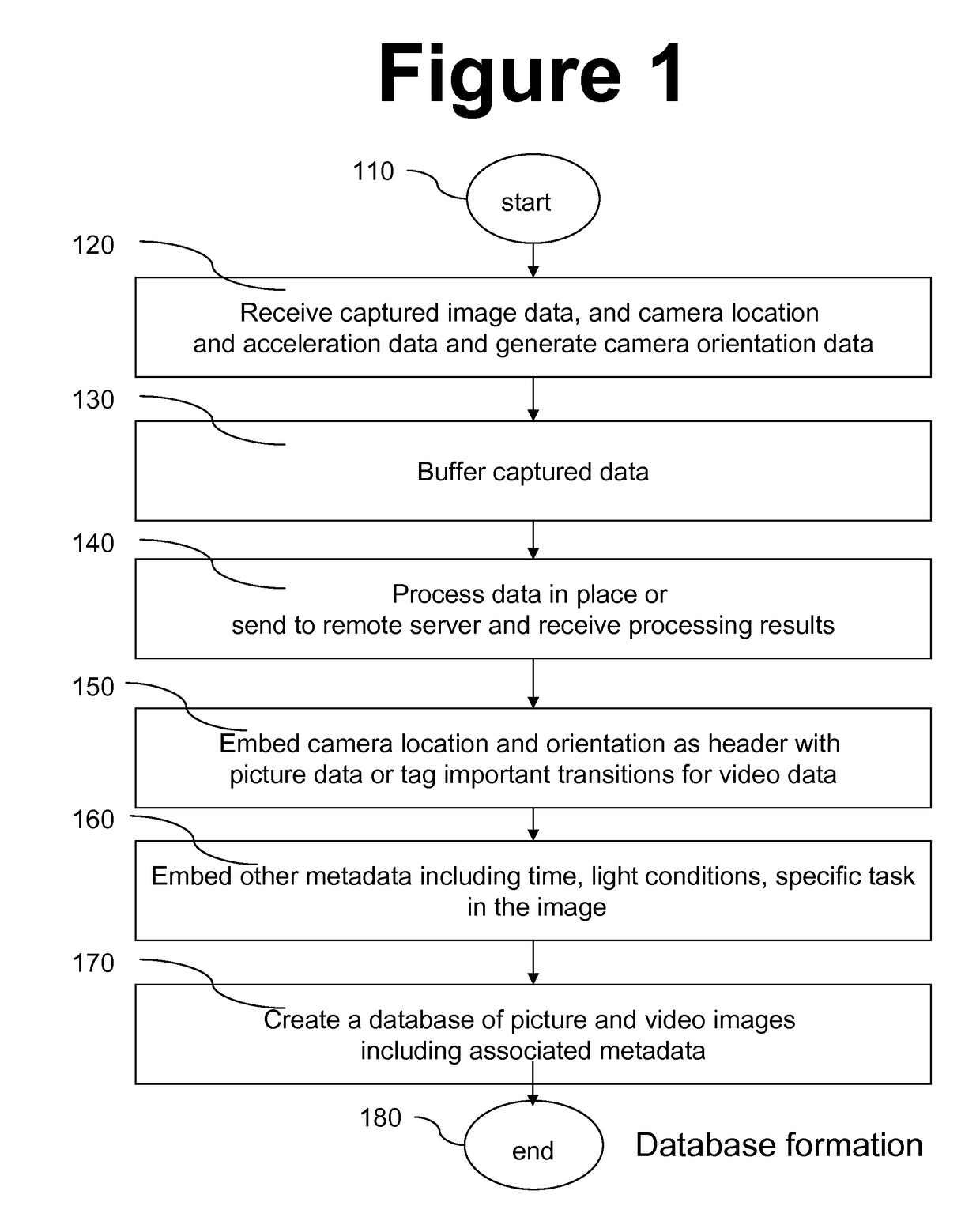
[0011]Aspects of present invention are directed to methods, devices and systems for using networked mobile devices for navigation purposes. Aspects of the present invention associate media files, such as photos and videos, with a navigation map to help users better orient themselves.
[0016]Regarding pose and orientation, user pose indicates the angles that the direction of sight of the user makes with the three location axes and camera orientation may include tilt and rotation. User pose may be estimated from the direction to which the mobile device is pointed or according to some other convention. Alternatively, user pose may be estimated independently and input to the mobile device. Information regarding the tilt and rotation of the camera at the time of capture of a particular image may be used to estimate camera orientation. This type of information may be inferred from image processing techniques. Alternatively, the accelerometer approach may be used that may be faster and more reliable when no clear ground-plane exists in the image. Aspects of the present invention provide methods and systems that allow users to retrieve pictures based on the motion and orientation of the camera. This is in contrast to the conventional systems that allow users to retrieve video by camera pan, zoom and object motion as opposed to camera motion.
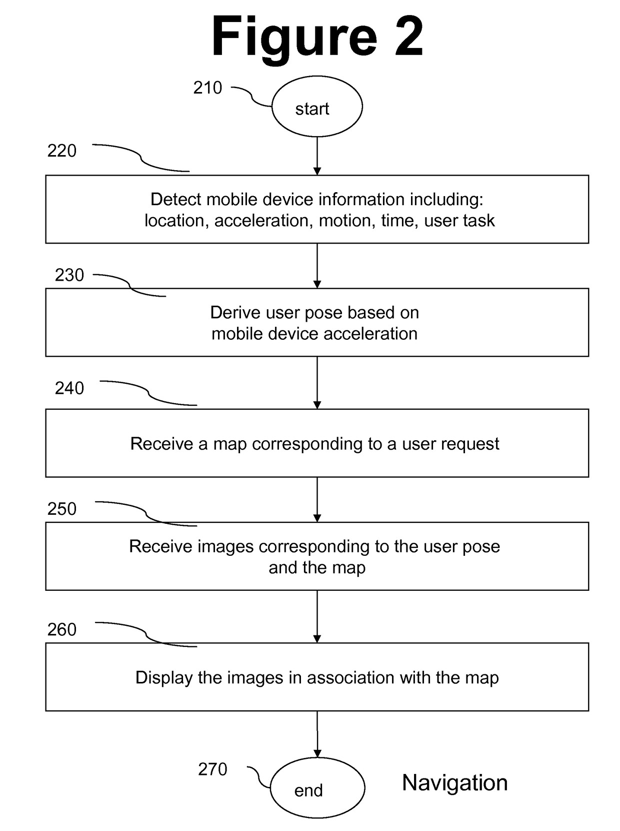
[0022]A stationary mode is invoked when the user requests his current location from the navigation device. Then, in addition to providing a map of the current location of the user, the device includes still photos of the landmarks at that current location. In addition to the location, the photos provided are matched to a current pose of the user possibly deduced from the pose of the navigation device or input to the navigation device. For example, if the back of the navigation device is facing up toward the northeast corner of an intersection where the user is standing, and a statue is located at the northeast corner, a view of the statue looking up at the statue is selected and shown on the mobile device in addition to the map. In this example the pose of the mobile device is used as a proxy for the pose of the user. Further, in this manner, the user can confirm his location on the map that is provided to him by the navigation device more easily and rapidly. In the stationary mode, the navigation device retrieves a map corresponding to the current location of the user and photos of the landmarks at that location corresponding to the pose of the user or the navigation device. A mere map may not be very user friendly. For example, with a mere map, the user has to still conform the information on the map such as street names to the information that he would be reading from street signs, provided there is sufficient light for him to read the signs. A dot on the map just shows the user where he is standing, it does not show him which way he is facing. However, a map together with appropriate photos of the landmarks may assist the user to quickly orient himself and plan his course of action.

Problems solved by technology

On the other hand, the proliferation of cameras and other imaging devices has caused the databases from which such images may be drawn to grow.

Method used


Image

  • Image matching in support of mobile navigation
  • Image matching in support of mobile navigation
  • Image matching in support of mobile navigation

Examples


Embodiment Construction

[0001]Field of the Invention

[0002]This invention generally relates to methods and systems for navigation and, more particularly, to use of mobile devices for navigation. This invention also generally relates to image databases and, more particularly to search of image databases.

[0003]Background of the Invention

[0004]Navigating unknown streets and cities is a common problem addressed by several types of domains such as map searching software on personal computers, automobile navigations systems and handheld navigation systems. Networked mobile devices are well suited to address the navigation issue because of their ability to retrieve and display maps and information related to a user's current location and his planned destination.

[0005]In an unrelated field of endeavor, creating an image diary has become easier due to proliferation of digital cameras and camera phones. At the same time, the large number of images, available in an image diary, has required more advanced methods of ma...


PUM


Abstract

Method, apparatus and system for improving navigation using mobile devices by adding previously captured media to navigation maps provided by mobile device. Added media include still images and video clips. Media captured at the same location using various camera orientations are available in an image database. Images in database include metadata indicating location, orientation and other parameters associated with each image. User location and pose are matched against metadata indicating location and camera orientation of captured images. User motion may also be matched to metadata indicating camera motion of stored video clips. Other parameters like lighting, seasonal factors, and tasks of walking, biking or driving may also be matched. User pose may be derived from an accelerometer embedded in the mobile device. Some or all of user parameters desired by user may be directly input to mobile device by user instead of being automatically detected by mobile device.

Description

DESCRIPTION OF THE INVENTION[0001]Field of the Invention[0002]This invention generally relates to methods and systems for navigation and, more particularly, to use of mobile devices for navigation. This invention also generally relates to image databases and, more particularly to search of image databases.[0003]Background of the Invention[0004]Navigating unknown streets and cities is a common problem addressed by several types of domains such as map searching software on personal computers, automobile navigations systems and handheld navigation systems. Networked mobile devices are well suited to address the navigation issue because of their ability to retrieve and display maps and information related to a user's current location and his planned destination.[0005]In an unrelated field of endeavor, creating an image diary has become easier due to proliferation of digital cameras and camera phones. At the same time, the large number of images, available in an image diary, has required...

Claims


Application Information

Patent Timeline
Patent Type & Authority Patents(United States)
IPC IPC(8): G01C21/00G01C21/32G06F17/30H04N1/00
CPCG01C21/32G06F17/30032G06F17/30061G06F17/30241H04N1/00244H04N1/00323H04N1/00127H04N2201/0084H04N2201/0086G06F16/29G06F16/436G06F16/444G01C21/3848
Inventor CARTER, SCOTTDENOUE, LAURENTPERTTULA, ARTTU
Owner FUJIFILM BUSINESS INNOVATION CORP
Why Eureka
Try Eureka