Geospatial representation of data-less map areas
a geospatial representation and data-less technology, applied in surveying and navigation, instruments, navigation instruments, etc., can solve problems such as the inability of devices to access data, the inability of applications to display portions of maps, and sometimes the entire map
- Summary
- Abstract
- Description
- Claims
- Application Information
AI Technical Summary
Benefits of technology
Problems solved by technology
Method used
Image
Examples
Embodiment Construction
[0020]In the following detailed description of the invention, numerous details, examples, and embodiments of the invention are set forth and described. However, it will be clear and apparent to one skilled in the art that the invention is not limited to the embodiments set forth and that the invention may be practiced without some of the specific details and examples discussed.
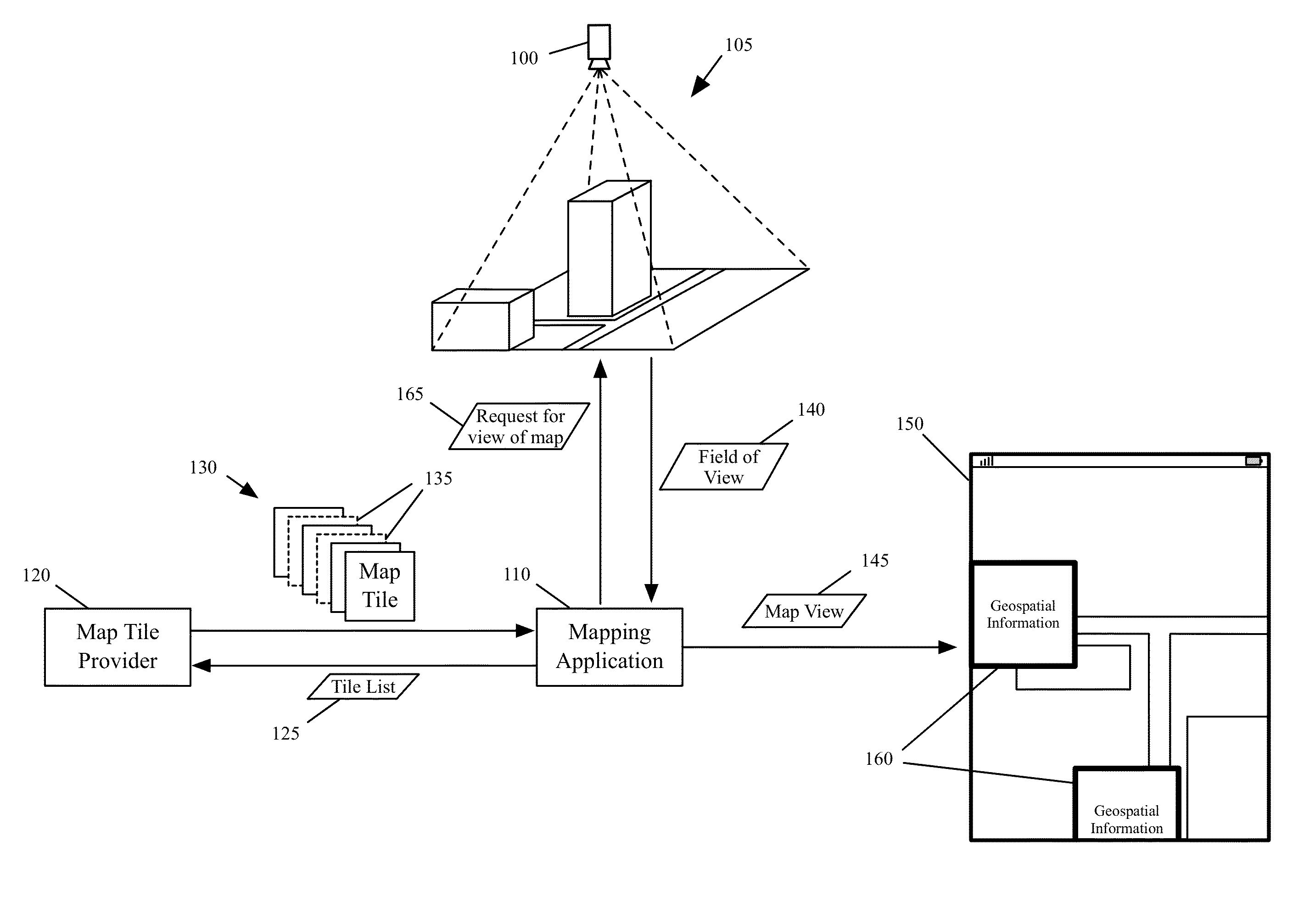
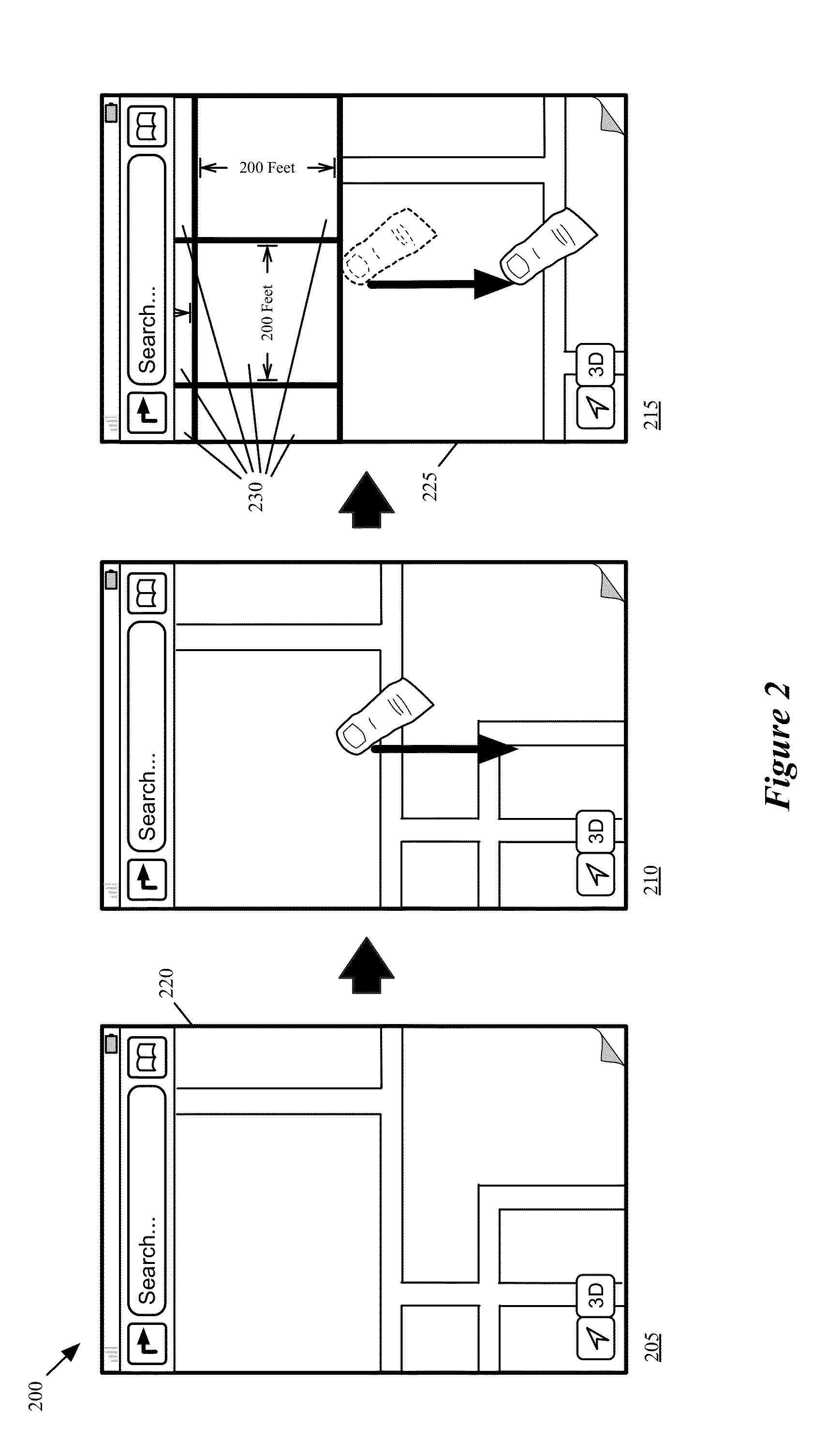
[0021]For a mapping application, some embodiments of the invention provide a novel method for rendering views of a three-dimensional (3D) map. In some embodiments, when rendering a view of the 3D map, the method identifies a portion of the 3D map to use for rendering the view. For the identified portion of the 3D map, the method of some embodiments identifies (1) a set of sections of the 3D map for which data is unavailable (also referred to as data-less sections) and (2) a set of sections of the map view for which data is available. Based on sections for which data is available, the method generates for the d...
PUM
 Abstract
Description
Claims
Application Information
 - R&D
- Intellectual Property
- Life Sciences
- Materials
- Tech Scout
- Unparalleled Data Quality
- Higher Quality Content
- 60% Fewer Hallucinations
Browse by: Latest US Patents, China's latest patents, Technical Efficacy Thesaurus, Application Domain, Technology Topic, Popular Technical Reports.
© 2025 PatSnap. All rights reserved.Legal|Privacy policy|Modern Slavery Act Transparency Statement|Sitemap|About US| Contact US: help@patsnap.com


