Method for realizing division of geospace three-dimensional grids

A 3D grid and space division technology, applied in 3D image processing, image data processing, 3D modeling, etc., can solve problems such as inaccuracy, data sharing obstacles, and increased data integration management.

Inactive Publication Date: 2009-12-09
吴立新
View PDF5 Cites 24 Cited by
  • Summary
  • Abstract
  • Description
  • Claims
  • Application Information

AI Technical Summary

Problems solved by technology

Obviously, the analysis of large-scale and global space based on the transformed Euclidean plane metric space will inevitably lead to incorrect results
[0007] In addition, different countries and regions adopt different projection methods. Various projection data bring insurmountable obstacles to global spatial data sharing, and also add a lot of trouble to regional, national and global data integration management. Influence the construction of digital earth and national spatial information infrastructure

Method used


Image

  • Method for realizing division of geospace three-dimensional grids
  • Method for realizing division of geospace three-dimensional grids
  • Method for realizing division of geospace three-dimensional grids

Examples


Embodiment Construction

[0056] In order to make the object, technical solution and advantages of the present invention clearer, the present invention will be described in further detail below in conjunction with specific embodiments and with reference to the accompanying drawings.

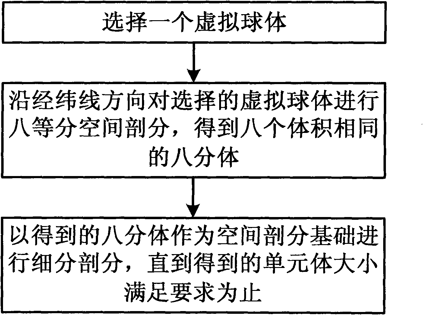
[0057] Such as figure 1 as shown, figure 1 The flow chart of the method for realizing the three-dimensional grid division of the earth space provided by the present invention, the method specifically includes the following steps:

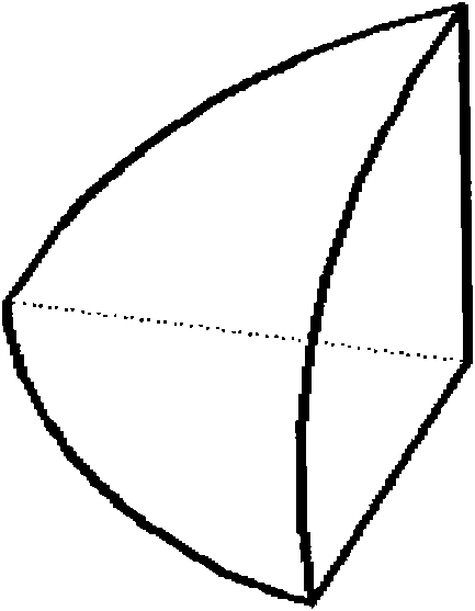
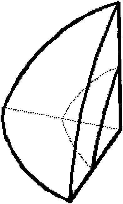
[0058] First, select a dummy sphere. The virtual sphere is not the same concept as the reference ellipsoid mentioned in geodesy. It is a virtual sphere, which can be an approximate sphere of the reference ellipsoid stipulated by the International Geodetic Association, or an approximate sphere whose radius is larger or smaller than the approximate sphere. virtual sphere. The radius of the virtual sphere depends on the research scope. For example, if the research scope is the atmosphere and be...


PUM


Abstract

The invention discloses a method for realizing division of geospace three-dimensional grids. The method comprises the following steps: selecting a virtual sphere; dividing the space of the virtual sphere into eight equal parts along the quadrillage direction to obtain eight octants with same volumes; performing degradation eight-ary tree recursive subdivision by taking the obtained octants as a space division basis until the size of the obtained unit body satisfies the requirement. The invention can realize the whole division to the geospace, fills the blank of the division of geospace three-dimensional grids and can build a global three-dimensional grid frame and be used in the key fields of geospace information sciences and technologies such as geospace data untied organization and code, geospace data integration management and shared utilization, global three-dimensional space multilayer model building and whole vision, and the like.

Description

technical field [0001] The invention relates to the technical field of geospatial information organization, in particular to a method for realizing three-dimensional grid division of geospatial space. Background technique [0002] Metric space is the basis of spatial data organization and analysis, and it is also the most important quantitative feature of space. The spatial reference for traditional spatial data organization and analysis is Euclidean space. For entities in non-Euclidean spaces such as spheres, mathematical projections must be used to convert them into planar data in Euclidean space in order to be effectively organized and expressed. [0003] A spherical surface is a curved surface that cannot be unfolded. If such a curved surface is to be unfolded on a plane, cracks and wrinkles will inevitably occur. This requires mathematical means to stretch and compress the longitude and latitude. The essence of the stretching and compression process is A process of pro...

Claims


Application Information

Patent Timeline
Patent Type & Authority Applications(China)
IPC IPC(8): G06T17/50G06T15/00G06T17/05
Inventor 吴立新余接情
Owner 吴立新
Why Eureka
Try Eureka