
A Spatial Scale Transformation Method for Land Use Spatial Planning Prediction and Simulation

A scale conversion and space simulation technology, applied in the field of geographic information, can solve problems such as time-consuming, loss of accuracy, and low efficiency

Active Publication Date: 2015-11-18
INST OF GEOGRAPHICAL SCI & NATURAL RESOURCE RES CAS
View PDF1 Cites 2 Cited by
  • Summary
  • Abstract
  • Description
  • Claims
  • Application Information

AI Technical Summary

Problems solved by technology

However, the less efficient and time-consuming the machines required for the simulation, and the conversion from vector to raster data results in a loss of precision

Method used


Image

  • A Spatial Scale Transformation Method for Land Use Spatial Planning Prediction and Simulation
  • A Spatial Scale Transformation Method for Land Use Spatial Planning Prediction and Simulation
  • A Spatial Scale Transformation Method for Land Use Spatial Planning Prediction and Simulation

Examples


Embodiment Construction

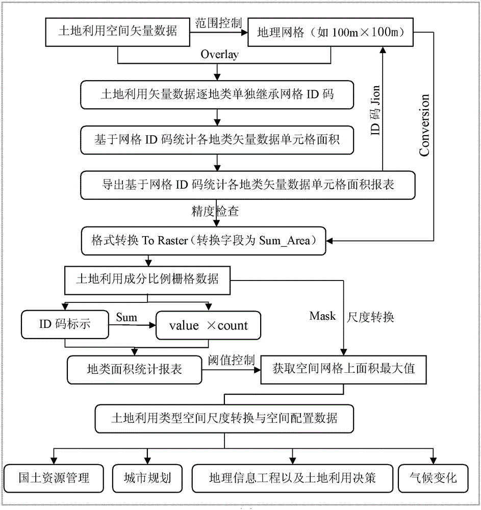
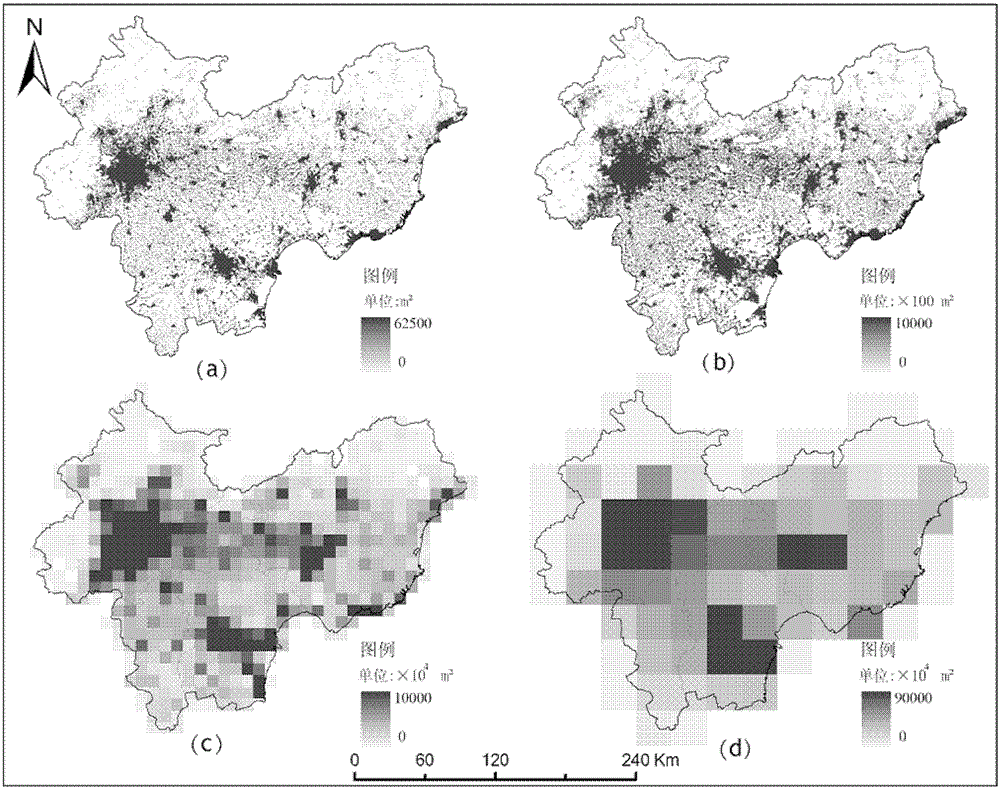
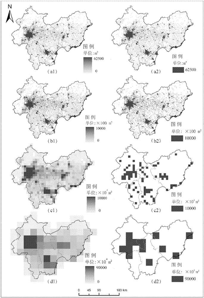
[0022] The land use spatial planning prediction and simulation spatial scale conversion method is aimed at serving land resource management, urban planning, geographic information engineering, land use decision-making, and climate change impact assessment in global climate negotiations. It fully integrates vector and raster conversion and Raster and raster scale conversion results, improve the accuracy of data use, closely combine practicability and scientificity, save a lot of time in the data operation process, and provide guarantee for data conversion accuracy and efficiency.

[0023] Accurate geographic data is the basis for quantitative description and research issues. The reliability of data and the quality of acquired data directly affect the results of representation and analysis. The land use vector data structure is complex, data exchange is difficult, and the performance of expressing spatial changes is poor. In order to meet the actual needs, the raster data has the...


PUM


Abstract

The invention relates to a method for predicting land use space planning and converting simulated space scale. A method for converting sub-region area conservation oriented land use space scale is realized for the problem on non-conservation of spatial distribution and area accuracy loss of scale conversion between the land use vector and the grid or each of the grids with different resolutions based on the land use vector or the grid space data; and the method specifically comprises the following steps of: carrying out automatic conversion of vector to grid component ratio data to land use type status or dynamic change data; carrying out statistic analysis to different land use statuses or dynamic change areas in the sub-regions; carrying out multi-scale grid conversion to the land use status or the dynamic space data; and carrying out a method for predicting the land use space, controlling simulated sub-region area conservation and configuring space. The method has wide application value in land and resources administration, city planning, geographic information engineering, land use decision and climate change impact evaluation in global climate talks. The method plays an important role in reducing uncertainty of simulation and prediction of the land use space.

Description

technical field [0001] The invention belongs to the technical field of geographic information related to land use decision-making. It mainly aims at the scale problem in the prediction and simulation of land use spatial planning, and establishes a high-precision spatial scale conversion method, which is mainly used in land resource management planning and urban planning. Decision-making and international negotiations on global climate change in the field of land-use change impact assessment. Background technique [0002] Land is the place where human beings produce and live. It is the basic state policy of our country to cherish, rationally use and effectively protect cultivated land. To some extent, land use change is also an important factor affecting global climate, ecosystems, economic interests and human health. Land use planning is an important means to guide the rational development and utilization of land and promote the economical and intensive use of land. The pr...

Claims


Application Information

Patent Timeline
Patent Type & Authority Patents(China)
IPC IPC(8): G06Q10/04G06Q50/00
CPCY02A90/10
Inventor 匡文慧迟文峰刘纪远
Owner INST OF GEOGRAPHICAL SCI & NATURAL RESOURCE RES CAS
Learn More