Three-dimensional geological raster body model construction method

A technology of three-dimensional geology and construction method, which is applied in the field of constructing three-dimensional geological body models and can solve problems such as accuracy and efficiency limitations.

Active Publication Date: 2016-02-10
马鞍山城智信息技术有限公司
View PDF4 Cites 9 Cited by
  • Summary
  • Abstract
  • Description
  • Claims
  • Application Information

AI Technical Summary

Problems solved by technology

[0007] Aiming at the current three-dimensional geological body modeling based on large-scale geological data and with a large-scale geological form as the background, the accuracy and efficiency are limited. The present invention provides a method for building a three-dimensional geological grid model

Method used


Image

  • Three-dimensional geological raster body model construction method
  • Three-dimensional geological raster body model construction method
  • Three-dimensional geological raster body model construction method

Examples


Embodiment 1

[0066] The following first explains the related concepts:

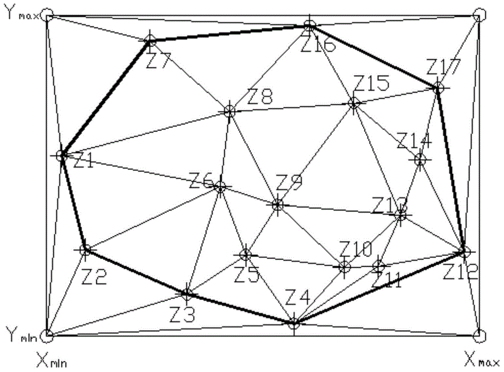
[0067] Geological body: the geometric form of a certain geological distribution in space, here specifically refers to a geometric form similar to a ladder.

[0068] The specific information of the geological body includes the unit number, the number of the unit contained in the geological body, and the number of the geological body where the unit is located.

[0069] A method for constructing a three-dimensional geological grid body model in this embodiment, the specific process is as follows:

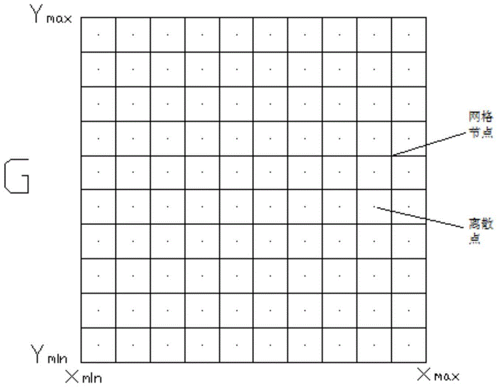
[0070] Step 1. Determine the standard engineering plane range: the known standard engineering plane range is a rectangular area [(x 1 , x 2 ), (y 1 ,y 2 )], the unit of the grid is: u[u x , u y , u z ], get the standard rectangular area G[(x min , x max ), (y min ,y max )]; then the calculation method of G is:

[0071] Step 2. Grid the standard rectangular area G to ensure the consistency of geological distribu...

Embodiment 2

[0113] A method for constructing a three-dimensional geological grid model in this embodiment is basically the same as that in Embodiment 1, except that the types of merged units are different:

[0114] Merge the unit body that intersects with a unit body: if the geological properties of the unit body and the intersecting unit body are different, do not merge; otherwise, find out the geological body where the intersecting unit body is located, and delete the intersecting surface of the unit body from the geological body And the geological data where it is located, and add the remaining 5 faces to the geological volume of the intersecting unit body; the unit body and the intersecting unit body are merged into the same geological volume.

Embodiment 3

[0116] A method for constructing a three-dimensional geological grid model in this embodiment is basically the same as that in Embodiment 1, except that the types of merged units are different:

[0117] Merge the unit body that intersects with two unit bodies: if the geological properties of this unit body and the two intersecting unit bodies are all different, do not merge; if it is only the same as one of the intersecting unit body geological properties, then proceed according to the method of embodiment 2 Just merge; if the geological properties of the three unit bodies are the same, add the unit body to the geological body where the adjacent unit body is located, and the geological body where the intersecting unit body is located needs to be merged;


PUM


Abstract

The present invention discloses a three-dimensional geological raster body model construction method, and belongs to the field of constructing three-dimensional geological body models. The three-dimensional geological raster body model construction method disclosed by the present invention has a particular procedure that comprises the following ten steps: determining a standard project plane range; rasterizing a standard rectangle region G; calculating an earth-surface triangulation net and an underground triangulation net of the standard rectangle region G; calculating a unit grid calculation line and a grid line of the standard rectangle region G; equidistantly dividing an auxiliary line and the calculation line; calculating geological attributes of discrete points; establishing a correspondence relationship between a calculation point and an auxiliary point; constructing three-dimensional geological raster unit bodies; classifying the unit bodies; and combining the unit bodies according to calculation information and position information of the unit bodies. A space is dispersed into a series of points, and the geological attributes of the points are calculated, and then association between the points is analyzed, and thus spatial geometrical bodies where the discrete points are located are combined, so that an overall geological distribution condition of the space is calculated, and the goals of high precision, little space limitation, high efficiency and strong applicability can be achieved.

Description

technical field [0001] The invention relates to the field of building a three-dimensional geological body model, in particular to a method for building a three-dimensional geological grid body model. Background technique [0002] The data acquisition in the existing 3D geological body construction mainly adopts two modes: discrete point acquisition and single point line string acquisition. Discrete point collection is to directly perform discrete single-point sampling without collecting connection relationship information between sampling points, such as collecting discrete elevation points based on topographic maps, collecting discrete elevation points in the field, and laser radar scanning collection. Single-point line string collection is to collect and organize data in the form of continuous coordinate strings, such as the collection of contour lines, the collection of ground lines in digital photogrammetry, and so on. The common feature of the above-mentioned sampling ...

Claims


Application Information

Patent Timeline
Patent Type & Authority Applications(China)
IPC IPC(8): G06T17/00
Inventor 陈树铭陈超东张乐
Owner 马鞍山城智信息技术有限公司
Why Eureka
Try Eureka