
Apparatus and method for route planning based on PM2.5 healthy trip
A technology for path planning, health, used in surveying devices, road network navigators, navigation, etc.
- Summary
- Abstract
- Description
- Claims
- Application Information
AI Technical Summary
Problems solved by technology
Method used
Image

Examples
Embodiment Construction
[0062] The present invention will be further described below in conjunction with accompanying drawing and specific embodiment:
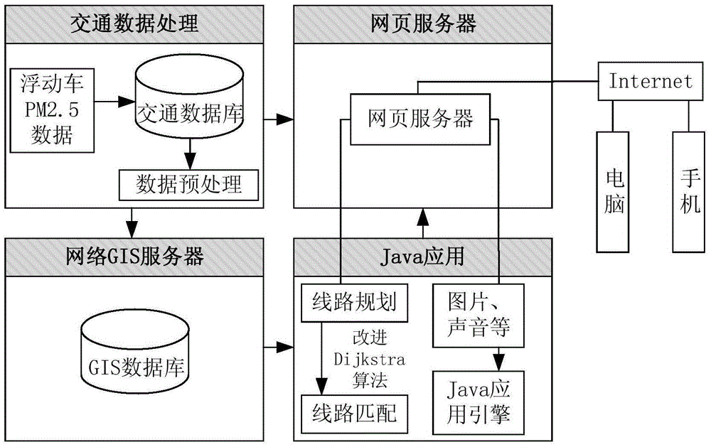
[0063] as attached figure 1 As shown, the route planning device based on PM2.5 healthy travel in the present invention obtains the PM2.5 concentration value through the vehicle-mounted PM2.5 detection equipment and establishes a traffic database in combination with traffic flow parameters. When the user enters the starting and ending information for navigation, the traffic data is imported into the GIS database, and the improved Dijkstra algorithm is used for line matching, and the matched line is transmitted to the web server through the cloud, and finally displayed on the user terminal computer or mobile phone .
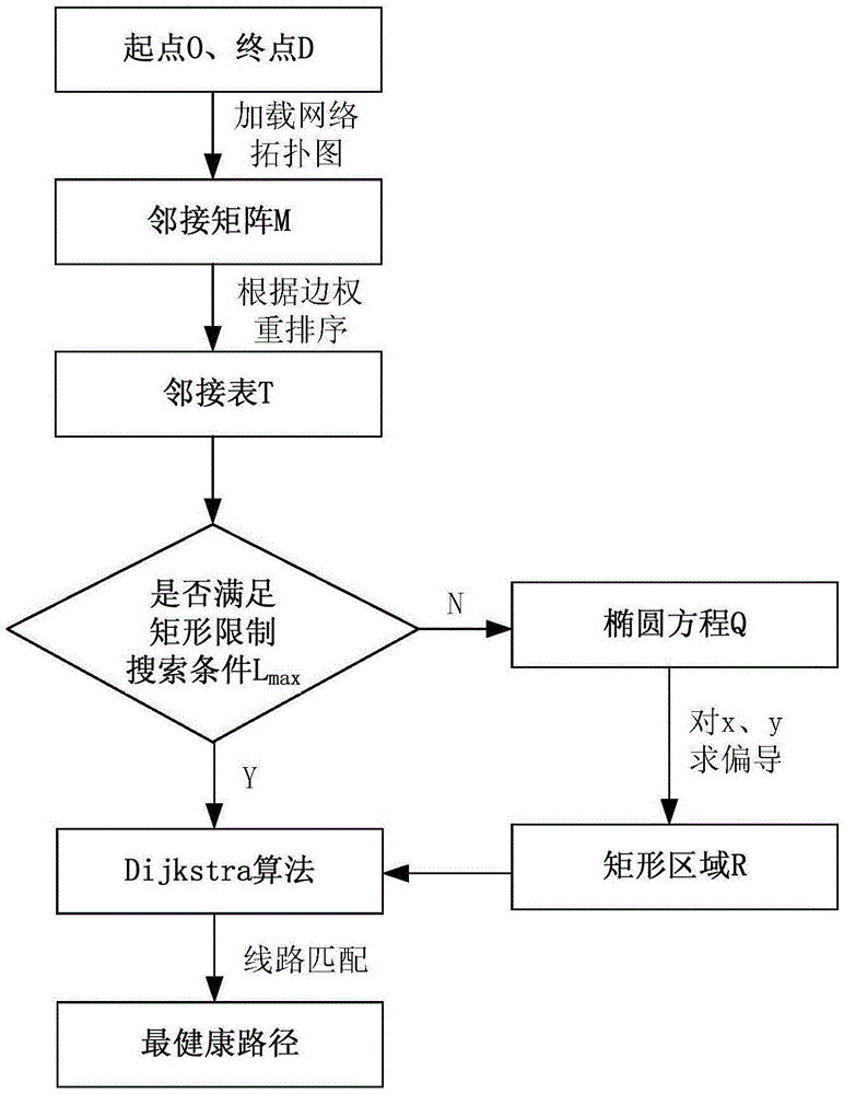
[0064] as attached figure 2 As shown, the path planning method based on PM2.5 healthy travel in the present invention is an improved Dijkstra algorithm. After the user inputs the start and end points, the network topology map is loaded...
PUM
 Abstract
Description
Claims
Application Information