Wide-range cruising path planning model for UAV (unmanned aerial vehicle) and method
A path planning and UAV technology, applied in the direction of navigation calculation tools, etc., can solve problems such as the inability to focus on supervision of water area supervision operations.
- Summary
- Abstract
- Description
- Claims
- Application Information
AI Technical Summary
Problems solved by technology
Method used
Image
Examples
Embodiment Construction
[0084] The present invention will be further described in detail below in conjunction with the accompanying drawings and embodiments.
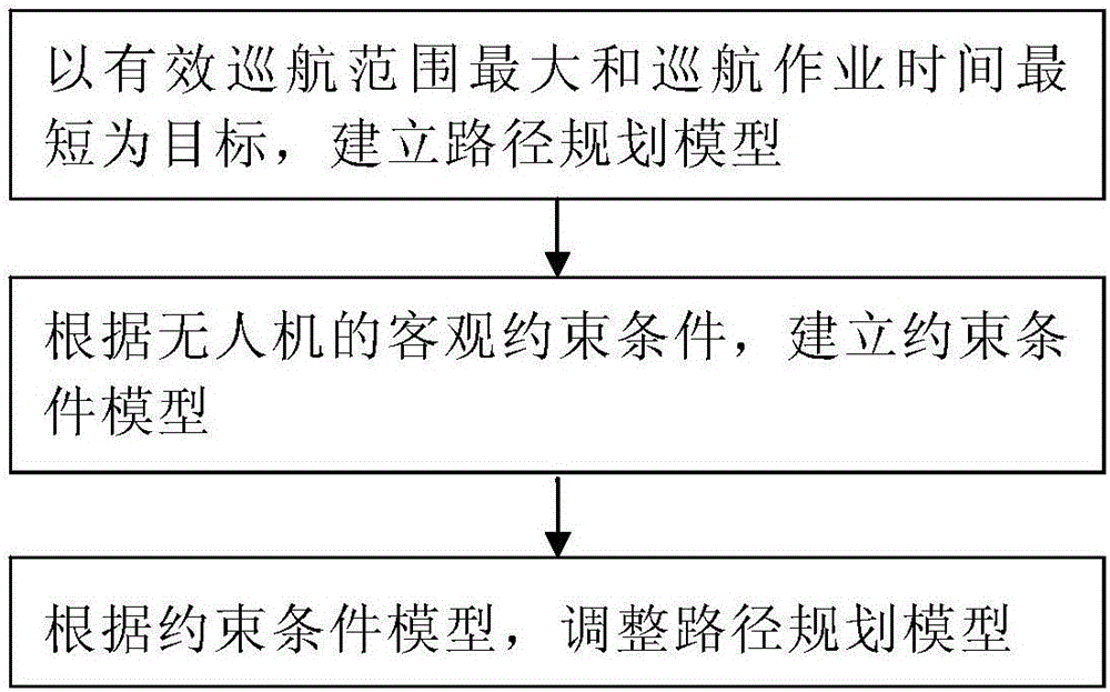
[0085] The large-scale cruising path planning model of the unmanned aerial vehicle disclosed by the present invention, the establishment steps include:
[0086] S10: Aiming at the largest effective cruising range and the shortest cruising operation time, establish a path planning model;
[0087] S101: Establishing an objective function with the largest effective cruising range;
[0088] Let N be the set of key regulatory waters, i (i=1, 2, 3, ..., n) be the number of key regulatory waters, then i∈N, and set the area of the i-th key regulatory waters as a i , the risk value is , then the effective cruising area of the i-th key regulatory waters is expressed as Let S be the set of key regulatory waters for a single operation cruise of the UAV, and , then the jth (j=1, 2, 3,..., n 1 , j∈S) The effective cruising area of cruising wat...
PUM
 Abstract
Description
Claims
Application Information
 - R&D
- Intellectual Property
- Life Sciences
- Materials
- Tech Scout
- Unparalleled Data Quality
- Higher Quality Content
- 60% Fewer Hallucinations
Browse by: Latest US Patents, China's latest patents, Technical Efficacy Thesaurus, Application Domain, Technology Topic, Popular Technical Reports.
© 2025 PatSnap. All rights reserved.Legal|Privacy policy|Modern Slavery Act Transparency Statement|Sitemap|About US| Contact US: help@patsnap.com


