A Coastline Detection Algorithm Based on Superpixel Merging SAR Image
A detection algorithm and superpixel technology, applied in image analysis, image enhancement, image data processing, etc., can solve the problems of coastline detection with great difficulty, inability to merge small areas, etc., to achieve accurate features and high edge fit. Effect
- Summary
- Abstract
- Description
- Claims
- Application Information
AI Technical Summary
Problems solved by technology
Method used
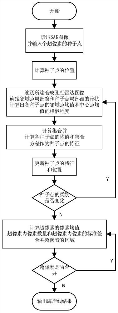
Image


Examples
Embodiment
[0096] Algorithm performance comparison mainly uses root mean square error (RMSE) and QA (overall accuracy) as the accuracy analysis indicators. Firstly, RMSE is compared, and the calculation formula is as follows:
[0097]
[0098] Among them, RMSE represents the average error between the hand-painted coastline and the coastline extracted by various algorithms, x 1k Indicates the pixel value of the kth position pixel in the binary image obtained by hand-drawn coastline extraction results. x 2k Indicates the pixel value of the kth position pixel in the binary image of the coastline extraction result obtained by the above theoretical model, and N indicates the number of image pixels. The smaller the RMSE value, the closer to the real coastline and the higher the accuracy.
[0099] For Envisat images, the RMSE comparison of the algorithm is shown in Table 1.
[0100] Table 1 RMSE comparison of three algorithms for Envisat images
[0101]
[0102] According to the RMSE ...
PUM
 Abstract
Description
Claims
Application Information