A data fusion method and device for a regional meteorological radar network
A weather radar and weather data technology, applied in image data processing, image enhancement, instruments, etc., can solve the problem of inaccurate weather radar jigsaw results, and achieve the effect of accurate jigsaw results.
- Summary
- Abstract
- Description
- Claims
- Application Information
AI Technical Summary
Problems solved by technology
Method used
Image
Examples
Embodiment 1
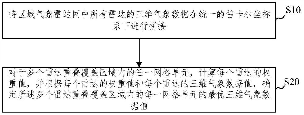
[0038] figure 1 It is a schematic diagram of a regional meteorological radar network data fusion method according to an embodiment of the present invention, such as figure 1 As shown, the embodiment of the present invention provides a kind of regional meteorological radar network data fusion method, comprising:
[0039] Step S10, splicing the three-dimensional meteorological data of all radars in the regional meteorological radar network under a unified Cartesian coordinate system;
[0040] Step S20, for any grid cell within the overlapping coverage area of multiple radars, calculate the weight value of each radar, and determine the multiple radars according to the weight value of each radar and the three-dimensional meteorological data value of each radar Optimal 3D weather data values for each grid cell within the overlapping coverage area.
[0041] Further, it also includes:
[0042] The three-dimensional weather data of each radar is determined according to the orig...
Embodiment 2
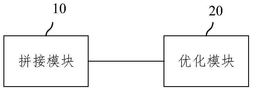
[0074] image 3 It is a schematic diagram of a regional meteorological radar network data fusion device according to an embodiment of the present invention, such as image 3 As shown, the embodiment of the present invention provides a regional meteorological radar network data fusion device, which is used to complete the method described in the above embodiment, specifically including a splicing module 10 and an optimization module 20, wherein,
[0075] The splicing module 10 is used for splicing the three-dimensional meteorological data of all radars in the regional meteorological radar network under a unified Cartesian coordinate system;
[0076] The optimization module 20 is used to calculate the weight value of each radar for any grid cell in the overlapping coverage area of multiple radars, and determine the multiple The optimal 3D meteorological data value of each grid cell within the radar overlapping coverage area.
[0077] The embodiment of the present invention p...
Embodiment 3
[0080] Figure 4 A schematic structural diagram of an electronic device for data fusion of a regional meteorological radar network provided by an embodiment of the present invention, such as Figure 4 As shown, the device includes: a processor 801, a memory 802 and a bus 803;
[0081] Wherein, the processor 801 and the memory 802 complete mutual communication through the bus 803;
[0082] The processor 801 is used to call the program instructions in the memory 802 to execute the methods provided by the above method embodiments, including, for example:
[0083] The three-dimensional meteorological data of all radars in the regional meteorological radar network are stitched together in a unified Cartesian coordinate system;
[0084] For any grid cell in the overlapping coverage area of multiple radars, calculate the weight value of each radar, and determine the overlapping coverage area of the multiple radars according to the weight value of each radar and the three-dimens...
PUM
 Abstract
Description
Claims
Application Information
 - R&D
- Intellectual Property
- Life Sciences
- Materials
- Tech Scout
- Unparalleled Data Quality
- Higher Quality Content
- 60% Fewer Hallucinations
Browse by: Latest US Patents, China's latest patents, Technical Efficacy Thesaurus, Application Domain, Technology Topic, Popular Technical Reports.
© 2025 PatSnap. All rights reserved.Legal|Privacy policy|Modern Slavery Act Transparency Statement|Sitemap|About US| Contact US: help@patsnap.com


