
Automatic image naming method based on target latitude and longitude

A technology of longitude, latitude and longitude, which is applied in still image data retrieval, still image data indexing, etc., which can solve the problems of human incompetence, low efficiency, time-consuming and labor-intensive, etc.

Active Publication Date: 2019-06-04
GUANGDONG POWER GRID CO LTD +1
View PDF3 Cites 0 Cited by
  • Summary
  • Abstract
  • Description
  • Claims
  • Application Information

AI Technical Summary

Problems solved by technology

[0003]The traditional working method needs to manually rename the photos, which is inefficient, time-consuming and labor-intensive, especially when there are many photos, it is difficult for manpower to do it

Method used


Image

  • Automatic image naming method based on target latitude and longitude
  • Automatic image naming method based on target latitude and longitude
  • Automatic image naming method based on target latitude and longitude

Examples


Embodiment Construction

[0042] In order to make the purpose, features and advantages of the present invention more obvious and understandable, the technical solutions in the embodiments of the present invention will be clearly and completely described below in conjunction with the accompanying drawings in the embodiments of the present invention. Obviously, the following description The embodiments are only some of the embodiments of the present invention, but not all of them. Based on the embodiments of the present invention, all other embodiments obtained by persons of ordinary skill in the art without making creative efforts belong to the protection scope of the present invention.

[0043] In the description of the present invention, it is to be understood that when a component is said to be "connected" to another component, it may be directly connected to the other component or there may be an intervening component at the same time. When a component is said to be "set on" another component, it ca...


PUM


Abstract

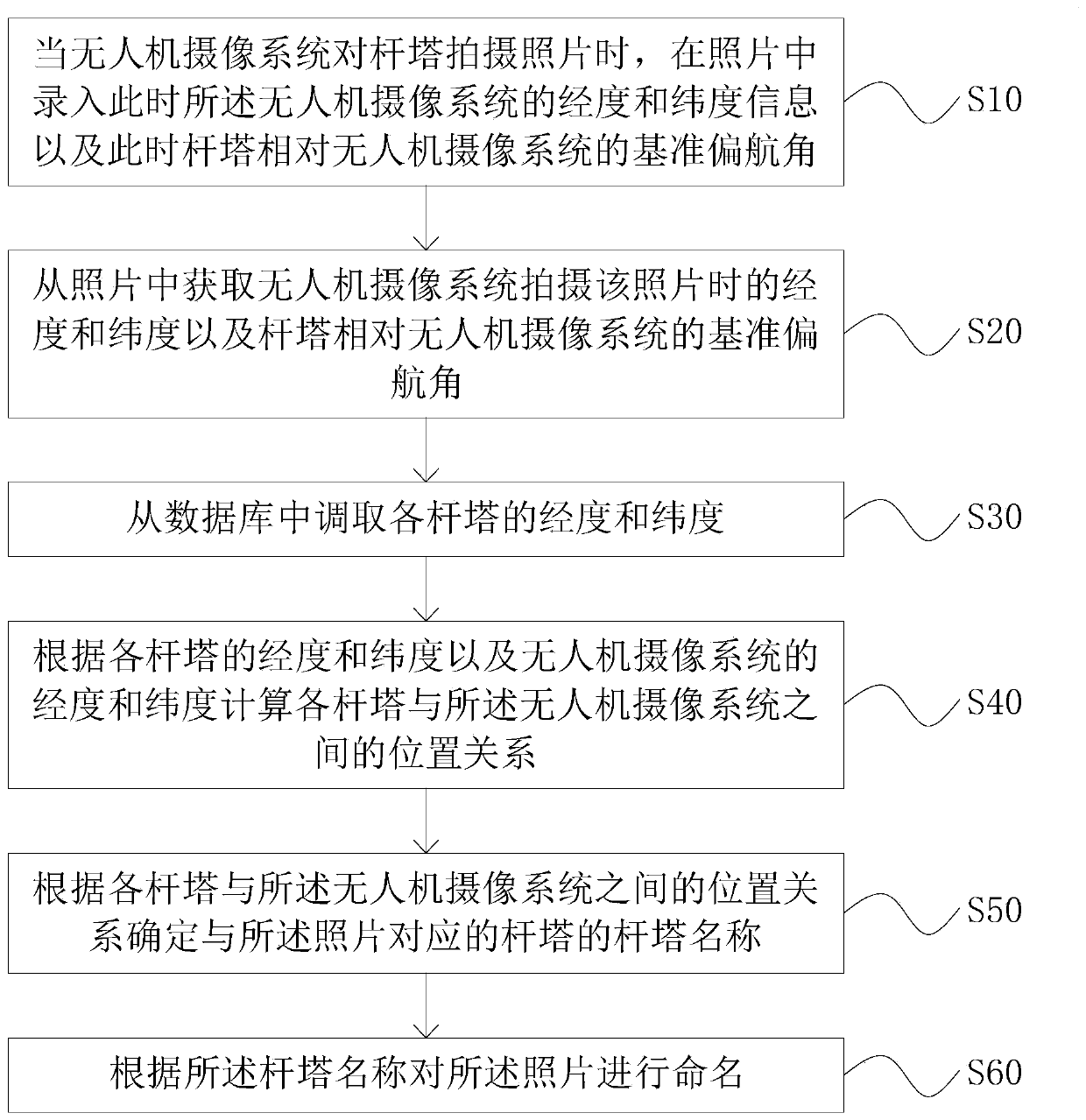
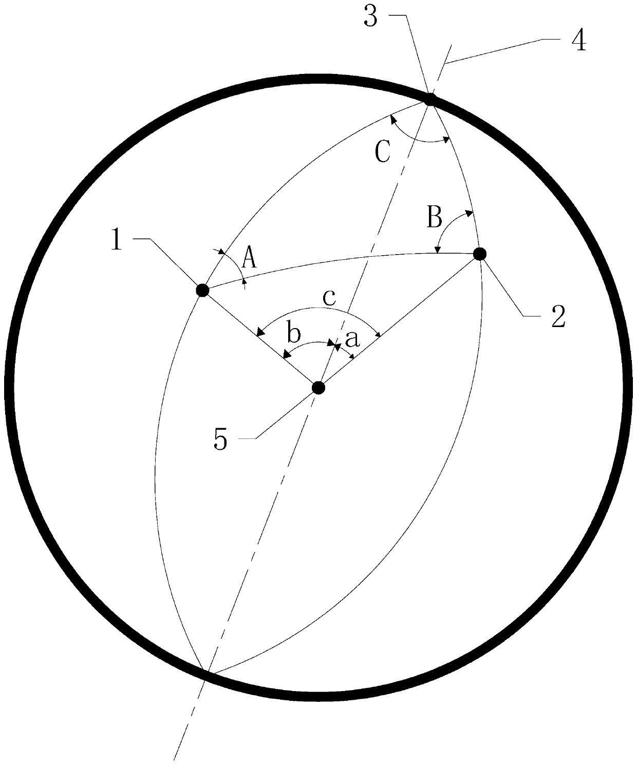
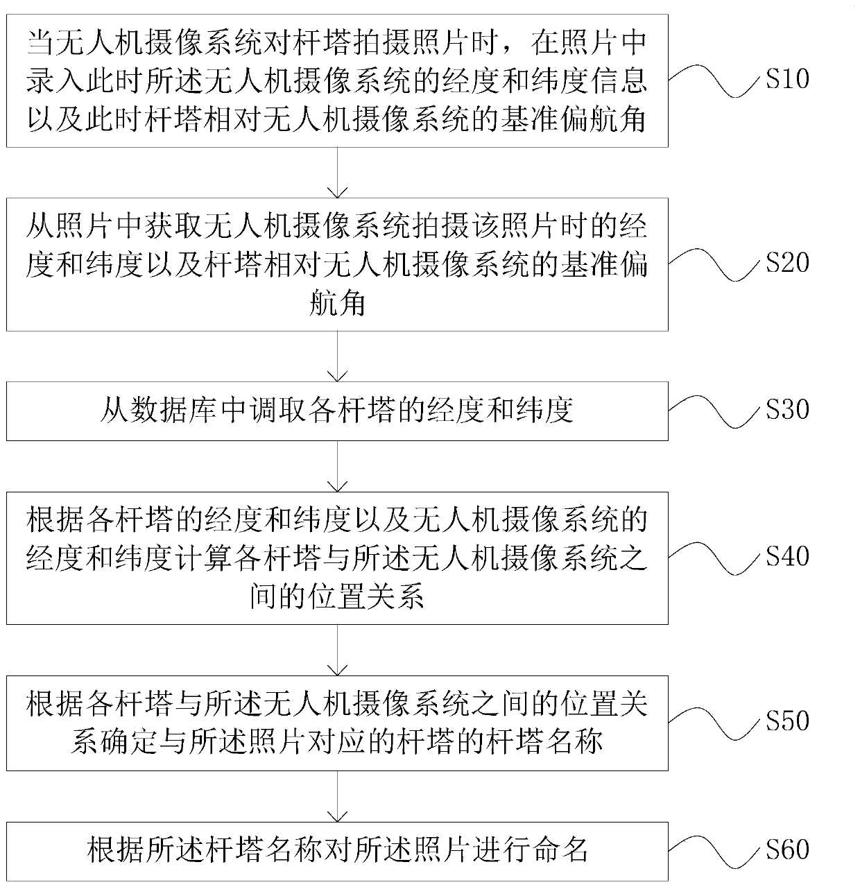
The invention relates to the technical field of image naming, and particularly discloses a longitude and latitude automatic image naming method based on a target, which comprises the following steps:when an unmanned aerial vehicle camera system shoots a tower, recording the longitude, latitude and reference yaw angle of the unmanned aerial vehicle camera system in the picture; acquiring longitudeand latitude of the unmanned aerial vehicle camera system when the unmanned aerial vehicle camera system shoots the photo and a reference yaw angle of the tower relative to the unmanned aerial vehicle camera system from the photo; calling the longitude and latitude of each tower from a database; calculating the position relation between each tower and the unmanned aerial vehicle camera system according to the longitude and latitude of each tower and the longitude and latitude of the unmanned aerial vehicle camera system; determining the tower name of the tower corresponding to the photo according to the position relationship between each tower and the unmanned aerial vehicle camera system; and naming the photo according to the tower name. The target-based latitude and longitude image automatic naming method provided by the invention can automatically rename the pictures shot by the unmanned aerial vehicle camera system.

Description

technical field [0001] The invention relates to the technical field of image naming, in particular to an automatic image naming method based on the latitude and longitude of a target. Background technique [0002] When erecting transmission lines, it is often necessary to use a large number of towers. Generally, in order to monitor and manage the working conditions of the towers, the traditional working method is that the staff use the drone camera system to take pictures of a large number of towers, and then copy the photos taken by the drone camera system to the computer. Then rename the photos according to the names of the poles and towers in the photos, and finally put the renamed photos into folders named after the line names. [0003] The traditional way of working requires manual renaming of photos, which is inefficient, time-consuming and labor-intensive, especially when there are many photos, manpower is not competent. [0004] Therefore, there is a need for an au...

Claims


Application Information

Patent Timeline
IPC IPC(8): G06F16/51
Inventor 邢文忠陈晓彬吴正航曾桂宏吴永峰
Owner GUANGDONG POWER GRID CO LTD
Learn More