A Method of Converting Spherical Coordinates in Panoramic Maps to Straight Lines
A panoramic map and spherical coordinate technology, applied in the field of coordinate conversion, can solve problems such as not meeting application requirements
- Summary
- Abstract
- Description
- Claims
- Application Information
AI Technical Summary
Problems solved by technology
Method used
Image


Examples
Embodiment Construction
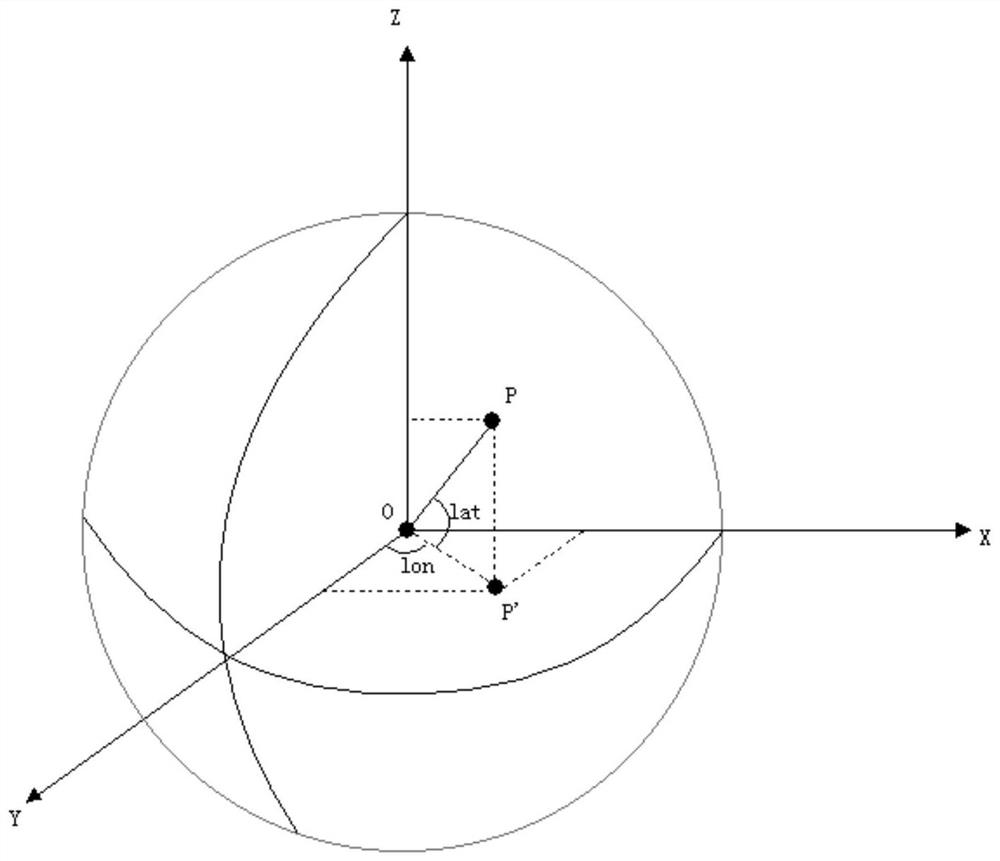
[0018] like Figures 1 to 4 As shown, a method for converting spherical coordinates in a panoramic map into straight line segments includes the following steps.
[0019] The first step is to take the sphere center O as the origin of the coordinates and the direction of the north pole as the Z axis; the direction with longitude as 0 degrees and latitude as 0 degrees is the X axis; the direction with longitude as 90 degrees and latitude as 0 degrees is Y The axis establishes a space Cartesian coordinate system; among them, the camera position is the center of the sphere.
[0020] The second step is to convert the two points P1(lon1,lat1) and P2(lon2,lat2) on the spherical surface to the space rectangular coordinate system O-XYZ, the result is P1´(x1,y1,z1), P2´(x2 ,y2,z2) conversion method is: x = R * cos(lat) * cos(lon), y = R * cos(lat) * sin(lon), z = R * sin(lat). Among them, R is the radius of the spherical coordinate system, lat is the longitude of the point on the spher...
PUM
 Abstract
Description
Claims
Application Information
 - R&D
- Intellectual Property
- Life Sciences
- Materials
- Tech Scout
- Unparalleled Data Quality
- Higher Quality Content
- 60% Fewer Hallucinations
Browse by: Latest US Patents, China's latest patents, Technical Efficacy Thesaurus, Application Domain, Technology Topic, Popular Technical Reports.
© 2025 PatSnap. All rights reserved.Legal|Privacy policy|Modern Slavery Act Transparency Statement|Sitemap|About US| Contact US: help@patsnap.com