Vehicle monitoring method, device, system and storage medium for electronic fence en route
A vehicle monitoring and vehicle technology, applied in the control/regulation system, vehicle position/route/height control, non-electric variable control and other directions, which can solve the problems of slow customs clearance and affecting the speed of goods logistics.
- Summary
- Abstract
- Description
- Claims
- Application Information
AI Technical Summary
Problems solved by technology
Method used
Image
Examples
Embodiment 1
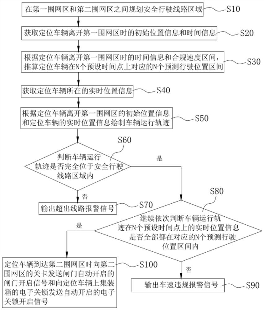
[0037] refer to figure 1 , Embodiment 1 of the present invention provides a method for monitoring vehicles on the way of an electronic fence, which specifically includes the following steps:
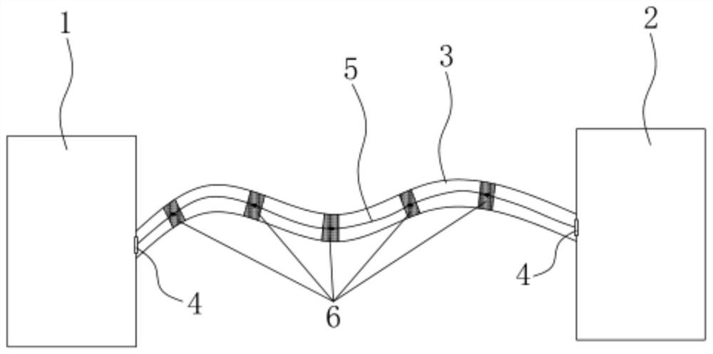
[0038] Step S10 , planning a safe driving route area 3 between the first fenced area 11 and the second fenced area 22 .
[0039] In a specific implementation of this embodiment, the first fenced area 1 and the second fenced area 2 can be control areas that require strict control of vehicles and access, such as: free trade zones, customs, bonded port areas , airport area, logistics industrial park, etc. In order to ensure the running speed and driving safety of vehicles on the safe driving route area 3 , a compliance speed range for vehicles is set in the safe driving route area 3 . Specifically, when the actual driving distance between the first fenced area 1 and the second fenced area 2 is 2 kilometers, the compliance speed range is 28-30 km / h; when the first fenced area 1 and the secon...
Embodiment 2
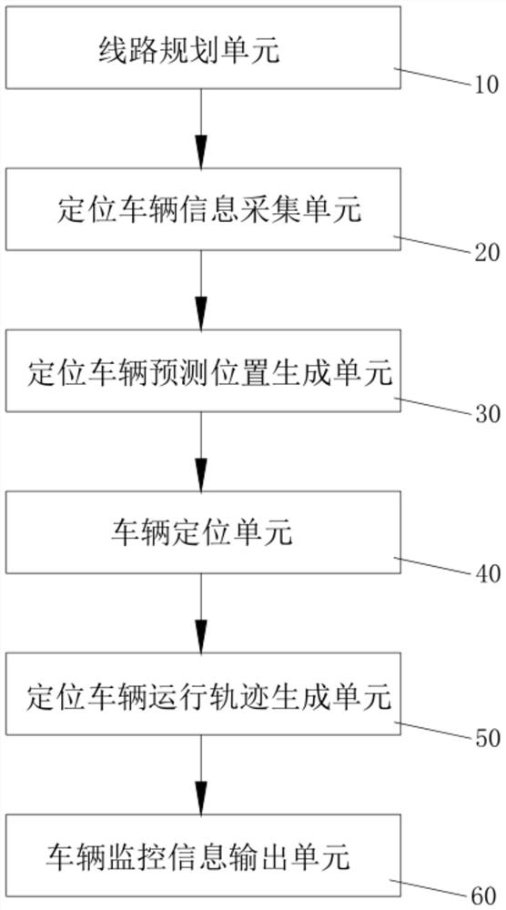
[0059] refer to image 3 , Embodiment 2 of the present invention provides an en route vehicle monitoring device for an electronic fence, including:
[0060] A route planning unit 10, configured to plan a safe driving route area 3 between the first fenced area 1 and the second fenced area 2 on the map;
[0061] The positioning vehicle information collection unit 20 is used to obtain the initial position and time data when the positioning vehicle leaves the first fenced area 1;
[0062] The predicted position generation unit 30 of the positioning vehicle is used to generate on the map each time after the positioning vehicle runs N preset time points according to the time data when the positioning vehicle leaves the first fenced area 1 and the compliance speed interval of the vehicle. The predicted driving position interval 6 corresponding to the point;
[0063] The vehicle positioning unit 40 is used to obtain the real-time position where the positioning vehicle is located;
...
PUM
 Abstract
Description
Claims
Application Information
 - R&D
- Intellectual Property
- Life Sciences
- Materials
- Tech Scout
- Unparalleled Data Quality
- Higher Quality Content
- 60% Fewer Hallucinations
Browse by: Latest US Patents, China's latest patents, Technical Efficacy Thesaurus, Application Domain, Technology Topic, Popular Technical Reports.
© 2025 PatSnap. All rights reserved.Legal|Privacy policy|Modern Slavery Act Transparency Statement|Sitemap|About US| Contact US: help@patsnap.com


