Method and system for active remote sensing satellite antenna phase center coordinate system conversion

A technology for antenna phase center and coordinate system conversion, which is applied to measuring instruments, instruments, surveying and mapping, and navigation, etc., to achieve the effects of high calculation accuracy, simple method, good application prospects and market prospects

Active Publication Date: 2022-01-25
SHANGHAI SATELLITE ENG INST
View PDF4 Cites 0 Cited by
  • Summary
  • Abstract
  • Description
  • Claims
  • Application Information

AI Technical Summary

Problems solved by technology

Not suitable for active remote sensing satellite antenna phase center coordinate system conversion

Method used


Image

  • Method and system for active remote sensing satellite antenna phase center coordinate system conversion
  • Method and system for active remote sensing satellite antenna phase center coordinate system conversion
  • Method and system for active remote sensing satellite antenna phase center coordinate system conversion

Examples


Embodiment Construction

[0047] The present invention will be described in detail below in conjunction with specific embodiments. The following examples will help those skilled in the art to further understand the present invention, but do not limit the present invention in any form. It should be noted that those skilled in the art can make several changes and improvements without departing from the concept of the present invention. These all belong to the protection scope of the present invention.

[0048] An embodiment of the present invention provides a method for converting an active remote sensing satellite antenna phase center coordinate system, including the following steps:

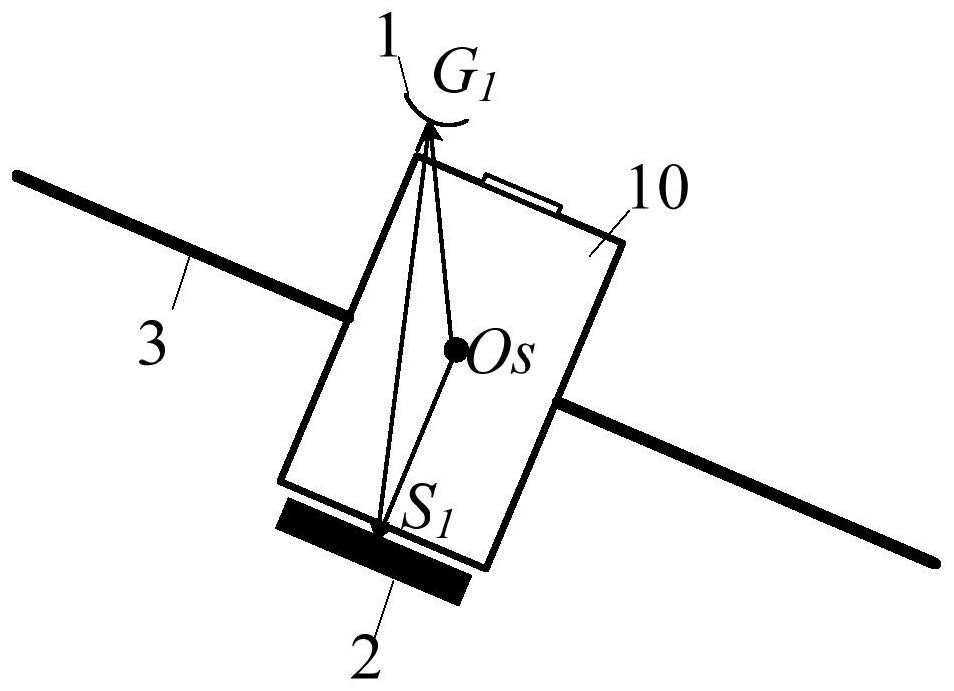
[0049] Step 1, obtain the vector of satellite GNSS antenna phase center under the WGS84 coordinate system by GNSS (Global Navigation Positioning System) observation data processing;

[0050] Step 2, according to the ground measurement, obtain the connection vector between the GNSS antenna phase center and the active rem...


PUM


Abstract

The present invention provides a kind of active remote sensing satellite antenna phase center coordinate system conversion method and system, obtain the vector of satellite GNSS antenna phase center under WGS84 coordinate system by GNSS (Global Navigation Positioning System) observation data processing; According to the ground measurement, get the satellite The line vector between the GNSS antenna phase center and the active remote sensing antenna phase center in the body coordinate system; calculate the coordinate transformation matrix from the satellite body coordinate system to the WGS84 coordinate system; calculate the vector of the satellite active remote sensing antenna phase center in the WGS84 coordinate system. The method for converting the active remote sensing satellite antenna phase center coordinate system of the invention is a key step in the precise image processing of the active remote sensing satellite.

Description

technical field [0001] The invention relates to the technical field of overall satellite design, in particular to a method and system for converting an active remote sensing satellite antenna phase center coordinate system. Background technique [0002] Active remote sensing satellites fly in orbital space formation through the main and auxiliary satellites, the satellites are launched, and the main and auxiliary satellites receive at the same time, forming an effective interference baseline and interferometric mapping of the earth. The accuracy of active remote sensing antenna phase center calculation directly affects the accuracy of surveying and mapping. [0003] After searching, it is found that the patent document CN 102981174A discloses a method for correcting the relative positioning accuracy of the change of the phase center of the GPS antenna, which realizes the correction of the relative positioning result of the target according to the change of the phase center o...

Claims


Application Information

Patent Timeline
Patent Type & Authority Patents(China)
IPC IPC(8): G01C15/00
CPCG01C15/00
Inventor 陆晴万向成陈重华李楠赵迪
Owner SHANGHAI SATELLITE ENG INST
Why Eureka
Try Eureka