Method and system for calibrating spatial position

A technology of spatial position and calibration method, which is applied in the information field and can solve problems such as target label measurement that cannot be measured.

Active Publication Date: 2022-05-03
HANGZHOU HIKVISION DIGITAL TECH
View PDF5 Cites 0 Cited by
  • Summary
  • Abstract
  • Description
  • Claims
  • Application Information

AI Technical Summary

Problems solved by technology

[0004] The purpose of the embodiments of the present invention is to provide a spatial position calibration method and system, in order to solve the problem when there is an obstacle between the base station equipment and the target tag to be measured, or the target tag to be measured is located outside the measurement range of the base station equipment , resulting in the inability to measure the target label that needs to be measured

Method used


Image

  • Method and system for calibrating spatial position
  • Method and system for calibrating spatial position
  • Method and system for calibrating spatial position

Examples


Embodiment Construction

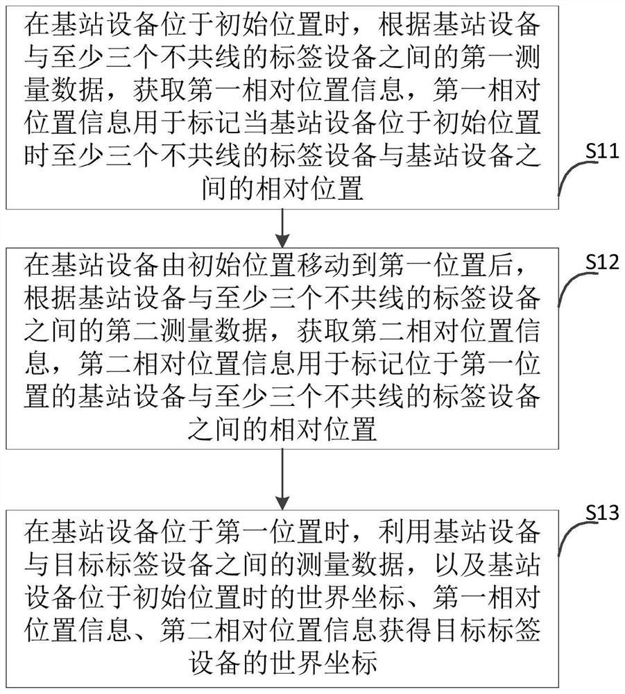
[0033] The following will clearly and completely describe the technical solutions in the embodiments of the present invention with reference to the accompanying drawings in the embodiments of the present invention. Obviously, the described embodiments are only some, not all, embodiments of the present invention. Based on the embodiments of the present invention, all other embodiments obtained by persons of ordinary skill in the art without making creative efforts belong to the protection scope of the present invention.

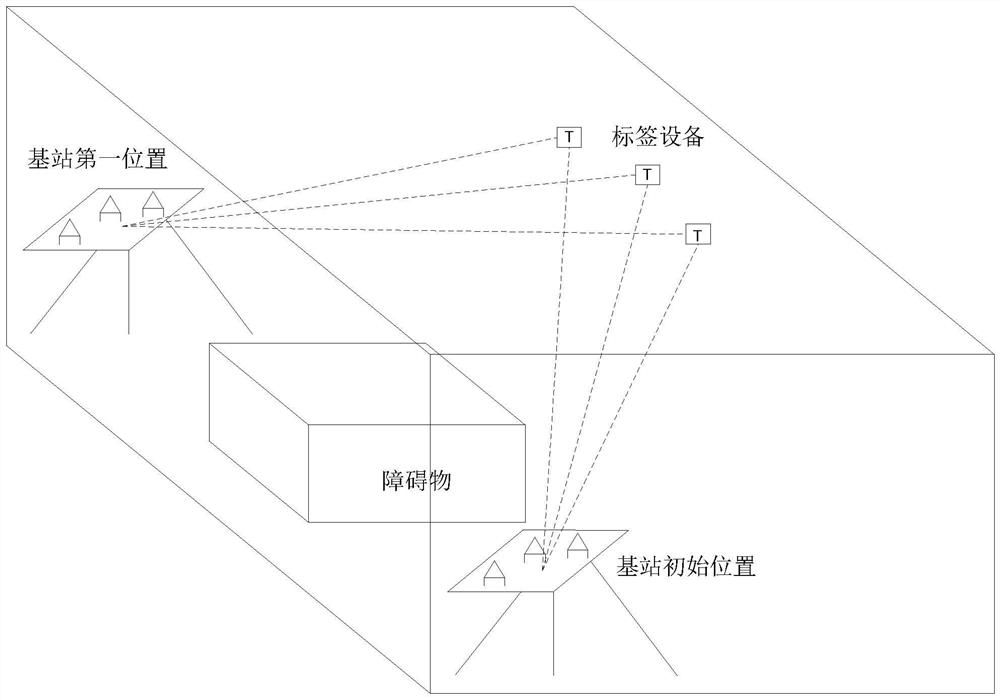
[0034] In the prior art, the spatial positioning technology is used to calibrate the spatial position of the equipment, and the target position may be too far away or seriously blocked. The method of the present invention is used to solve the problem that the above situation cannot directly use the spatial positioning technology for calibration.

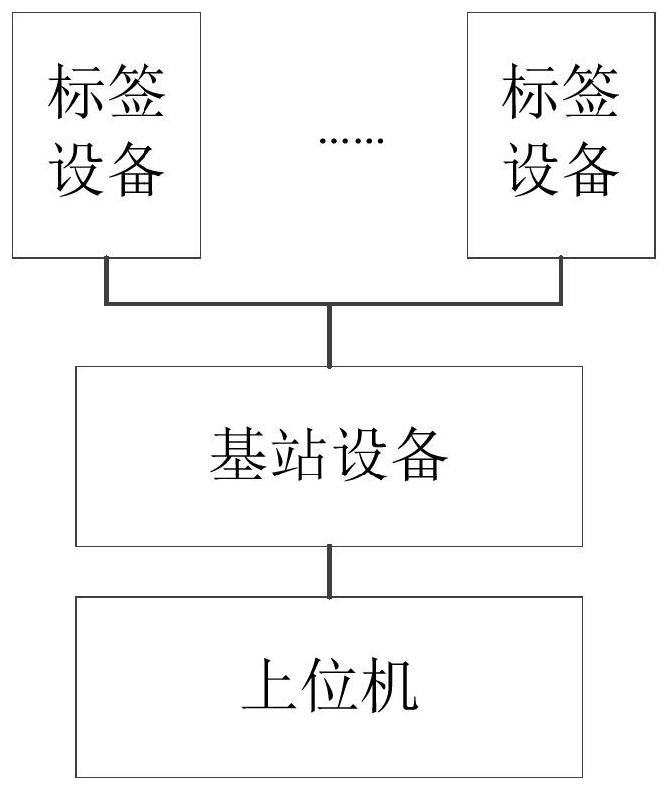
[0035] The equipment of the present invention such as figure 1 As shown, it includes: a mobile base station device...


PUM


Abstract

Embodiments of the present invention provide a spatial position calibration method and system, which are applied in the field of information technology. When the base station equipment is located at the initial position, according to the first measurement data between the base station equipment and at least three non-collinear tag equipment, Acquiring the first relative position information; after the base station moves from the initial position to the first position, according to the second measurement data between the base station and at least three non-collinear tag devices, acquiring the second relative position information; at the base station When the device is at the first position, the world coordinates of the target tag device are obtained by using the measurement data between the base station device and the target tag device, the world coordinates when the base station device is at the initial position, the first relative position information, and the second relative position information. Therefore, the target tag device can be calibrated through the base station device and the tag device, thereby solving the problem that the target tag to be measured cannot be measured.

Description

technical field [0001] The present invention relates to the field of information technology, in particular to a spatial position marking method and system. Background technique [0002] At present, when calibrating the space position of the equipment, the label equipment is generally installed at a predetermined position in the space to be calibrated or on the equipment to be calibrated, and the distance between the base station equipment and the label equipment is measured to complete the space to be calibrated. Or the calibration of the equipment to be calibrated. [0003] However, when there is an obstacle between the base station device and the target tag to be measured, or the target tag to be measured is located outside the measurement range of the base station device, the target tag to be measured cannot be measured. Contents of the invention [0004] The purpose of the embodiments of the present invention is to provide a spatial position calibration method and sys...

Claims


Application Information

Patent Timeline
Patent Type & Authority Patents(China)
IPC IPC(8): H04W64/00G01S5/00
CPCH04W64/00G01S5/0009
Inventor 杜天一
Owner HANGZHOU HIKVISION DIGITAL TECH
Why Eureka
Try Eureka