
Globes having marked zones of geographic interest

Inactive Publication Date: 2006-04-06
WILSON KEITH P
View PDF14 Cites 0 Cited by
  • Summary
  • Abstract
  • Description
  • Claims
  • Application Information

AI Technical Summary

Benefits of technology

[0009] The present invention relates to an Earth globe for studying continental position theories, and methods of marking the globe to facilitate in the study of the relationship of continents and other land masses on the Earth. The Earth globe comprises graphical image representations of a plurality of land masses at locations representing the current position of the land masses on Earth and a plurality of at least a portion of great circle indication lines graphically marked on the globe generally corresponding to a linear portions of geographical features, such as a land mass coast, a land mass shelf, an island chain, or a mountain chain. By study of globes that are so marked, one can formulate theories of possible historical motion of land masses on Earth, and additionally acquire a greater appreciation for the relative positional relationship of land masses.
[0010] In a surprising aspect of the present invention, it has been discovered that in the study of great circle lines corresponding to linear portions of geographical features, a number of the great circle lines actually intersect at a small

Problems solved by technology

This expanding earth theory also has challenges, including questions regarding location and creation of mountains, and so forth.

Method used


Image

  • Globes having marked zones of geographic interest
  • Globes having marked zones of geographic interest
  • Globes having marked zones of geographic interest

Examples


Embodiment Construction

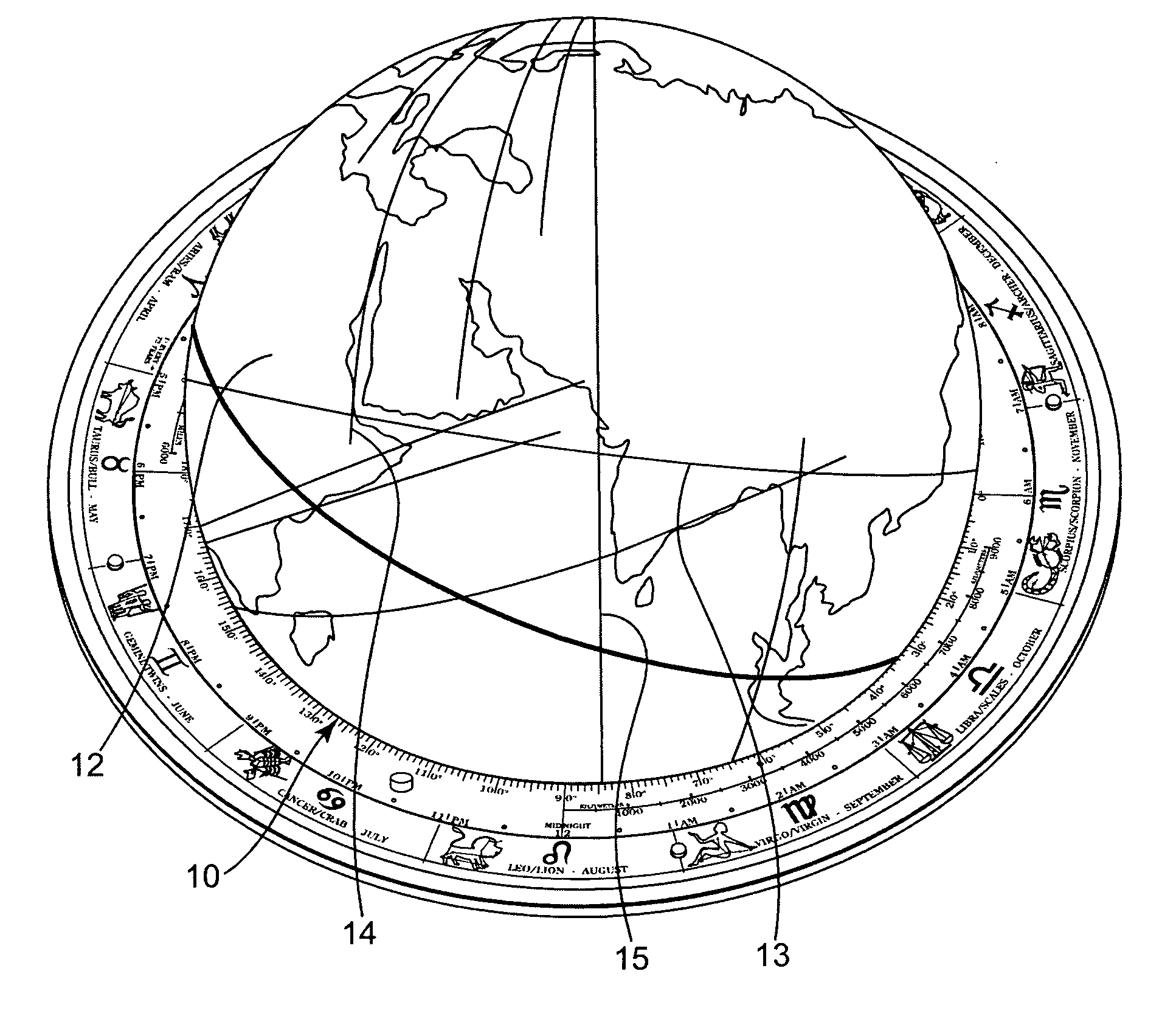
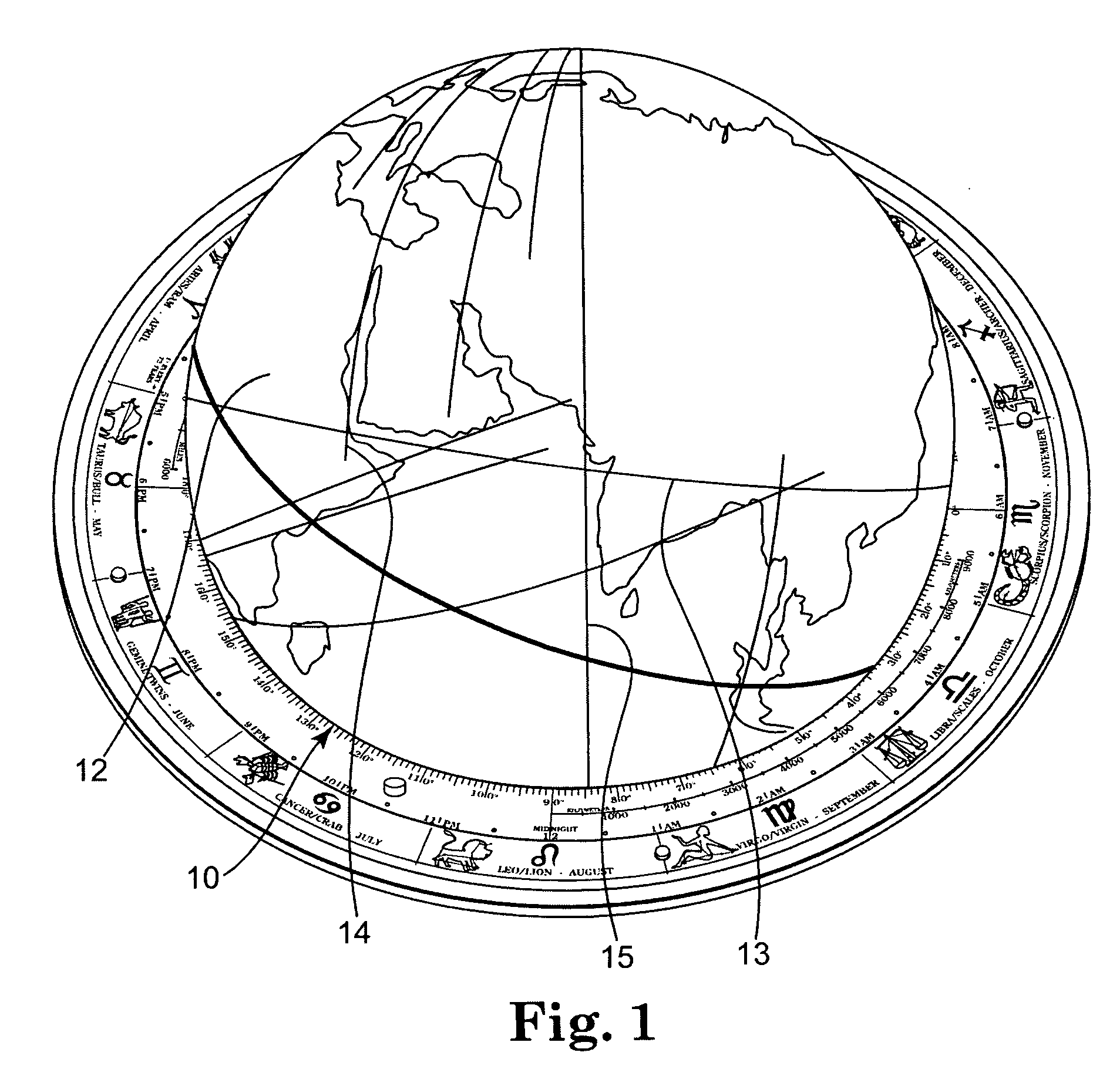
[0017] Turning now to the drawings, wherein like numerals indicate like parts, FIG. 1 is a perspective view of globe 10 having graphical image representations of a plurality of land masses such as Africa 12 and India 13 at locations representing the current position of the land masses on Earth. Great circle indication lines 14 and 15 are graphically marked on globe 10 generally corresponding to linear portion geographical features of land masses 12 and 13. As shown in this embodiment, the great circle indication lines are graphically marked as the complete great circle of the globe. Specifically, great circle indication line 14 is provided corresponding generally to the coast of Africa 12 at the Red Sea. Similarly, great circle indication line 15 is provided corresponding generally to the southwestern coast of India 13. Great circle indication lines 14 and 15 are seen to converge at an intersection zone on globe 10 just outside of the view of this Figure.

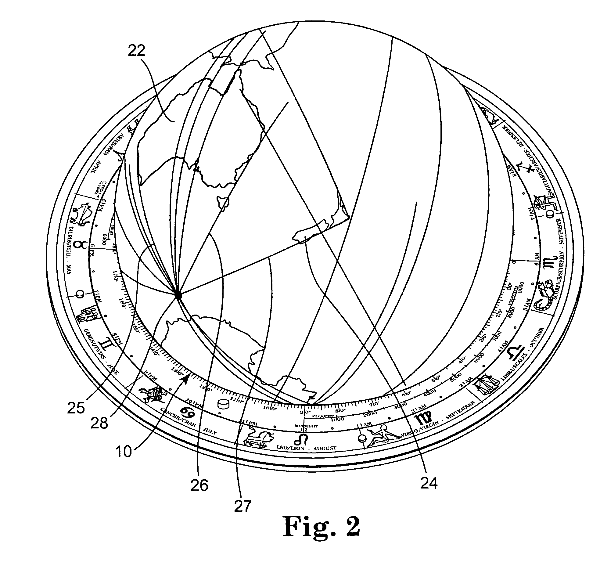
[0018]FIG. 2 is a perspecti...


PUM


Abstract

An Earth globe is provided for studying continental position theories. The globe comprises graphical image representations of a plurality of land masses at locations representing the current position of the land masses on Earth. A plurality of at least a portion of great circle indication lines are graphically marked on the globe that generally correspond to linear portions of geographic features on the globe. Globes having at least one graphically marked intersection zone corresponding to an area within about 5° of defined geographic points are also provided. Methods for marking globes are also described.

Description

PRIORITY CLAIM [0001] This Non-provisional Patent Application claims priority from United States Provisional Patent Application having Ser. No. 60 / 605,045, filed on Aug. 27, 2004, and titled GLOBES HAVING MARKED ZONES OF GEOGRAPHIC INTEREST, wherein the entire contents of said provisional application is incorporated herein by reference.FIELD OF THE INVENTION [0002] The present invention relates to globes of the Earth. More specifically, the present invention relates to Earth globes having markings that identify zones of geographic interest. BACKGROUND OF THE INVENTION [0003] In examining a globe of the world, one can casually observe that it appears that the continents appear to “fit together” like pieces of a puzzle. This has lead to a number of theories in the development of the Earth with the geography as it appears today. In 1912, Alfred L. Wegener proposed a hypothesis of continental drift, suggesting that the Earth's continents had at one time been joined. In Wegener's hypothe...

Claims


Application Information

Patent Timeline
IPC IPC(8): G09B27/08
CPCG09B27/08
Inventor WILSON, KEITH P.
Owner WILSON KEITH P
Learn More