

Geographic Identification System
a technology of geographic identification and information system, applied in the field of mapping services, can solve the problems of cumbersome input of information into the device while driving, affecting the accuracy of the map, so as to achieve efficient representation of geographic locations
- Summary
- Abstract
- Description
- Claims
- Application Information
AI Technical Summary
Problems solved by technology
Method used
Image

Examples
Embodiment Construction
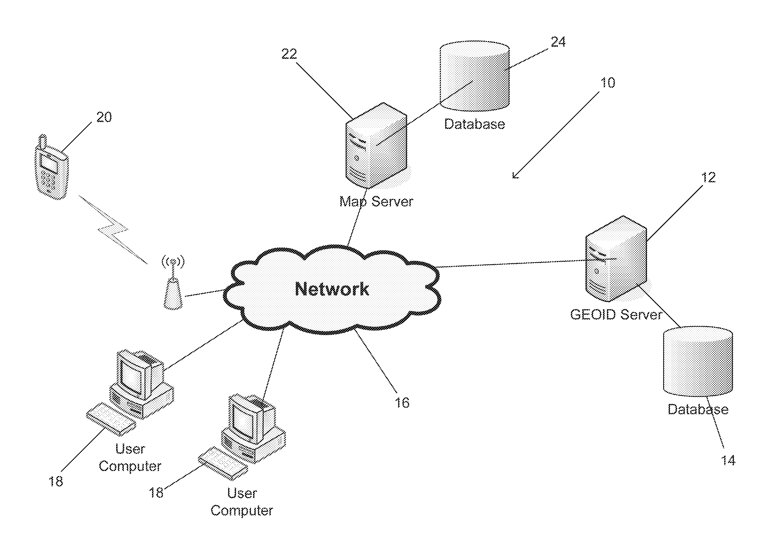
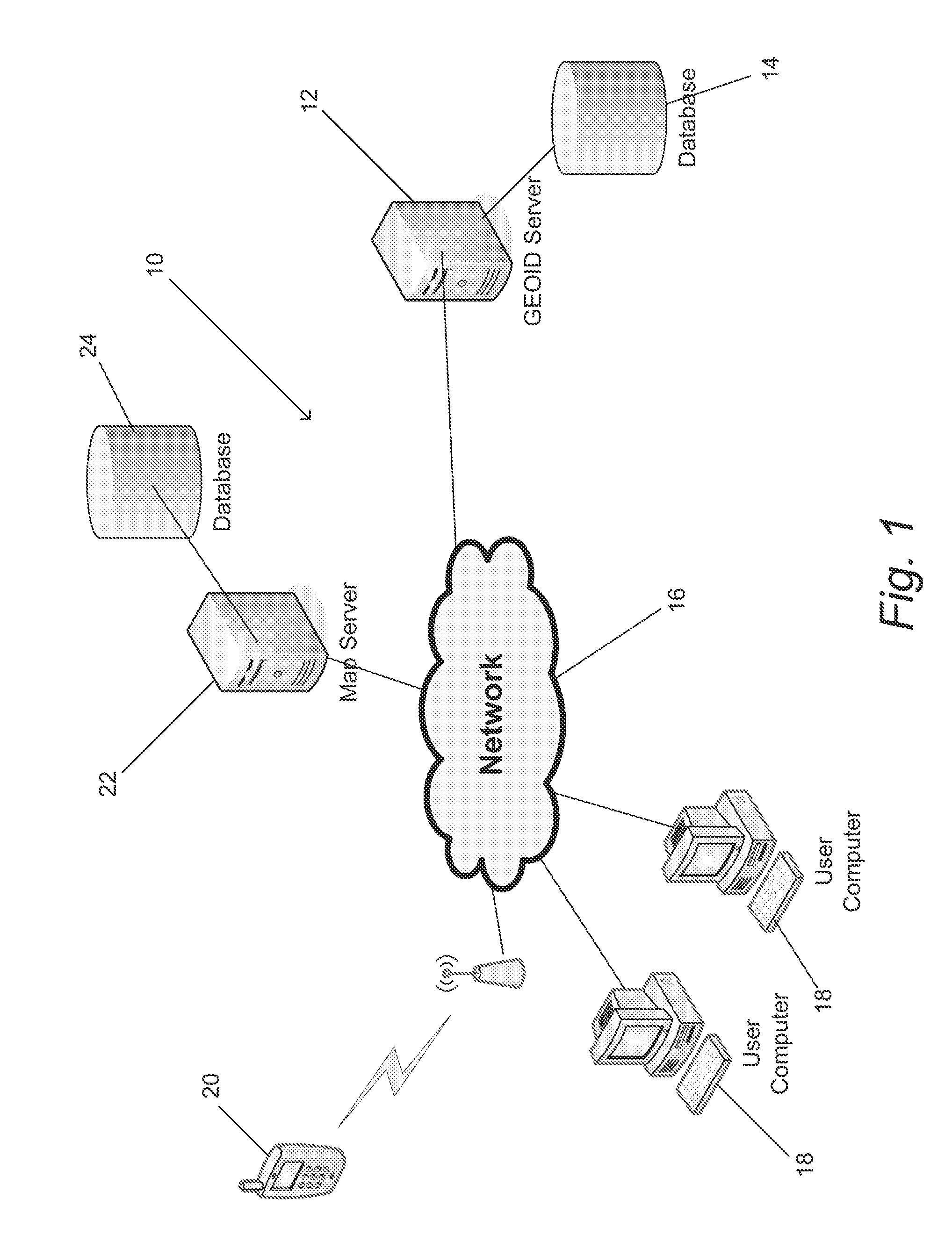
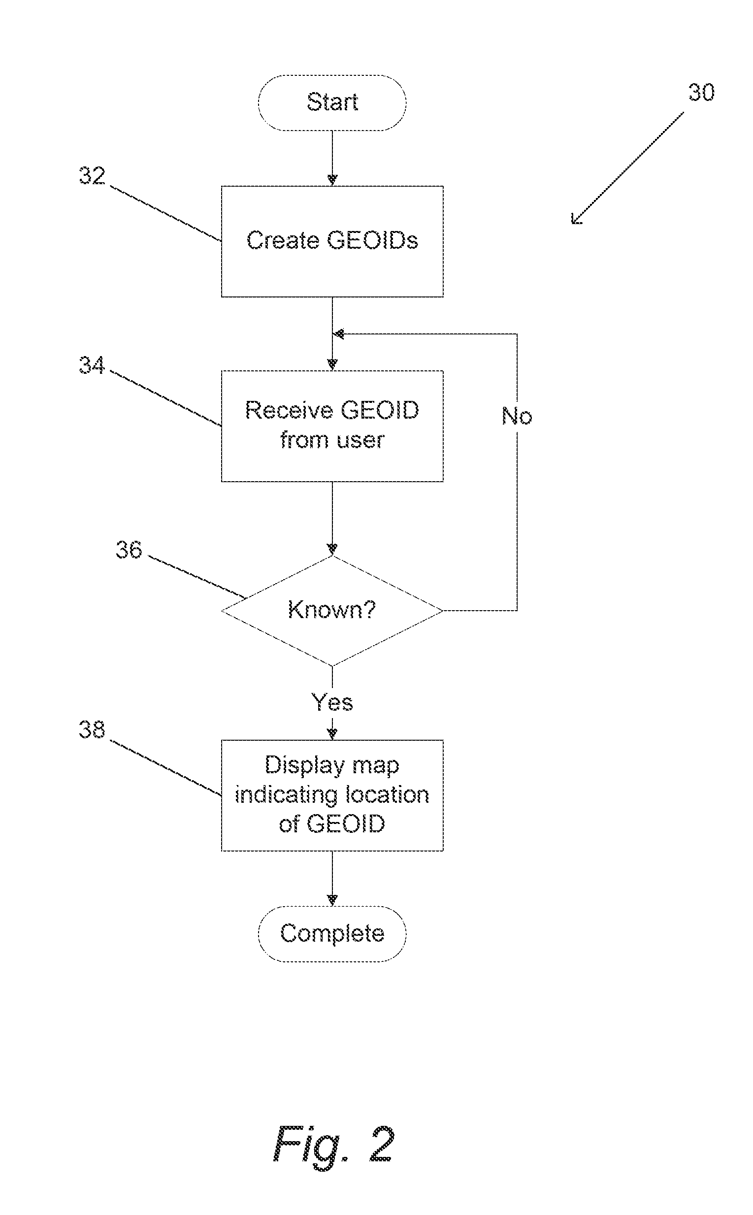
[0062]Turning now to the drawings, geographic identification systems and methods of displaying geographic locations on maps and providing related location based services in accordance with embodiments of the invention are illustrated. The geographic location of an object can be expressed via any of a number of different coordinate systems including but not limited to latitude and longitude on the surface of the Earth, and / or a street address including a street address, a city, and / or a postal or ZIP code. The term “geographic identification”, which can be shortened to GEOID, includes an alphanumerical label (GEOID label), which may be unique, and a set of specific geographic information assigned to aforementioned GEOID label. The set of geographic information includes but is not limited to one or more static geographic locations, one or more routes, and / or information identifying one or more mobile assets. The geographic location to which the GEOID label points, can be a fixed geogr...
PUM
 Abstract
Description
Claims
Application Information