System and method for vehicular localization relating to autonomous navigation

a technology for autonomous navigation and vehicle localization, applied in the direction of navigation instruments, process and machine control, etc., can solve the problems of inaccurate gps localization, accumulation of errors as the vehicle travels, and inconvenient use, so as to enhance localization techniques, enhance the estimated location and heading of the vehicle, and improve the precision and accuracy of estimated location

Inactive Publication Date: 2019-10-17
FARADAY&FUTURE INC
View PDF3 Cites 8 Cited by
  • Summary
  • Abstract
  • Description
  • Claims
  • Application Information

AI Technical Summary

Benefits of technology

[0003]Examples of the disclosure are directed to enhancing localization techniques for safe autonomous driving navigation. A system in accordance with a preferred embodiment of the present invention estimates a current location and heading of a vehicle using a location system such as GPS, and analyzes on-board sensor information relating to the vehicle's surroundings, such as LIDAR and / or camera data. In accordance with one embodiment, the system uses the location information to retrieve map information related to the estimated location of the vehicle including information about landmarks (e.g., location, type, dimensions) within the vicinity the vehicle's estimated location. In accordance with one embodiment, the map information and sensor information are used by the system to enhance the estimated location and heading of the vehicle. For example, the system analyzes map information and the sensor information to perform map matching of the landmarks described in the map information to the landmarks detected by the vehicle's onboard sensors and then determines the vehicle's position and orientation relative to the landmarks identified in the retrieved map information. By determining the vehicle's position and orientation relative to the landmarks described in the map, which includes the location of the landmarks (e.g., latitude and longitude coordinates, X and Y coordinates within the map), the system improves the precision and accuracy of the estimated location and heading of the vehicle. In this way, the vehicle can more safely navigate around the geographic area described by the map.

Problems solved by technology

GPS techniques (including Global Navigation Satellite Systems (GNSS)), however, can result in some uncertainty under certain conditions.
For example, GPS localization can be inaccurate because of signal blockage (e.g., due to tall buildings, being in a tunnel or parking garage), signal reflections off of buildings, or atmospheric conditions.
Moreover, dead reckoning techniques can be imprecise and can accumulate error as the vehicle travels.

Method used


Image

  • System and method for vehicular localization relating to autonomous navigation
  • System and method for vehicular localization relating to autonomous navigation
  • System and method for vehicular localization relating to autonomous navigation

Examples


Embodiment Construction

[0012]In the following description of examples, references are made to the accompanying drawings that form a part hereof, and in which it is shown by way of illustration specific examples that can be practiced. It is to be understood that other examples can be used and structural changes can be made without departing from the scope of the disclosed examples. Further, in the context of this disclosure, “autonomous driving” (or the like) can refer to autonomous driving, partially autonomous driving, and / or driver assistance systems.

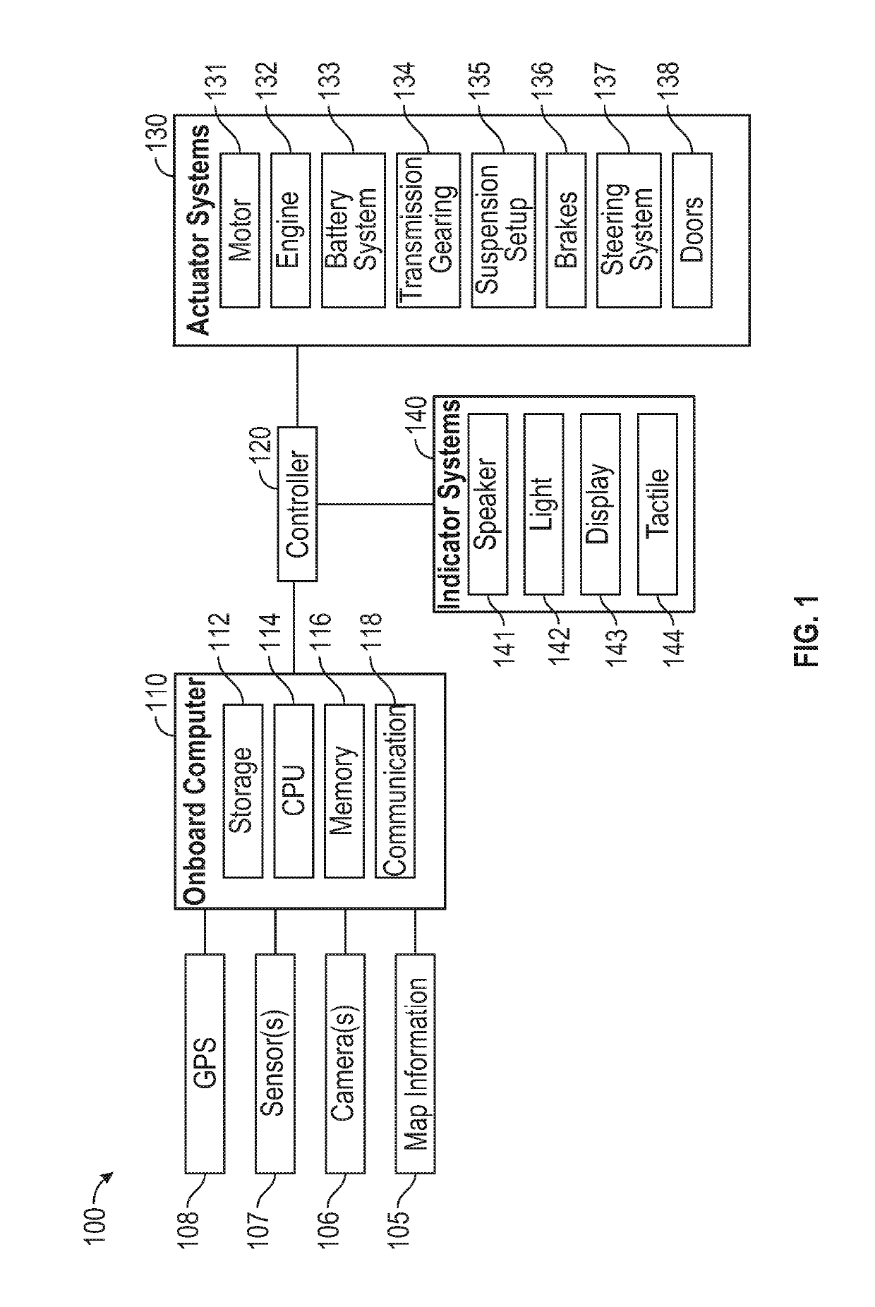
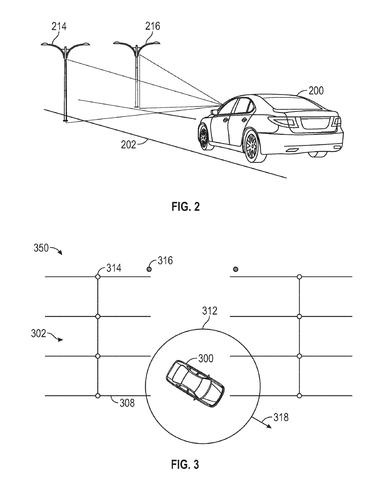
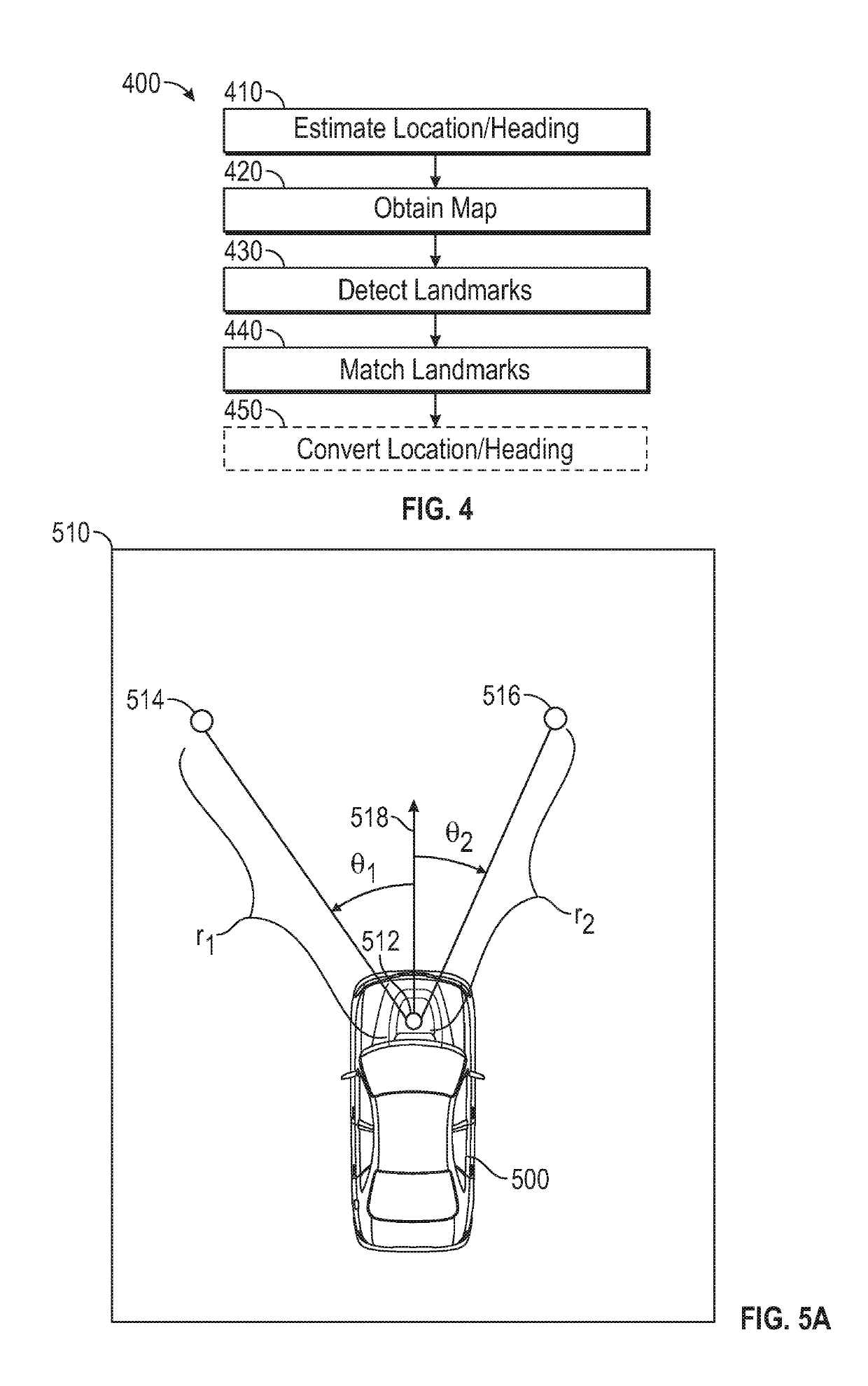
[0013]Autonomous vehicles can use location and heading information for performing autonomous driving operations. Examples of the disclosure are directed to using map information and sensor information for enhancing autonomous vehicle navigation. For example, a system in accordance with a preferred embodiment of the present invention can estimate a current location and heading of a vehicle using a location system such as GPS, and analyze on-board sensor info...


PUM


Abstract

A system for use in a vehicle, the system comprising one or more sensors; one or more processors coupled to the one or more sensors; and a memory including instructions, which when executed by the one or more processors, cause the one or more processors to perform a method. The method comprising determining an estimated location of the vehicle, obtaining map information based on the estimated location of the vehicle, obtaining sensor information relating the vehicle's proximate surroundings from the one or more sensors, detecting a first landmark and a second landmark in physical proximity to the vehicle based on the sensor information, and localizing the vehicle location based on the map information and the first and second landmarks.

Description

FIELD OF THE DISCLOSURE[0001]This relates generally to vehicle localization for autonomous vehicle navigation.BACKGROUND OF THE DISCLOSURE[0002]Vehicles, especially automobiles, increasingly include various systems and sensors for determining the vehicle's location. Current localization techniques for vehicles include Global Positioning Systems (GPS) and dead reckoning. GPS techniques (including Global Navigation Satellite Systems (GNSS)), however, can result in some uncertainty under certain conditions. For example, GPS localization can be inaccurate because of signal blockage (e.g., due to tall buildings, being in a tunnel or parking garage), signal reflections off of buildings, or atmospheric conditions. Moreover, dead reckoning techniques can be imprecise and can accumulate error as the vehicle travels. Accurate localization of a vehicle, however, is critical to achieve safe autonomous vehicle navigation. Therefore, a solution to enhance localization techniques for autonomous ve...

Claims


Application Information

Patent Timeline
Patent Type & Authority Applications(United States)
IPC IPC(8): G01C21/36G05D1/02G05D1/00
CPCG05D1/0088G05D1/0278G05D1/0248G01C21/3644G05D1/0219G05D1/0274G01C21/20G01C21/28G01C21/30G05D1/0246G05D2201/0213
Inventor SHIN, KWANG KEUN J.KIM, DAE JINBAE, HONG S.
Owner FARADAY&FUTURE INC
Why Eureka
Try Eureka