Underwater wireless sensor network cover control method based on surface even allocation

A wireless sensor and network coverage technology, applied in the field of underwater wireless sensor network coverage control based on uniform surface configuration, can solve the problems of large underwater monitoring range, limited underwater three-dimensional space coverage, and difficulty in obtaining information

Active Publication Date: 2008-09-03
JIANGSU SHENXIANG ELECTROMECHANICAL
View PDF0 Cites 14 Cited by
  • Summary
  • Abstract
  • Description
  • Claims
  • Application Information

AI Technical Summary

Problems solved by technology

[0003] 1) Underwater unmanned detection: Affected by factors such as high water pressure, unpredictable underwater activities, and large-scale water changes, manual methods are not suitable for water environment monitoring;
[0004] 2) Localization and accuracy of knowledge acquisition: Since the water environment at different levels shows typical localization and instantaneous changes, local detection is more accurate and effective than remote sensing and telemetry, but it is difficult to obtain sufficient information;
[0005] 3) The underwater monitoring range is large: the current technical level limits the communication between underwater equipment and ground equipment. In order to monitor the unstable large-scale underwater environment, a large amount of equipment deployment and maintenance costs are required
The two issues considered in coverage are: (a) whether the initial arrangement of sensor nodes covers the entire target area; (b) whether these nodes can accurately and completely collect the information of the target area
In addition, once the nodes are configured, the two-dimensional random method cannot change the position of the nodes on the horizontal plane. The random distribution of nodes inevitably leads to the problem that nodes in some areas are relatively concentrated, while nodes in other areas are relatively scarce. Limited coverage of lower 3D spaces

Method used


Image

  • Underwater wireless sensor network cover control method based on surface even allocation
  • Underwater wireless sensor network cover control method based on surface even allocation
  • Underwater wireless sensor network cover control method based on surface even allocation

Examples


Embodiment Construction
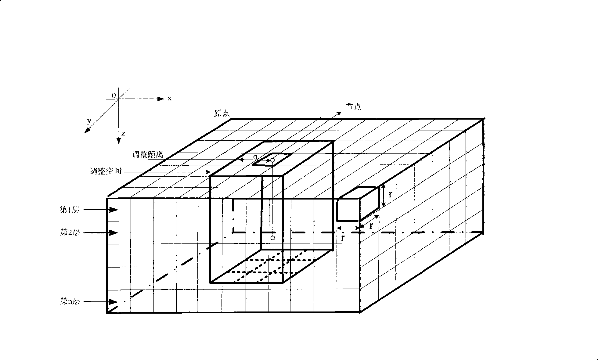
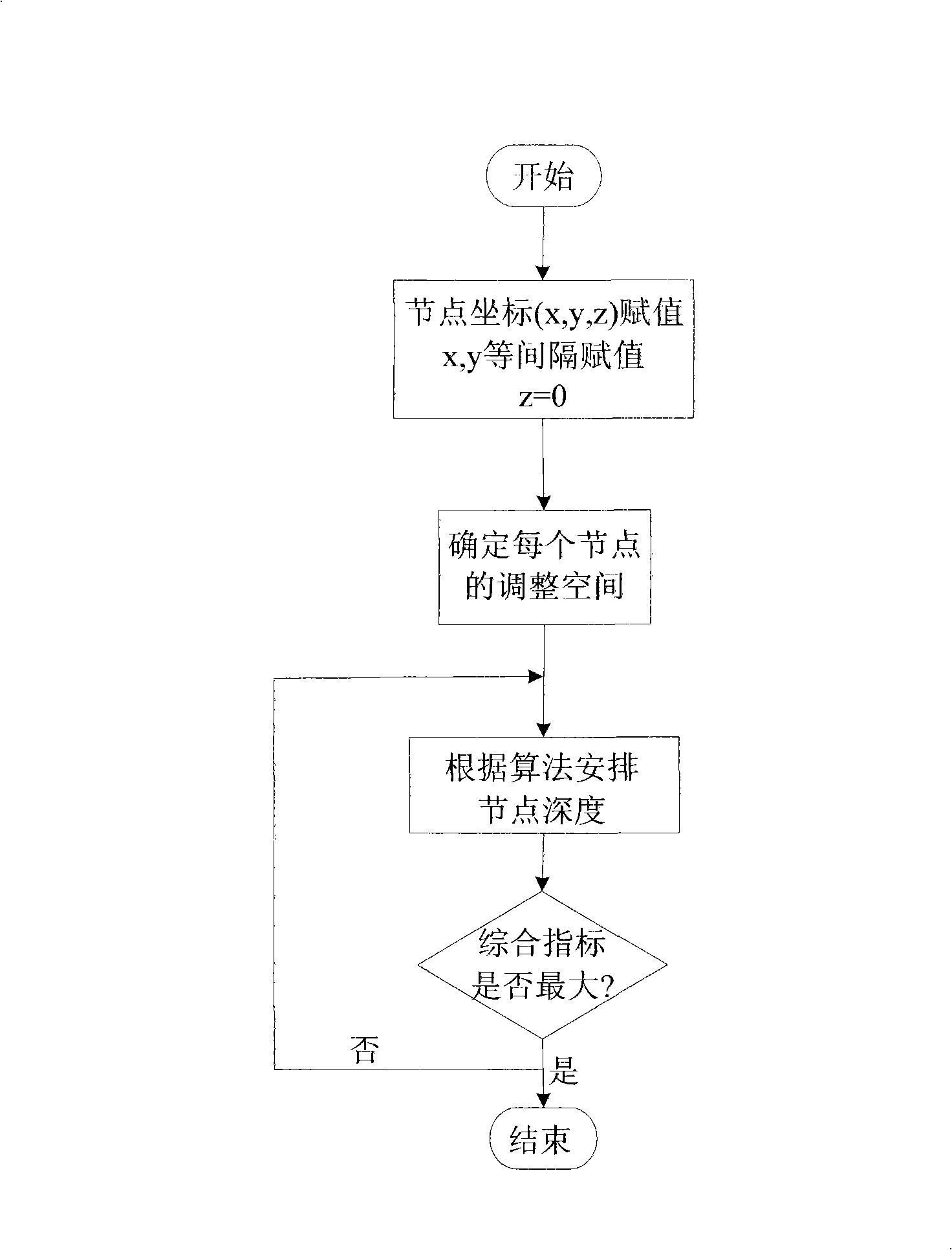
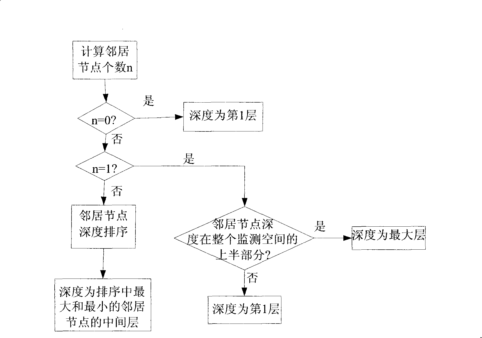
[0027] The core idea of ​​the present invention is: after distributing the nodes evenly and equidistantly on the horizontal plane, adjust the depth of the nodes so that the comprehensive index composed of the coverage of the entire monitoring area and the average distance between the nodes reaches the maximum, so as to realize the maximum three-dimensional space degree of coverage.

[0028] The present invention will be described in further detail below in conjunction with the accompanying drawings.

[0029] As mentioned above, the water area to be monitored is modeled with a cuboid, and the three-dimensional coordinate system of the water area to be monitored is determined. as attached figure 1 As shown in , select an appropriate point in the water area to be monitored as the origin of the coordinate system. The two dimensions of the horizontal plane are represented by the x-axis and the y-axis, respectively, and the direction perpendicular to the horizontal plane is represe...


PUM


Abstract

The invention discloses a method for controlling network coverage of a three-dimension underwater wireless sensor to solve the default of the prior control method. The method of the invention includes: evenly arranging sensor node array on a horizontal plane of the water area to be monitored and determining the three-dimension coordinate of each node in the array; determining the range of the adjusting space of each node based on the value of the adjusting distance; determining the adjusting depth of the node according to the number and depth of adjacent sensor nodes within the adjusting space of each sensor node; calculating the aggregative indicator value, which is weighting combined by a coverage degree and mean distance, based on the depth of each node so as to define the adjusting depth of each sensor node corresponding to the maximum aggregative indicator value as the final depth of the sensor node. The method of the invention is applicable for wetland aquatic environment real time monitoring system based on the wireless sensor network, and the maximum coverage of the three-dimension monitoring water area is achieved.

Description

technical field [0001] The invention relates to the technical field of water environment monitoring using a wireless sensor network, such as a wetland water environment monitoring system, in particular to a coverage control method for underwater wireless sensor networks (UWSNs) based on uniform surface configuration. Background technique [0002] In recent years, with the intensification of global water pollution, people have paid more and more attention to the water environment, including water environment monitoring, scientific exploration, commercial mining and coastline protection. Water environment monitoring is limited by the following factors: [0003] 1) Underwater unmanned detection: Affected by factors such as high water pressure, unpredictable underwater activities, and large-scale water changes, manual methods are not suitable for water environment monitoring; [0004] 2) Localization and accuracy of knowledge acquisition: Since the water environment at differen...

Claims


Application Information

Patent Timeline
Patent Type & Authority Applications(China)
IPC IPC(8): H04L12/28G01C13/00
Inventor 蒋鹏陈峰
Owner JIANGSU SHENXIANG ELECTROMECHANICAL
Why Eureka
Try Eureka