
Method for generating electronic channel chart based on Changjiang River standards
An electronic navigation map and production method technology, applied in directions such as road network navigators, can solve problems such as difficulty in directly converting electronic navigation map data sets, failure to follow digital hydrographic data transmission standards, etc., to protect intellectual property rights and legitimate rights and interests, Ensure high quality and maintain the effect of accuracy
- Summary
- Abstract
- Description
- Claims
- Application Information
AI Technical Summary
Problems solved by technology
Method used
Image

Examples
Embodiment Construction
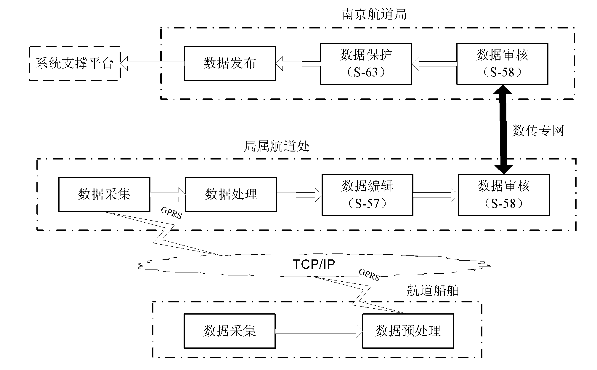
[0058] See attached figure 1 , the production process of data collection → data processing and channel map editing → channel map review and channel map release → channel map application described in the system of the present invention means that the original data collection is completed on the channel survey ship and the collected data is preprocessed , and then send these data to the channel office database through the GPRS network; at the channel office, first process the data obtained from the channel ships, and then edit and generate ENC data or ER files according to the requirements of the S-57 standard to complete the electronic channel chart Digital production, and finally use the CJ-58 standard to check whether the ENC data conforms to the specifications, and the tested ENC data is sent to the audit and release center of the Waterway Bureau through the digital transmission network; the audit release center will audit the ENC data obtained from the database, and this is ...
PUM
 Abstract
Description
Claims
Application Information