Generating method of pedestrian business district based on electronic map
A technology for electronic maps and business districts, applied in digital data processing, special data processing applications, instruments, etc., can solve problems such as not considering flyovers and zebra crossings, negative impact on site selection results, slow processing speed, etc., and achieve a fast screening process But orderly, time-saving, cleverly conceived effect
- Summary
- Abstract
- Description
- Claims
- Application Information
AI Technical Summary
Problems solved by technology
Method used
Image

Examples
Embodiment Construction
[0022] Hereinafter, the present invention will be described in detail based on the drawings, and the purpose and effects of the present invention will become more apparent.
[0023] The method for generating a pedestrian business district based on an electronic map of this embodiment includes the following steps:
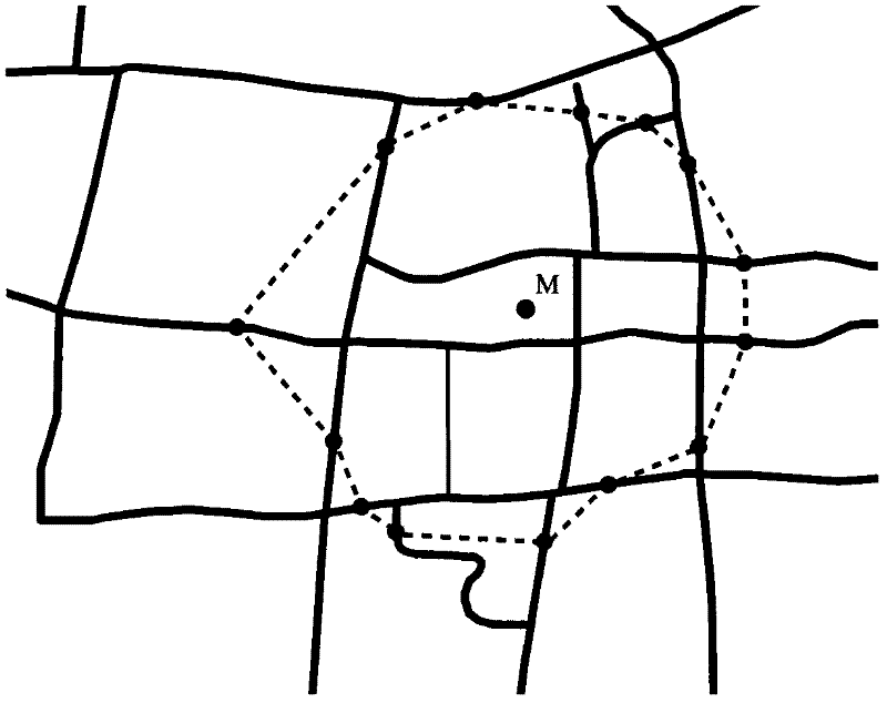
[0024] The first step is to calculate the critical distance value according to the given walking time and walking speed.
[0025] In this example, given a walking time of 8 minutes and a walking speed of 1.2 meters per second, the critical distance value is 576 meters.
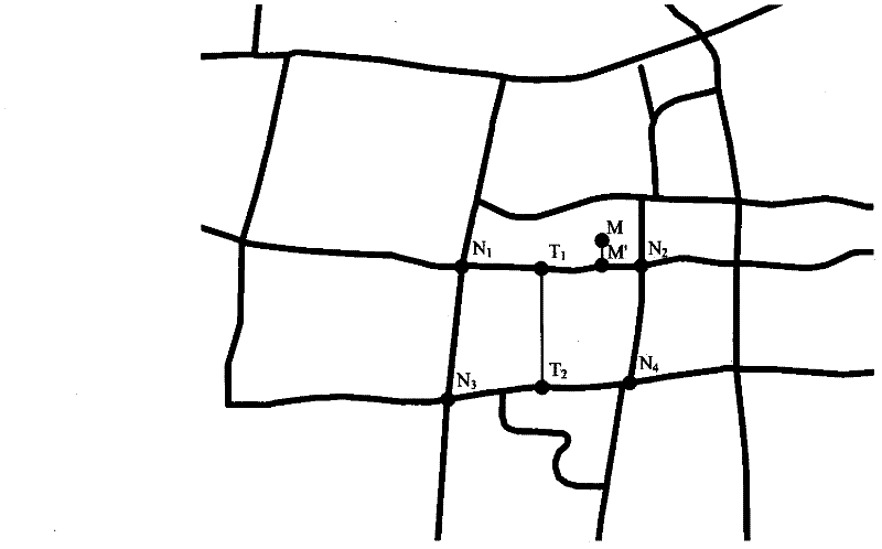
[0026] The second step is to select opportunities ( figure 1 M), and transfer the opportunity point M to the nearest road arc node M′, and add this node to the opening table; if there is an overpass on the road arc mapped to the opportunity point M, then Add the nodes at both ends of the road arc where the brother points of the flyover are located to the opening table; if there is a zebra crossing on the ro...
PUM
 Abstract
Description
Claims
Application Information
 - R&D Engineer
- R&D Manager
- IP Professional
- Industry Leading Data Capabilities
- Powerful AI technology
- Patent DNA Extraction
Browse by: Latest US Patents, China's latest patents, Technical Efficacy Thesaurus, Application Domain, Technology Topic.
© 2024 PatSnap. All rights reserved.Legal|Privacy policy|Modern Slavery Act Transparency Statement|Sitemap