
Three-dimensional geological structure model angular point grid dissection method considering folds

A three-dimensional geological and structural model technology, applied in 3D modeling, image data processing, instruments, etc., can solve the problem of no geological structure model division, difficulty in the accuracy of real geological attribute expression in attribute assignment, and no consideration of the spatial distribution characteristics of geological structures, etc. question

Active Publication Date: 2016-04-20
CHINA UNIV OF GEOSCIENCES (WUHAN)
View PDF4 Cites 17 Cited by
  • Summary
  • Abstract
  • Description
  • Claims
  • Application Information

AI Technical Summary

Problems solved by technology

However, the existing spatial voxel subdivision methods do not consider the spatial distribution characteristics of the geological structure, and do not divide the spatial voxels based on the geological structure model, which makes the established attribute model lack the constraints of the geological structure conditions, which is of great importance for the follow-up Attribute assignments and their accuracy in representing real geological attributes pose difficulties

Method used


Image

  • Three-dimensional geological structure model angular point grid dissection method considering folds
  • Three-dimensional geological structure model angular point grid dissection method considering folds
  • Three-dimensional geological structure model angular point grid dissection method considering folds

Examples


Embodiment Construction

[0040] The present invention will be further described below in conjunction with drawings and embodiments.

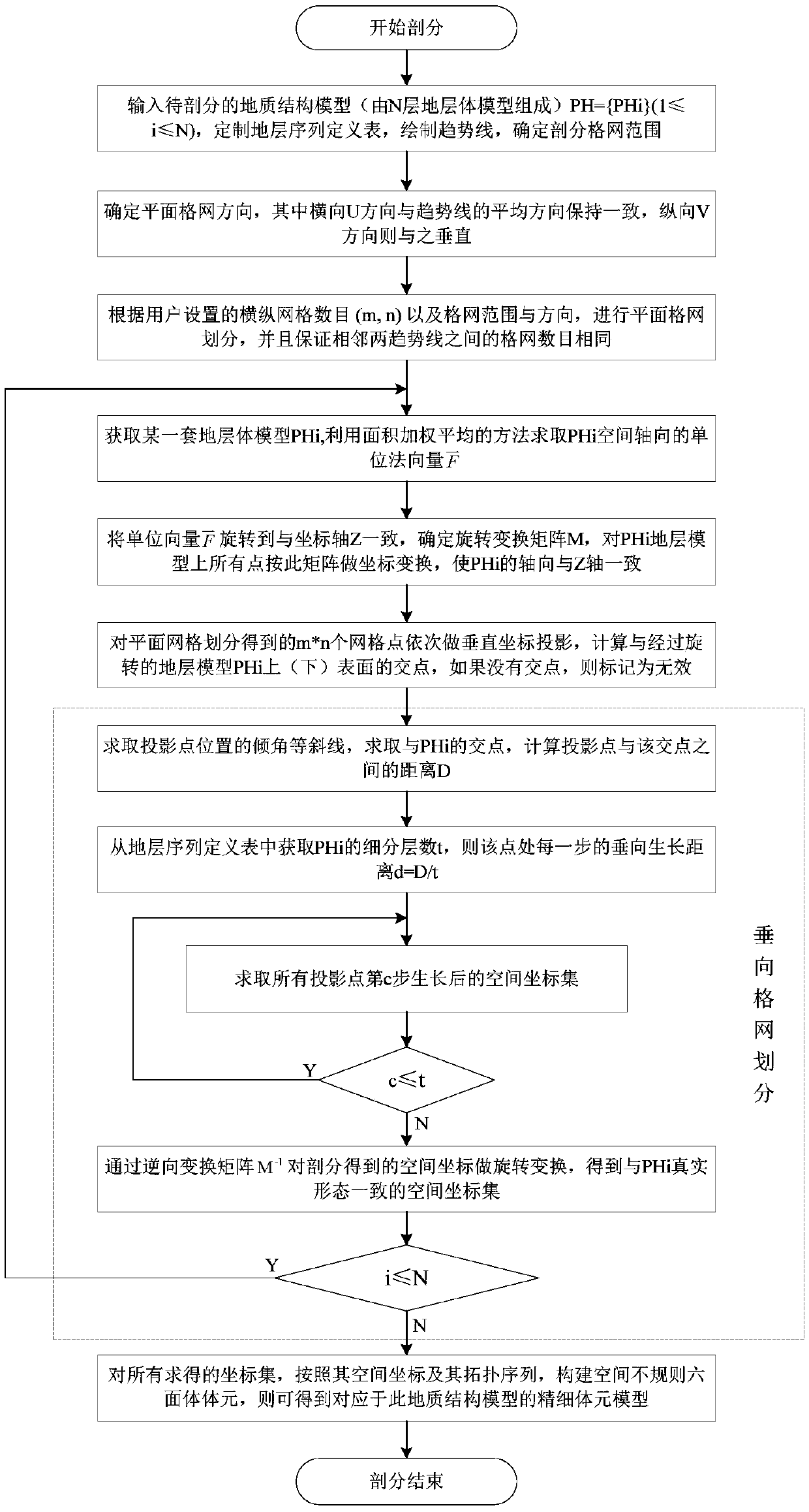
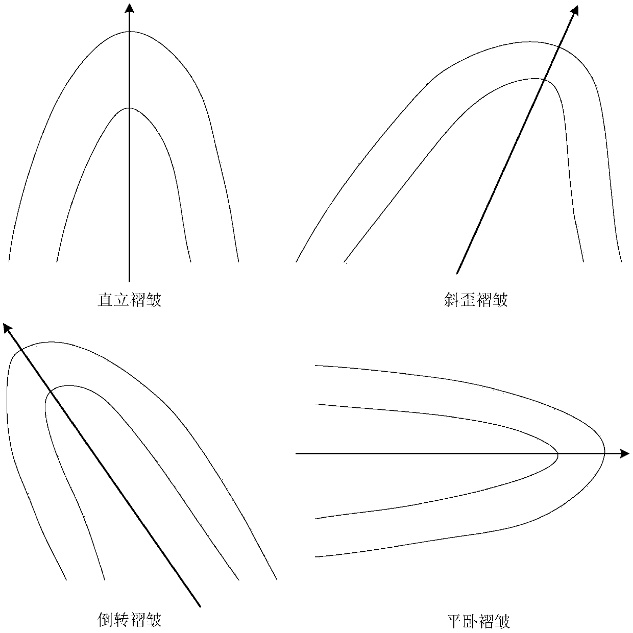
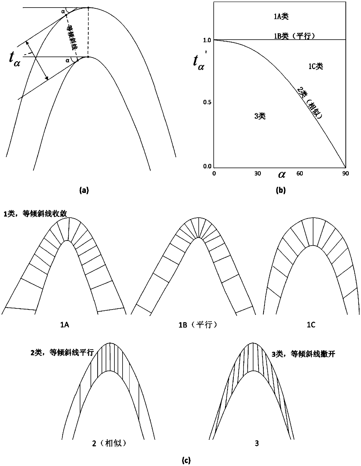
[0041] The present invention provides a three-dimensional geological structure model corner grid subdivision method in consideration of folds. On the basis of the three-dimensional geological structure model, fully consider the spatial shape characteristics of folds, and use the basic types of Ramsey folds and dip angle isoclines Based on the corner point grid as the spatial volume element data model, and the stratum structure model as the layer direction control, the plane grid is divided by the trend line and the projection range of the geological structure model on the XOY plane, and then the stratum body model is calculated The spatial axis of the grid is rotated to be consistent with the Z axis through matrix transformation. The vertical grid division is obtained by growing the projected points on the surface along the direction of the inclination isocline of the po...


PUM


Abstract

The invention provides a three-dimensional geological structure model angular point grid dissection method considering folds. The spatial morphological characteristics of the folds and the regulation of isoclinal lines in Ramsey fold classification are fully considered on the basis of a three-dimensional geological structure model, and angular point grid dissection of the geological structure model is performed with an angular point grid acting as a spatial metadata model and a stratigraphic structure model acting as layer control. Planar grid dissection is performed through the projection range of trend lines and the geological structure model in an XOY plane. Spatial rotation is performed on the multivalued surface stratums of the folds included in the geological model. Vertical grid dissection is obtained through growth of projection points on a curved surface along an inclination angle and other isoclinal line directions according to certain step length, and resetting is performed through inverse matrix transformation after completion of dissection. The spatial coordinates of the corresponding points are calculated through transverse and vertical grid dissection, and the spatial metal-model is constructed according to the coordinates and topological information and visually displayed so that transformation from the three-dimensional geological structure model to the angular point grid meta-model considering the folds is realized.

Description

technical field [0001] The invention relates to a three-dimensional geological structure model corner grid subdivision method in consideration of folds, and belongs to the fields of three-dimensional graphics and three-dimensional geological modeling. Background technique [0002] 3D geological modeling technology is the core technology in the field of geological information technology, and it is also a key technology and hot issue in the construction of 3D spatial information systems. Geological spatial data has the characteristics of multi-source, heterogeneous, and multi-scale, which puts forward higher requirements for the construction and visualization of 3D geological models with true 3D data structures. The built model must not only meet the 3D visual display of complex geological structures Requirements, it should support the follow-up geological spatial analysis. 3D geological modeling can be divided into 3D geological structure modeling and geological attribute mo...

Claims


Application Information

Patent Timeline
IPC IPC(8): G06T17/05G06T17/30
CPCG06T17/05G06T17/30
Inventor 刘刚陈麒玉吴冲龙田宜平张志庭翁正平
Owner CHINA UNIV OF GEOSCIENCES (WUHAN)
Learn More