System and method for simulating flight tracks of unmanned aerial vehicles on basis of GPS (global positioning system) simulation

A technology of flight trajectory and simulation system, applied in the field of unmanned aerial vehicles, can solve the problems that it is difficult to meet the rapid development of real-time simulation software, the code style and quality are uneven, and the real-time performance of code is not easy to guarantee, etc.

Inactive Publication Date: 2017-05-17
SHENYANG AEROSPACE UNIVERSITY
View PDF3 Cites 6 Cited by
  • Summary
  • Abstract
  • Description
  • Claims
  • Application Information

AI Technical Summary

Problems solved by technology

The style and quality of hand-written codes vary from good to bad, which reduces the reliability of software operation and increases the possibility of code errors, and the real-time performance of the code is not easy to guarantee. The performan

Method used


Image

  • System and method for simulating flight tracks of unmanned aerial vehicles on basis of GPS (global positioning system) simulation
  • System and method for simulating flight tracks of unmanned aerial vehicles on basis of GPS (global positioning system) simulation
  • System and method for simulating flight tracks of unmanned aerial vehicles on basis of GPS (global positioning system) simulation

Examples


Embodiment Construction

[0055] An embodiment of the present invention will be further described below in conjunction with the accompanying drawings.

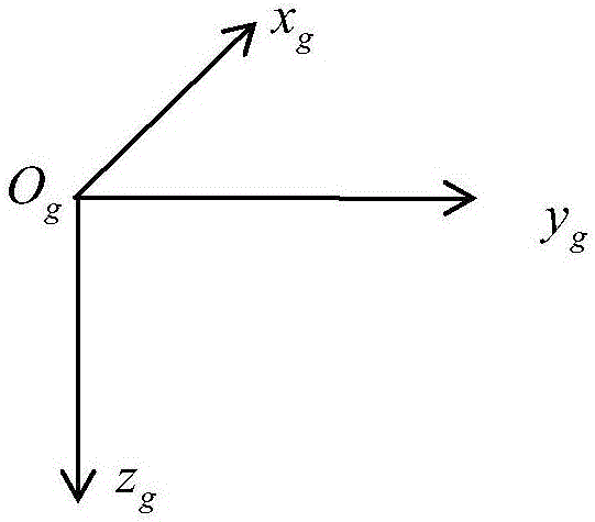
[0056] In the embodiment of the present invention, the ground coordinate system (ground axis system) S used g -O g x g the y g z g Such as figure 1 As shown, choose a point O on the ground g ;Find a coordinate axis x in the horizontal g Axis, fixed; z g The selection rule of the axis is: in the coordinate axis cluster pointing to the center of the earth, find a coordinate axis perpendicular to the ground as z g axis; y g The axis is found in the horizontal plane according to the right-hand rule;

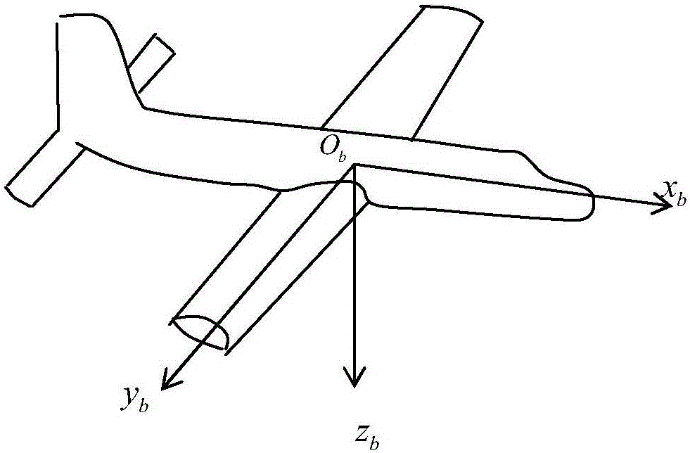
[0057] In the embodiment of the present invention, the adopted body coordinate system (body axis system) S b -O b x b the y b z b Such as figure 2 As shown, the origin O b Choose the center of mass of the aircraft, and the coordinate system moves with the aircraft; find a coordinate axis x on the plane of symmetry of the aircraft b , the coo...


PUM


Abstract

The invention discloses a system for simulating flight tracks of unmanned aerial vehicles on the basis of GPS (global positioning system) simulation, and belongs to the technical field of unmanned aerial vehicles. The system comprises an unmanned aerial vehicle track generating module, a GPS data processing module, a communication module and a flight control computer. The system has the advantages that the system is in basic working modes of analyzing movement of GPS satellite constellations, optimally positioning four satellite options and simulating GPS receivers, accordingly, obtained location information of the unmanned aerial vehicles can be converted into corresponding GPS signals, the GPS signals can be inputted into the flight control computer, and GPS navigation simulation experiments for real-time dynamic functions for receiving signals by the receivers at given locations in given time can be implemented; a method is speedy and simple and is high in precision and real-time performance, development processes of simulation systems can be accelerated, and the efficiency of simulation and verification work of flight control systems can be improved; NMEA 0183 protocols are generated in software forms, accordingly, the system can be communicated with true flight control, and transition from virtuality to reality can be implemented.

Description

technical field [0001] The invention belongs to the technical field of unmanned aerial vehicles, and in particular relates to a simulation system and method for unmanned aerial vehicle flight trajectory based on GPS simulation. Background technique [0002] In the current UAV flight simulation, how to simulate the state of the UAV (latitude and longitude, altitude and attitude) is an important problem that the entire simulation system needs to solve. The wide application of GPS global positioning system just provides a good platform, namely Design a GPS simulator to simulate the GPS satellite signal received by the UAV at the set time and position. Through the interpretation of the GPS receiver, it is as if the UAV is running at the set position for the flight control simulation system. Most of the GPS signal simulators in the market today calculate the positioning signal according to the given flight track of the aircraft, and most of them cannot realize the real-time dynam...

Claims


Application Information

Patent Timeline
IPC IPC(8): G06F17/50
CPCG06F30/20
Inventor 张红梅刘昌镇徐光延
Owner SHENYANG AEROSPACE UNIVERSITY
Why Eureka
Try Eureka