Local refreshing method of large-scale terrain rendering in three-dimensional scene
A large-scale terrain and three-dimensional scene technology, applied in the field of spatial geographic information systems, can solve problems such as low refresh efficiency, and achieve the effect of ensuring refresh speed and reducing data scheduling time.
- Summary
- Abstract
- Description
- Claims
- Application Information
AI Technical Summary
Benefits of technology
Problems solved by technology
Method used
Image
Examples
Embodiment 1
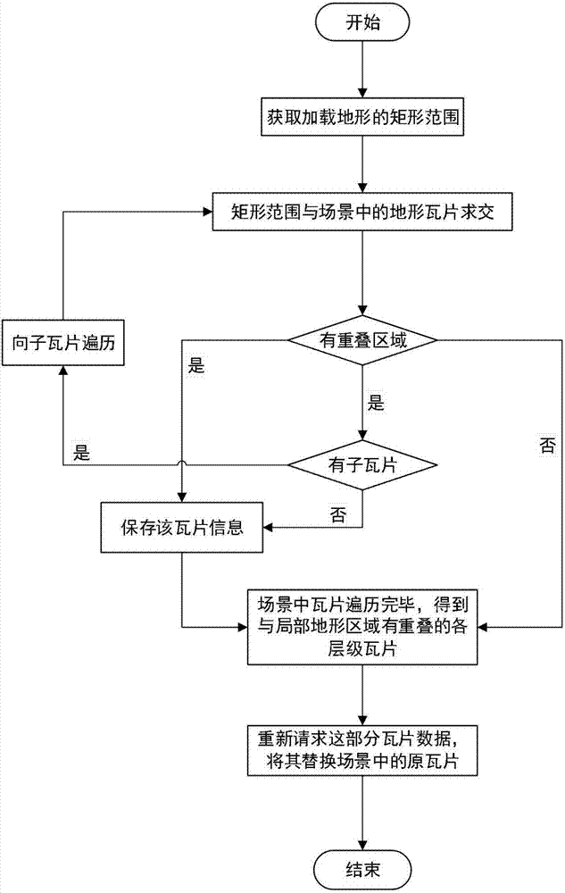
[0033] Suppose you need to load the local Hangzhou terrain dataset in the global 3D scene, follow step 1 to obtain the local Hangzhou terrain's two-dimensional rectangular range xmin, xmax, ymin, ymax, where x represents its longitude direction, and y represents its latitude direction. According to step 2, do the intersection operation between the rectangular range and the terrain tiles loaded in the scene, and traverse to the sub-terrain tiles to get all the terrain tiles in the scene that overlap with the rectangular range; follow step 3 , rebuild the image and elevation datasets of these terrain tiles, construct new terrain tiles, and replace the original terrain tiles in the scene accordingly, which completes the partial refresh of Hangzhou terrain.
PUM
 Abstract
Description
Claims
Application Information
 - R&D
- Intellectual Property
- Life Sciences
- Materials
- Tech Scout
- Unparalleled Data Quality
- Higher Quality Content
- 60% Fewer Hallucinations
Browse by: Latest US Patents, China's latest patents, Technical Efficacy Thesaurus, Application Domain, Technology Topic, Popular Technical Reports.
© 2025 PatSnap. All rights reserved.Legal|Privacy policy|Modern Slavery Act Transparency Statement|Sitemap|About US| Contact US: help@patsnap.com

