Three-dimensional display method of ocean waves based on ocean remote sensing data
A technology of three-dimensional display and ocean remote sensing, which is applied in the field of radar remote sensing, and can solve problems such as not adding actual measured data
- Summary
- Abstract
- Description
- Claims
- Application Information
AI Technical Summary
Problems solved by technology
Method used
Image
Examples
Embodiment Construction
[0056] The specific embodiments of the present invention will be further described below in conjunction with the accompanying drawings, but the present invention is not limited.
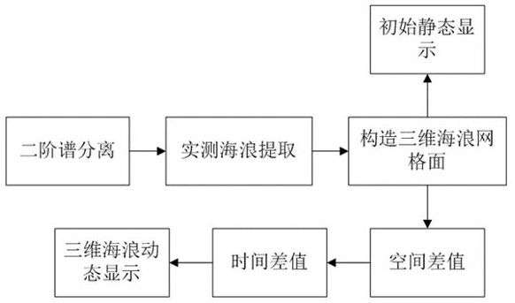
[0057] figure 1 A 3D ocean wave display method based on ocean remote sensing data is shown. By extracting the second-order spectrum inversion wave parameters from the radar Doppler spectrum map, the kriging space interpolation algorithm is used to fill the grid nodes to simulate the preliminary 3D The waves are smoothed, and finally the cubic spline interpolation algorithm is used to interpolate the time series, so that the time intervals are continuous to achieve dynamic display; the specific steps are as follows:
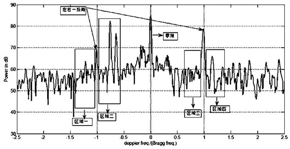
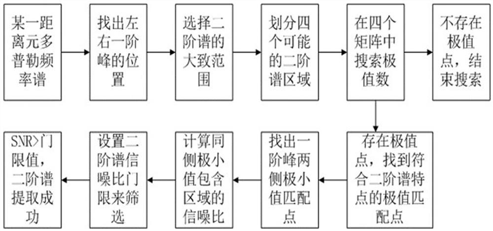
[0058] (1) Extract the second-order spectrum from the radar Doppler spectrum map, such as image 3 shown, including the following sub-steps:
[0059] (1) Select a Doppler spectrum map of a distance element from a field of measured data, and estimate the position of the second-order spe...
PUM
 Abstract
Description
Claims
Application Information
 - R&D
- Intellectual Property
- Life Sciences
- Materials
- Tech Scout
- Unparalleled Data Quality
- Higher Quality Content
- 60% Fewer Hallucinations
Browse by: Latest US Patents, China's latest patents, Technical Efficacy Thesaurus, Application Domain, Technology Topic, Popular Technical Reports.
© 2025 PatSnap. All rights reserved.Legal|Privacy policy|Modern Slavery Act Transparency Statement|Sitemap|About US| Contact US: help@patsnap.com


