Representation of a travel route by means of a navigation system

A driving route and navigation system technology, applied in navigation, surveying and mapping and navigation, road network navigator, etc., can solve the problem of low weight and achieve the effect of early boundary conditions

Active Publication Date: 2018-12-07
BAYERISCHE MOTOREN WERKE AG
View PDF11 Cites 0 Cited by
  • Summary
  • Abstract
  • Description
  • Claims
  • Application Information

AI Technical Summary

Problems solved by technology

This disadvantage or underweighting is especially noticeable when the path shown runs parallel to the short side of the navigation system display

Method used


Image

  • Representation of a travel route by means of a navigation system
  • Representation of a travel route by means of a navigation system
  • Representation of a travel route by means of a navigation system

Examples


Embodiment Construction

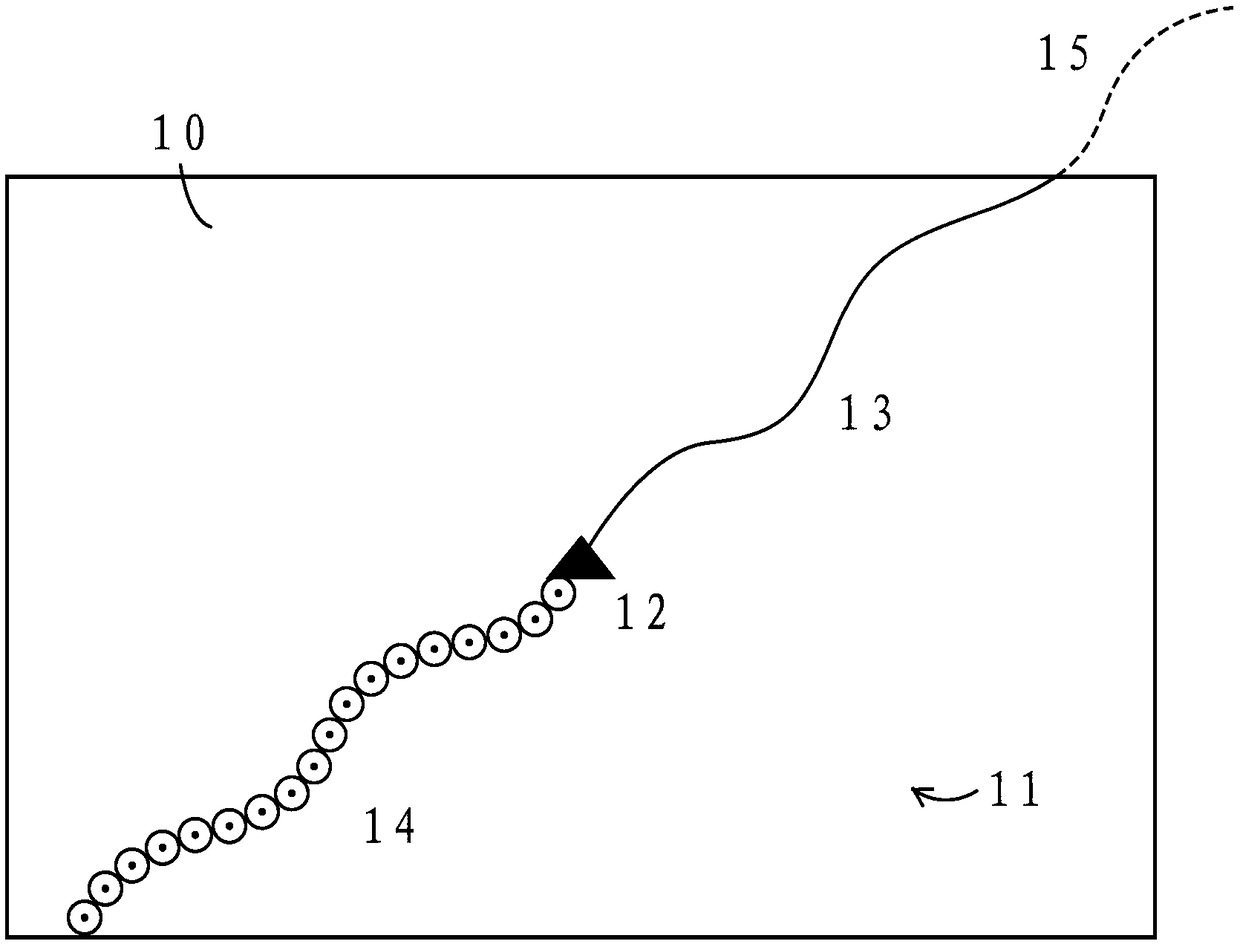
[0022] Figure 1A is a simplified schematic diagram of a graphical representation 10 according to the prior art. On the display of the known navigation system, a graphical representation 10 of the digitized map is shown and the traveled sections 14 of the driving route 11 are highlighted. During the route guidance, the own position 12 is displayed centrally at or near the intersection of the diagonals of the screen, regardless of the selected display mode, such as the north display or the direction of travel display.

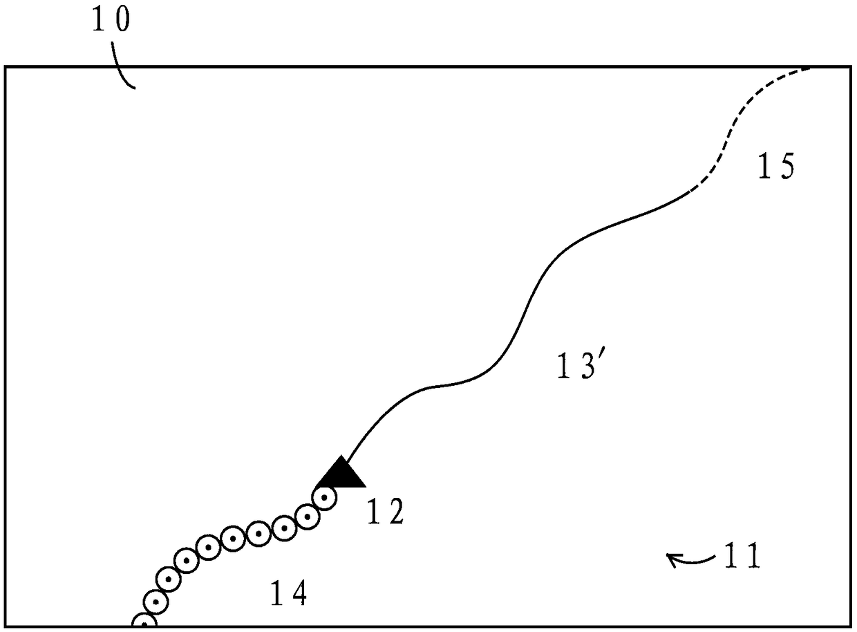
[0023] Figure 1B is a simplified schematic diagram of a graphical representation 10 in accordance with the present invention. On the display of the navigation system according to the invention, a graphical representation 10 of the digitized map and the traveled sections 14 of the driving route 11 are displayed. and Figure 1A In contrast, a part of route 11 that has already been traversed is concealed, and a further segment 15 of route 11 that has yet to be t...


PUM


Abstract

A method for presenting a journey route by way of a navigation system, in particular a navigation system of a two-wheeled or four-wheeled motor vehicle, in which a graphical presentation of a digitized map and the course of the journey route already traveled is presented on a display of the navigation system, includes, given an unchanged scale of the presentation with the traveling of sections ofthe journey route, the sections of the journey route that have already been traveled are fully or partly faded out and further sections of the journey route that are still to be traveled, which were absent in the presentation before sections of the journey route that have already been traveled were faded out, are faded in or presented graphically on the display. The invention aslo relates to a navigation system, a motor vehicle, a medium readable by a processor, and a computer system.

Description

technical field [0001] The invention relates to a method for displaying a driving route by means of a navigation system, in particular of a two-wheel or four-wheel motor vehicle, wherein a graphic representation of a digitized map and passed sections of the driving route are displayed on a display of the navigation system. Background technique [0002] DE 10 2006 054 326 A1 discloses a method for displaying route information of a navigation system, in which a graphic representation of a digitized map is shown on a display and the traveled sections of a driving route are highlighted. The driving speed is detected when a road section is traversed and the road section passed is highlighted based on the correspondingly determined driving speed. [0003] During route guidance, display screens of known navigation systems show: a partial map, the position of the host vehicle in the partial map, the route (in color) calculated by the navigation system and possibly additional informa...

Claims


Application Information

Patent Timeline
Patent Type & Authority Applications(China)
IPC IPC(8): G01C21/30G01C21/36
CPCG01C21/30G01C21/365G01C21/3658G01C21/367G01C21/3694G01C21/3676
Inventor W·哈恩
Owner BAYERISCHE MOTOREN WERKE AG
Why Eureka
Try Eureka