A camera calibration optimization method under a road cloud monitoring platform

A camera calibration and optimization method technology, applied in the field of intelligent transportation, can solve the problems of inaccurate camera calibration results and poor versatility

Active Publication Date: 2019-04-26
CHANGAN UNIV
View PDF3 Cites 9 Cited by
  • Summary
  • Abstract
  • Description
  • Claims
  • Application Information

AI Technical Summary

Problems solved by technology

[0004] The purpose of the present invention is to provide a camera calibration optimization method under the road cloud monitoring platform to solve the problems of inaccurate camera calibration results and poor versatility of the traditional method

Method used


Image

  • A camera calibration optimization method under a road cloud monitoring platform
  • A camera calibration optimization method under a road cloud monitoring platform
  • A camera calibration optimization method under a road cloud monitoring platform

Examples


Embodiment Construction

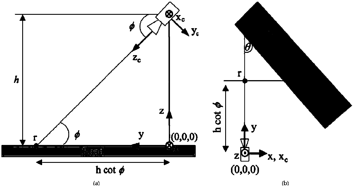
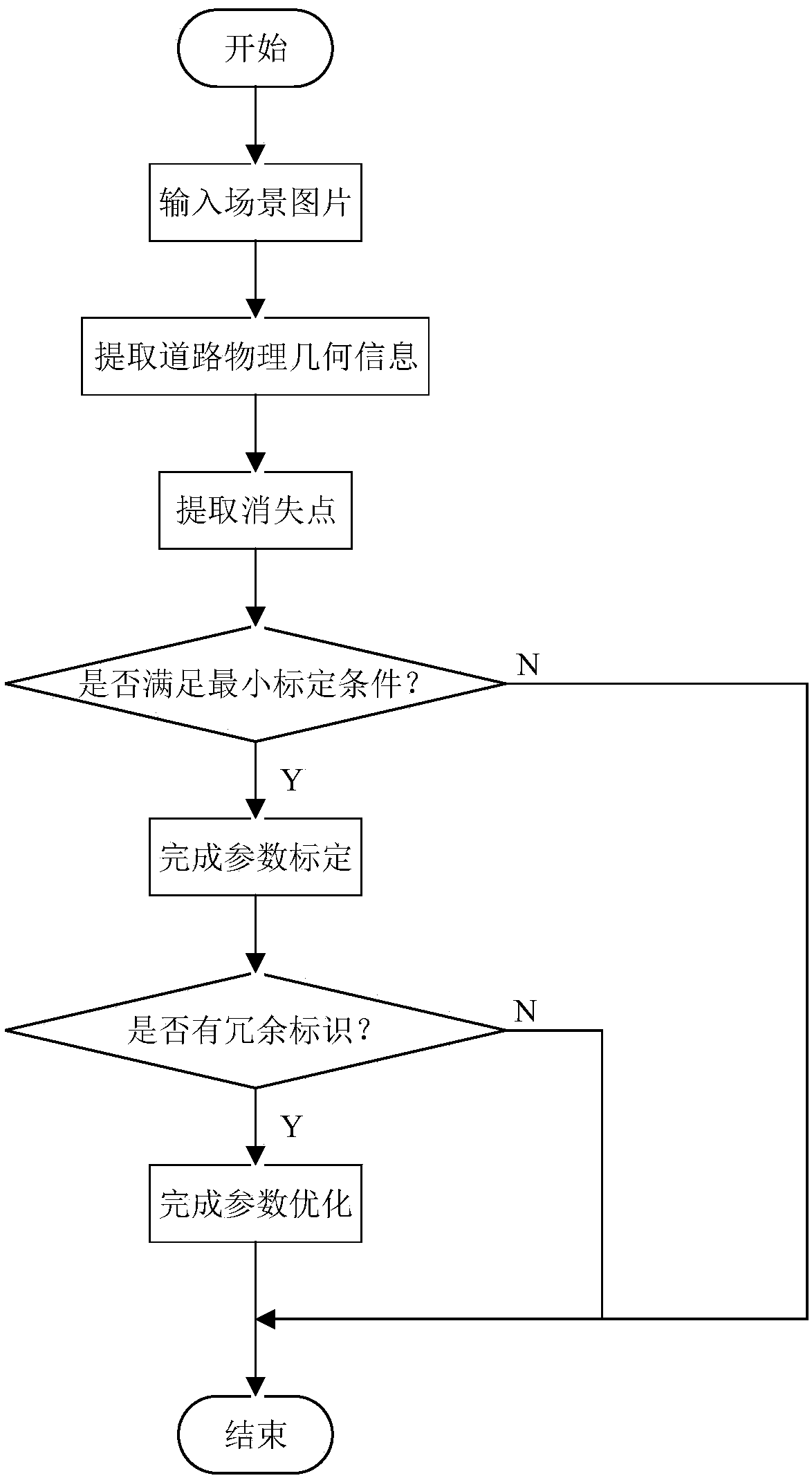
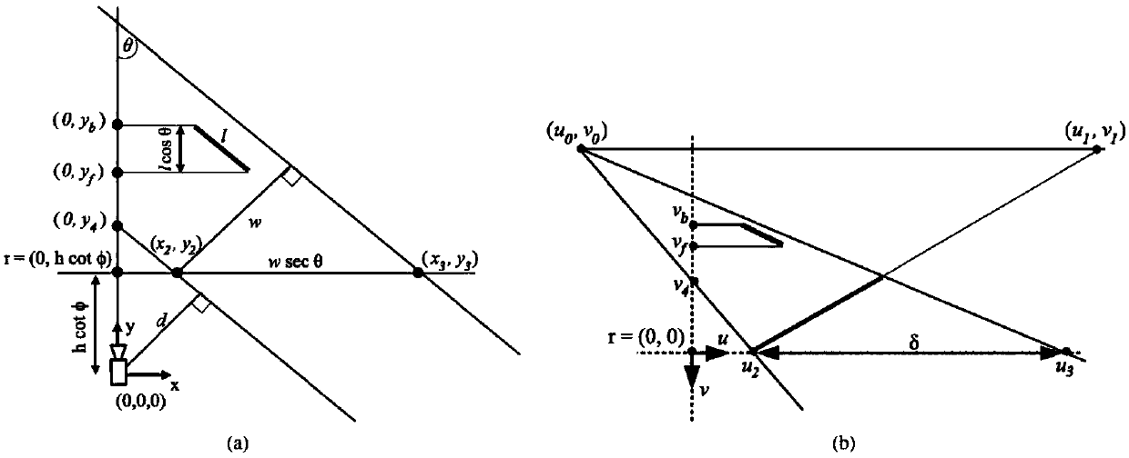
[0107]The invention utilizes the parallel line feature which is very easy to extract in the traffic scene, and automatically recognizes the minimum calibration condition, so as to perform camera calibration. The method based on the vanishing point is used for calibration, and the minimum calibration conditions are determined by automatically identifying the road edge line, road width line and road center dotted line, and the calibration is performed according to different minimum calibration conditions. In the actual scene of the road, the lane line group including the edges on both sides of the road is a good parallel line group to find the vanishing point. The intersection line between the horizontal line in the center of the road image and the edges on both sides of the road is often used as a line segment to calculate the width of the road. Dashed lines with fixed intervals in the middle are often used as a good set of road lines for calculating road lengths. These paramet...


PUM


Abstract

The invention discloses a camera calibration optimization method under a road cloud monitoring platform, which comprises the following steps of: automatically identifying geometrical identifications such as road edge lines and road dotted lines from a road traffic scene, and solving parameters such as orientation and focal length of a camera by utilizing a multi-identification fusion scene adaptive calibration method according to the data so as to complete calibration. And on the basis, if a redundant identifier exists, a calibration result can be optimized. The method can adapt to different road traffic scenes, and the pan-tilt camera is used for extracting a large amount of geometric information in the scenes to complete the camera calibration and optimization process. The method is simple to implement and good in universality, can be applied to camera calibration under various road scenes, and can optimize the calibration result.

Description

technical field [0001] The invention relates to the technical field of intelligent transportation, in particular to a camera calibration optimization method under a road cloud monitoring platform. Background technique [0002] There are many technologies for collecting traffic information. The buried coil detector is the most widely used in my country. This method is relatively mature in technology, but it has many defects in terms of coverage, detection parameters, maintainability, and ease of installation. , Other methods such as radar, infrared, ultrasonic, etc. are also flawed. In recent years, the method of obtaining traffic information parameters through video has gradually matured. The most commonly used is the road cloud monitoring platform, which is more flexible than traditional cameras. The camera can obtain data of different road scenes by rotating, and the amount of data is greatly increased. In most cases Without human intervention, the recognition, tracking an...

Claims


Application Information

Patent Timeline
Patent Type & Authority Applications(China)
IPC IPC(8): G06T7/80
CPCG06T7/80Y02T10/40
Inventor 王伟唐心瑶张朝阳武非凡李俊彦梁浩翔雷琪杨露云旭侯景严刘莅辰贾金明
Owner CHANGAN UNIV
Why Eureka
Try Eureka