Three-dimensional visualization method of river channel water surface considering water surface gradient

A technology of water surface gradient and river channel, which is applied in the direction of instrumentation, calculation, image data processing, etc., can solve the problems of large amount of calculation, without considering the high water level in the upper reaches of the natural river, and the low water level in the downstream

Active Publication Date: 2021-07-06
长江空间信息技术工程有限公司(武汉) +1
View PDF5 Cites 0 Cited by
  • Summary
  • Abstract
  • Description
  • Claims
  • Application Information

AI Technical Summary

Problems solved by technology

The second category is vertex water, which mainly uses mathematical methods such as wave spectrum simulation, Fourier transform, function combination, and fluid dynamics to simulate the change law of the vertex elevation of the water body grid, and then reflects the wave effect of the water surface. Real, but the calculation is large and the efficiency is not high, such as the paper "Dynamic Water Surface Simulation Algorithm Based on OGRE in 3D Games", the paper "A Realistic Water Wave Surface Modeling Method for Virtual Environment", and the patent "A GPU-based Real-time dynamic water surface simulation method", etc.
[0003] These two types of methods do not consider the characteristics of high water level in the upstream and low water level in the downstream of the natural river, that is, the characteristics of water surface gradient, so it is difficult to apply to the 3D visualization of the water level process at the basin level

Method used


Image

  • Three-dimensional visualization method of river channel water surface considering water surface gradient
  • Three-dimensional visualization method of river channel water surface considering water surface gradient
  • Three-dimensional visualization method of river channel water surface considering water surface gradient

Examples


Embodiment

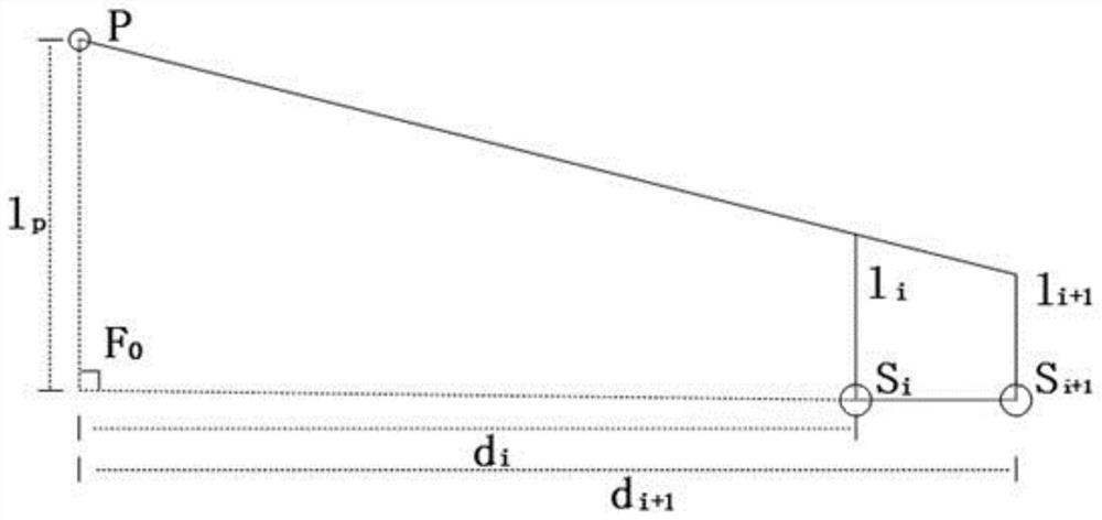
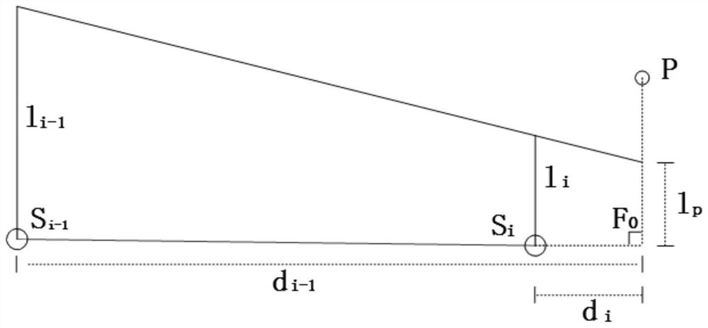
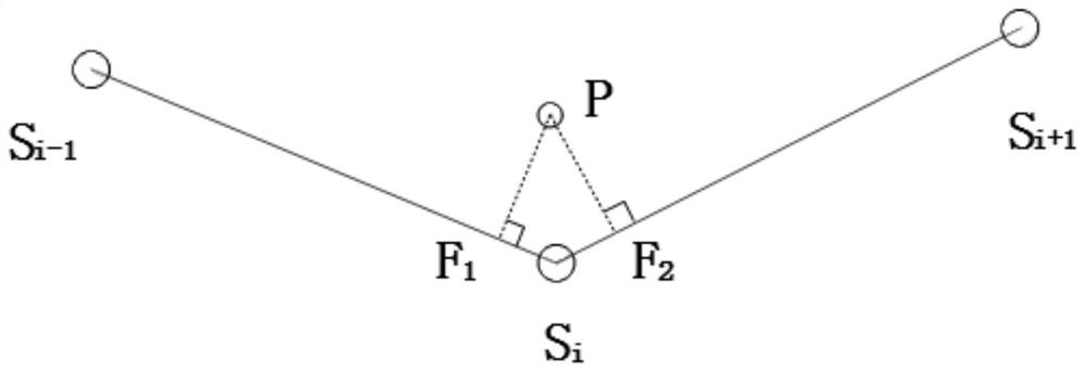
[0081] Taking the 3D visualization method of the river channel water surface considering the water surface gradient applied to a reservoir according to the present invention as an example to describe in detail, it also has a guiding role for the 3D visualization method of the river channel water surface considering the water surface gradient applied to other water areas of the present invention.

[0082] In this embodiment, the water surface boundary line of a certain reservoir and the measured water level data of a hydrological survey station are used as existing data. Select the water surface boundary line from Badong No. 2 Station to Sandouping Dam site of a certain reservoir, and select the water levels of twelve measuring stations at 8:00 on August 4, 2012 as input, from downstream to upstream respectively Sandouping Dam Site 158.68m, Taiping Creek 158.69m, Liulin Creek 158.69m, Jiuwan Creek 158.71m, Xintan 158.72m, Xiangxi 158.73m, Zigui Station 158.74m, Shazhen Creek 158...


PUM


Abstract

The invention discloses a three-dimensional visualization method of the water surface of a river course in consideration of the gradient of the water surface. It includes the following steps: Step 1: Data preparation; Step 2: Densify the boundary points of the water surface boundary polygon; Step 3: Triangulate the polygon; Step 4: Interpolate and adjust the elevation of the boundary points based on the water level process data; Step 5 : Water surface rendering based on the adjusted triangulation. The invention has the advantages of ensuring that the visualization effect of the water surface is more real, flexible, practical and has strong applicability.

Description

technical field [0001] The invention relates to the technical field of three-dimensional simulation and visualization, more specifically, it is a method for three-dimensional visualization of river water surface in consideration of water surface gradient. Background technique [0002] The existing methods for 3D visualization of water surface are mainly divided into two categories: the first category is textured water, which mainly simulates the visual effects of reflection, refraction, and wave light on the water surface through technologies such as dynamic texture, concave-convex texture, and projection texture. This method is more efficient. High, but unable to reflect the undulations of the water body. Such as papers "Realization of Real-time Water Effects in Large-Scale Virtual Scenes", "Real-time Water Surface Environment Simulation Based on Cg and OpenGL", etc. The second category is vertex water, which mainly uses mathematical methods such as wave spectrum simulatio...

Claims


Application Information

Patent Timeline
Patent Type & Authority Patents(China)
IPC IPC(8): G06T17/20
CPCG06T17/20
Inventor 徐志敏张力马瑞范青松邵炜璇
Owner 长江空间信息技术工程有限公司(武汉)
Why Eureka
Try Eureka