Voronoi graph-based method for automatically dividing traffic road network into traffic cells

A road network, automatic division technology, applied in special data processing applications, structured data retrieval, geographic information databases, etc., can solve problems such as lack of research

Active Publication Date: 2019-10-08
SOUTHEAST UNIV
View PDF4 Cites 10 Cited by
  • Summary
  • Abstract
  • Description
  • Claims
  • Application Information

AI Technical Summary

Problems solved by technology

The technology of using computer to express electronic road map is very mature, but there is still a lack of research on the rational and rapid division of traffic districts on the basis of electronic road map

Method used


Image

  • Voronoi graph-based method for automatically dividing traffic road network into traffic cells
  • Voronoi graph-based method for automatically dividing traffic road network into traffic cells
  • Voronoi graph-based method for automatically dividing traffic road network into traffic cells

Examples


Embodiment Construction

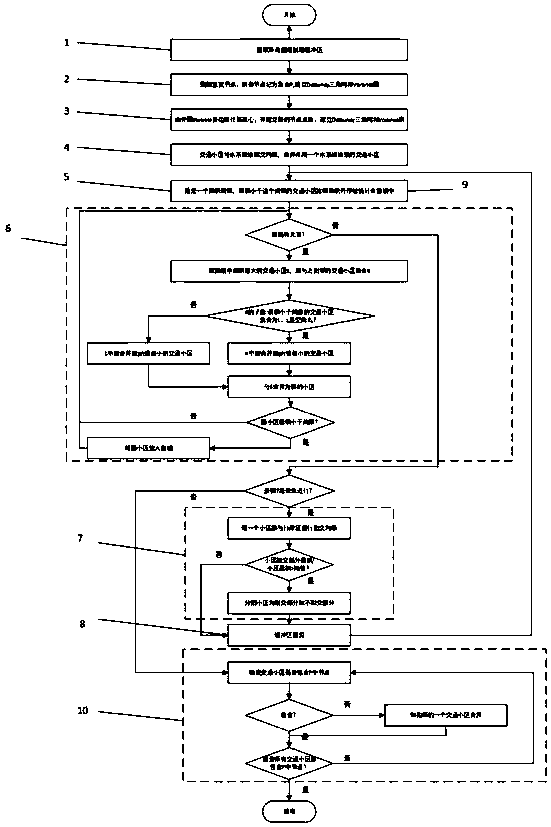
[0034] The steps and flow of the present invention will be further introduced below in conjunction with specific implementation methods, taking the automatic division of traffic districts in Nanjing as an example.

[0035] like figure 1 Shown, this paper provides a kind of method based on the traffic road network of Voronoi diagram to divide traffic district automatically, comprise the steps:

[0036] Step S1 extracts all roads in Nanjing to establish a buffer zone. Extract all traffic roads in Nanjing, and establish a geographic buffer zone based on a buffer radius of 500m.

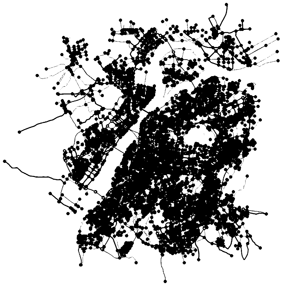
[0037] Steps S2 and S3 generate a Voronoi diagram, which is the traffic area in the initial state, and each traffic node corresponds to a traffic area.

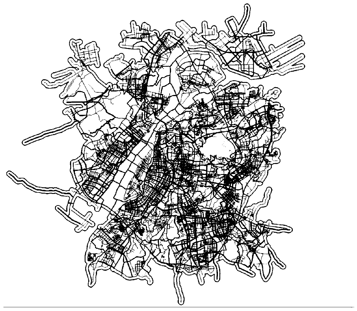
[0038] Step S4 has input the water system and green area file of Nanjing, then merge the traffic areas according to the green area and water system, and merge the traffic areas under the same green area and water system.

[0039] Steps S5 and S6 merge ...


PUM


Abstract

The invention discloses a Voronoi graph and road network-based traffic cell automatic division method, which comprises the following steps of extracting all roads, and creating a geographic buffer area; deleting the repeated road nodes, and pre-creating a Voronoi graph; creating the Voronoi graph, and forming the initial traffic cells; merging the cells according to a greenbelt system; giving a minimum area threshold value, and counting the cells of which the areas are smaller than the minimum area threshold value; merging the cells with the areas smaller than the threshold value, and enablingall the cells to be larger than the area threshold value; cutting the cells by using an administrative region; S8, cutting the cells according to the buffer area, and re-counting the cells with the areas smaller than the threshold value, repeating the step S6, and continuing to merge the cells; and S10, checking the cells to ensure that all the traffic cells at least comprise one road node. According to the method, the traffic cells can be automatically divided within the limited time, so that the time and energy for manually dividing the cells by the user are saved, and meanwhile, the errorspossibly caused by the manual operation during the process are also avoided.

Description

technical field [0001] The invention relates to the technical field of computer abstract expression of traffic maps, in particular to a technology for automatically dividing traffic areas according to traffic road networks. Background technique [0002] The transportation system is not only a complex system involving multiple disciplines, cross-regions, and large-scale, but also has the characteristics of huge experimental costs or even impossible experiments. With the continuous development of computer network technology, its application in the field of transportation is gradually widespread. The intelligent transportation system is to apply advanced technology to the transportation management system, so as to realize the informatization, networking and automation of the transportation system. The technology of expressing electronic road map by computer is very mature, but there is still a lack of research on the rational and rapid division of traffic districts on the basi...

Claims


Application Information

Patent Timeline
Patent Type & Authority Applications(China)
IPC IPC(8): G06F16/29
CPCG06F16/29
Inventor 王炜金坤屠雨王宇航梁鸣璋
Owner SOUTHEAST UNIV
Why Eureka
Try Eureka