City expansion detection method and device based on heterologous noctilucent remote sensing image

A technology of urban expansion and remote sensing images, applied in the direction of instruments, calculations, character and pattern recognition, etc., can solve difficult problems such as urban expansion, and achieve high efficiency and accuracy

Active Publication Date: 2020-02-07
WUHAN UNIV
View PDF7 Cites 1 Cited by
  • Summary
  • Abstract
  • Description
  • Claims
  • Application Information

AI Technical Summary

Problems solved by technology

However, limited by the uncertain data revisit cycle, the amount of data on a global scale, especially in developing countries with rapid urbanization, is relatively small, and it is also difficult to construct a time series to analyze urban sprawl

Method used


Image

  • City expansion detection method and device based on heterologous noctilucent remote sensing image
  • City expansion detection method and device based on heterologous noctilucent remote sensing image
  • City expansion detection method and device based on heterologous noctilucent remote sensing image

Examples


Embodiment Construction

[0025] The present invention will be further described in detail with reference to the accompanying drawings and examples.

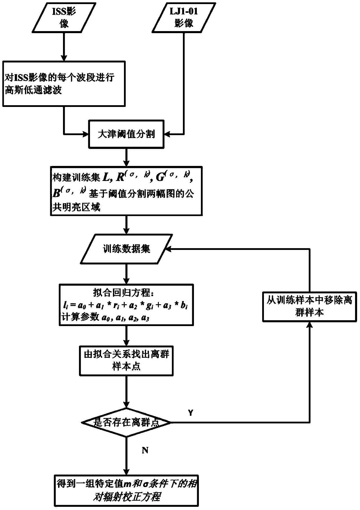
[0026] see figure 1 , the embodiment of the present invention proposes a method for detecting urban sprawl based on heterogeneous luminous remote sensing images, including the following steps:

[0027] 1. Input the images covering the research area, including obtaining the LJ1-01 night light image of the research area, the ISS night light image and the land cover data of the corresponding year;

[0028] In this example, Wuhan City, Hubei Province is taken as the research area to detect its urban expansion from 2010 to 2018. ISS night light images covering Wuhan area in 2010 and LJ1-01 night light images covering Wuhan area in 2018 were collected, as well as land cover data in 2010 and 2018. Data collection may be performed in advance during specific implementation.

[0029] 2. Image preprocessing, including geometric correction and reprojection of ima...


PUM


Abstract

The invention provides an urban expansion detection method and a device based on a heterologous noctilucent remote sensing image. The urban expansion detection method comprises the following steps: inputting an LJ1-01 night light image, an ISS night light image and land cover data of a corresponding year of a research area; preprocessing the image data, wherein the preprocessing comprises geometric correction and reprojection; constructing a relative radiometric calibration model and iteratively solving, and simulating an ISS image with LJ1-01 image similar features; and constructing a featurespace combination, and carrying out region classification. According to the relative radiometric calibration model between the heterologous noctilucent remote sensing images and the resolving method,the problem of shortage of night light data with the resolution of 100 m can be solved. The feature combination for classification is constructed by adopting the data before and after change and theratio of the data before and after change, the urban expansion area can be more accurately and automatically classified, and the efficiency and accuracy are much higher than those of a manual mode.

Description

technical field [0001] The invention belongs to the application of luminous remote sensing in the field of urban development, and proposes a brand-new urban expansion detection method and device based on heterogeneous luminous remote sensing images. Background technique [0002] Although urban areas occupy only a small portion of the Earth's surface, their impact on the surrounding environment is significant. Economic development and population growth have brought about the acceleration of China's urbanization process. This phenomenon has brought some positive effects, such as the improvement of people's living standards, the upgrading of industrial structure, and the improvement of production efficiency, etc., but at the same time, some negative effects such as traffic congestion, farmland degradation, and urban heat island effect have also followed. . Therefore, a reasonable urban development plan can make the city develop healthily, and a timely and accurate grasp of th...

Claims


Application Information

Patent Timeline
Patent Type & Authority Applications(China)
IPC IPC(8): G06K9/00G06K9/62
CPCG06V20/176G06F18/2411G06F18/214
Inventor 李熙尹子民宋杨李长辉
Owner WUHAN UNIV
Why Eureka
Try Eureka