

Method for measuring complex structure for form of old city block
A measurement method and complexity technology, applied in the direction of 2D image generation, editing/combining graphics or text, image data processing, etc., can solve problems such as the lack of comprehensive description of street shapes
- Summary
- Abstract
- Description
- Claims
- Application Information
AI Technical Summary
Problems solved by technology
Method used
Image

Examples
Embodiment Construction
[0065] Below in conjunction with accompanying drawing and specific embodiment the present invention is described in further detail:
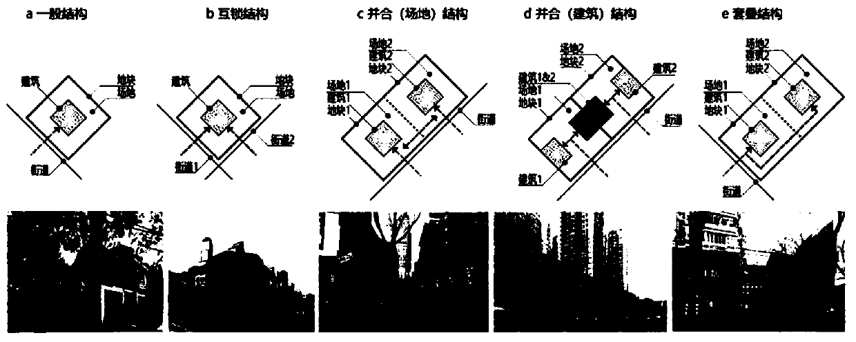
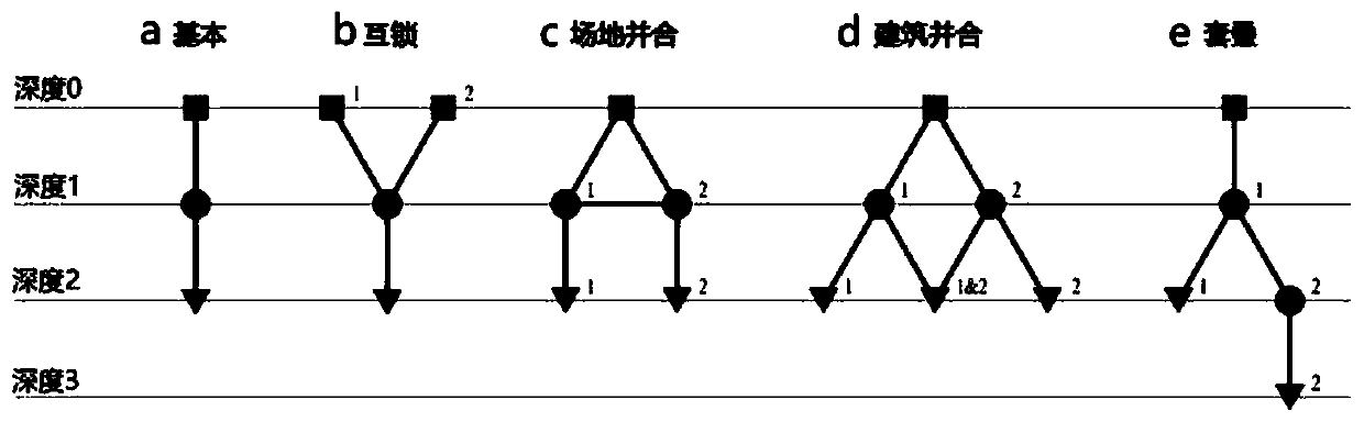
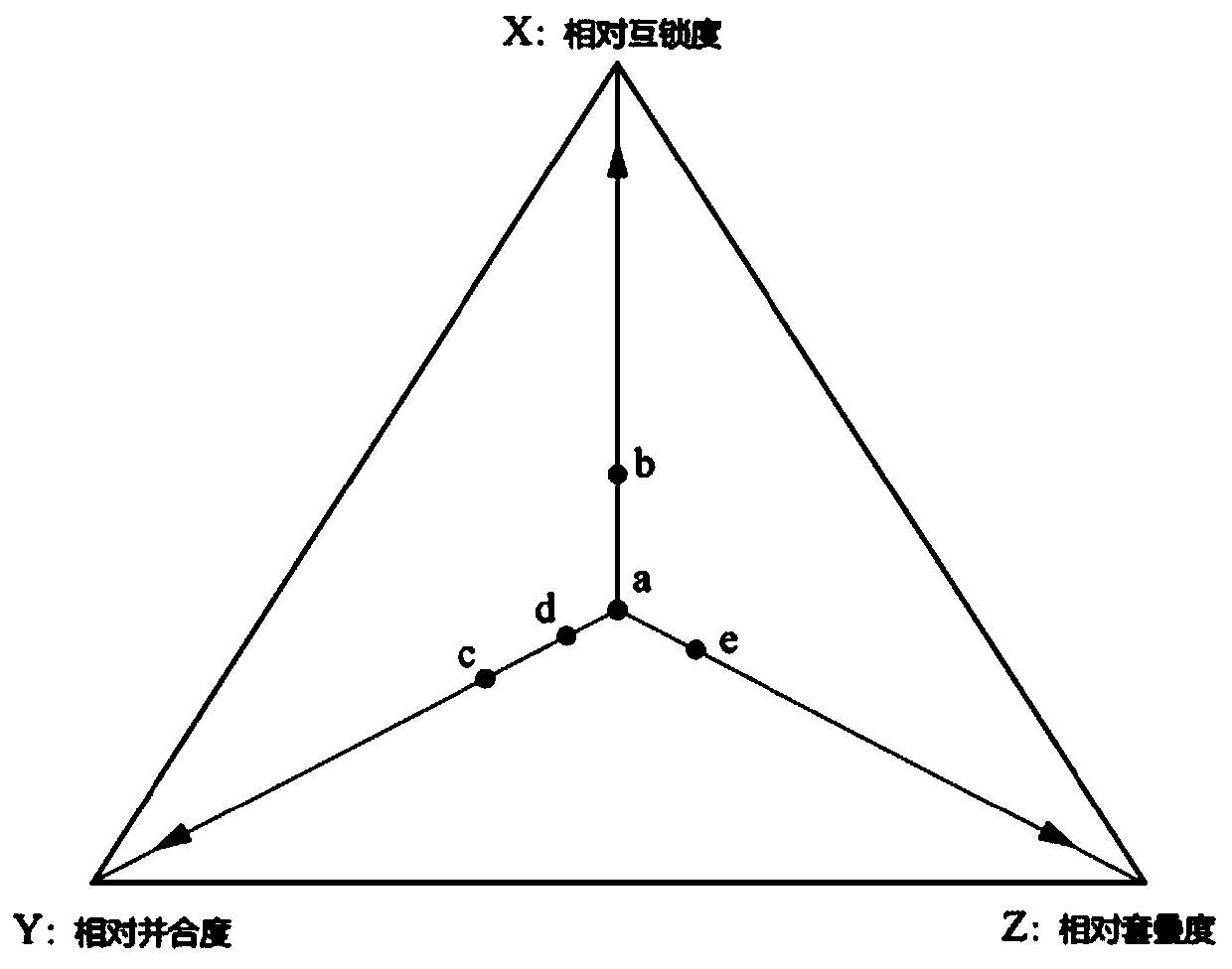
[0066] The present invention provides a measurement method for the complex structure of the old city block shape, which is a measurement method that can simultaneously describe the topological relationship among the three elements of streets, plots and buildings, and is used as a method for cognition and understanding of urban blocks. Technical tools for complex characterization in morphology.
[0067] As the technical solution of the present invention, its flow process is as follows;
[0068] First, he defined three types of "void" spaces in the hierarchical elements of urban form: street, area, and room. They constitute a continuous spatial network that accommodates different activities of people, and at the same time connect the different morphological elements one by one, from urban organization to streets to plots and plot sequences as wel...
PUM
 Abstract
Description
Claims
Application Information