Device, system and method for generating geofences based on public-safety factors
- Summary
- Abstract
- Description
- Claims
- Application Information
AI Technical Summary
Benefits of technology
Problems solved by technology
Method used
Image

Examples
Embodiment Construction
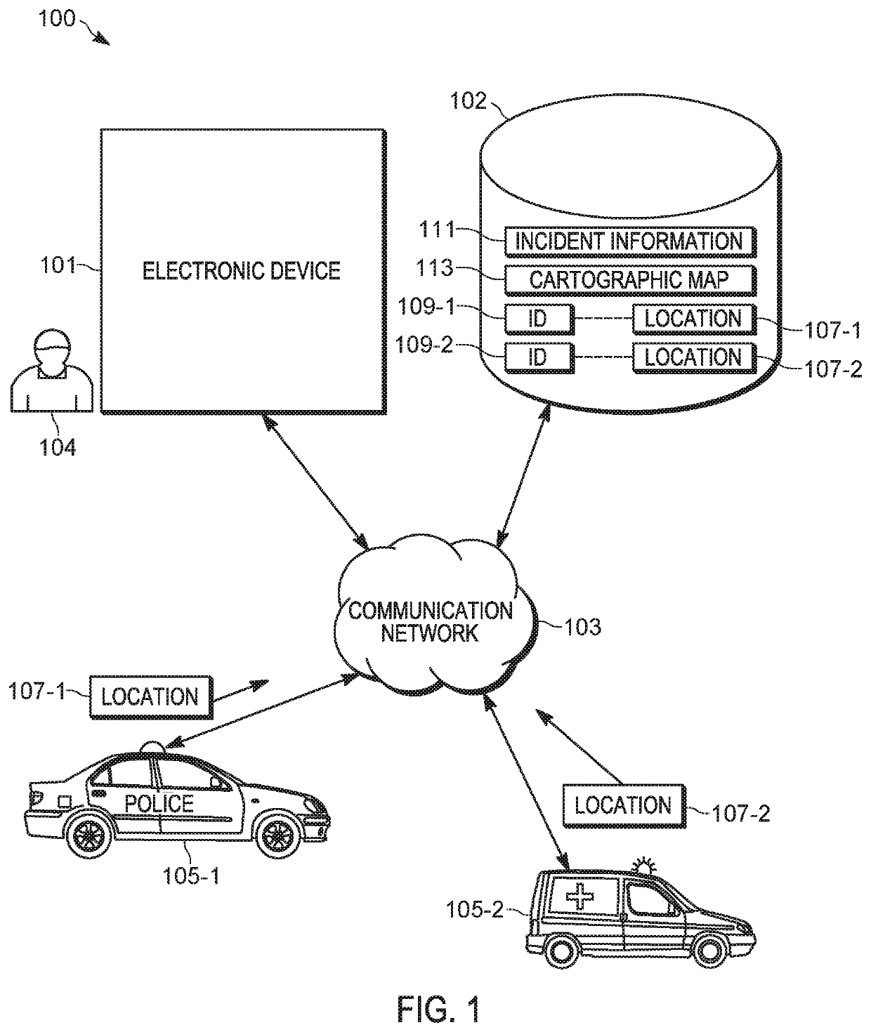
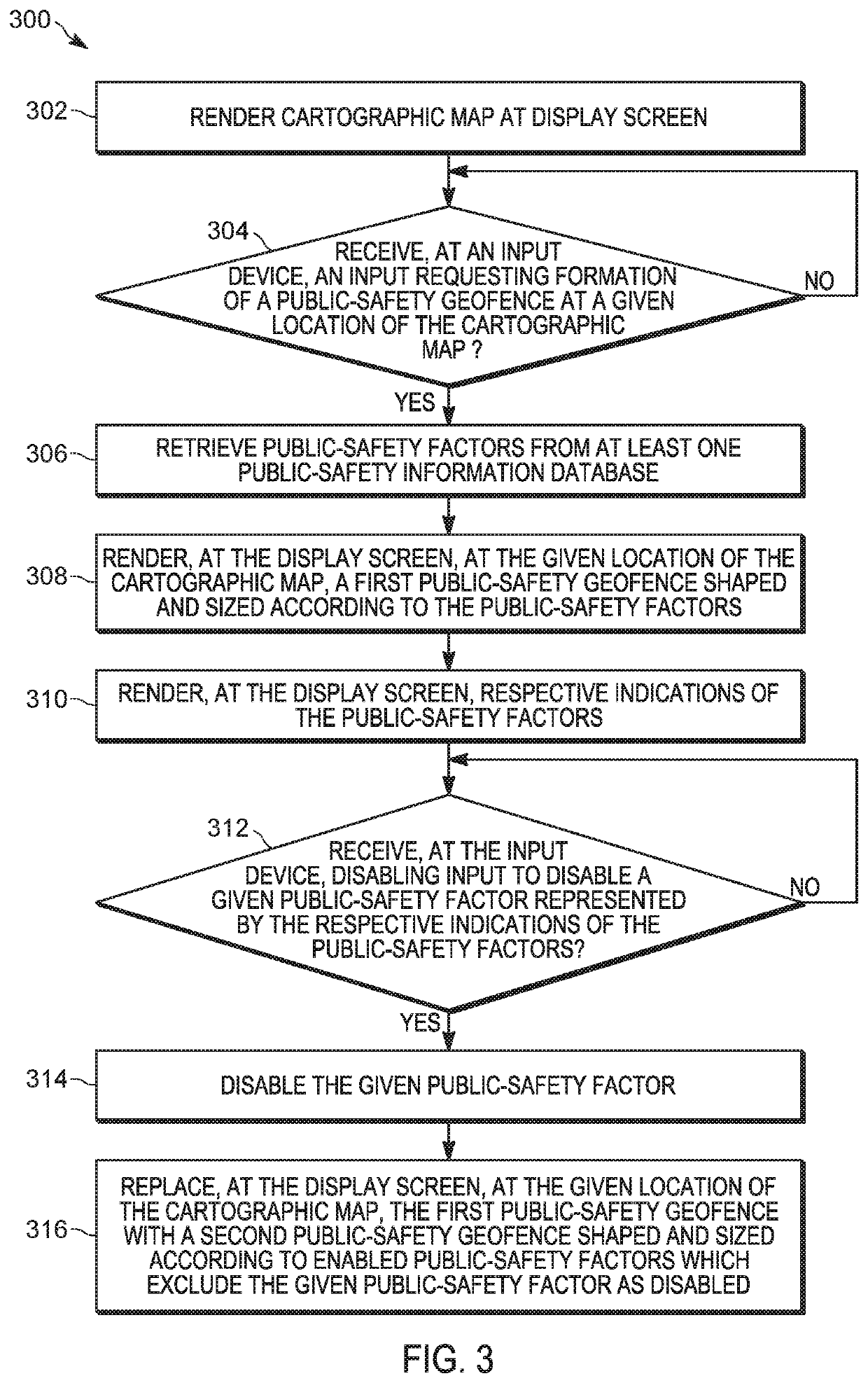
[0011]Public-safety personnel, such as dispatchers, often draw geofences relying on visual, visible map elements and manual drawing of the geofence. However, there are many cases where geofences having boundaries that are complex would be appropriate. While such geofences could be manually drawn, drawing such geofences is both time-consuming and requires significant use of input devices; when the geofences are used to dispatch public-safety responders to a public-safety incident, delays in manually drawing complex geofences may lead to delays in dispatching public-safety responders to the public-safety incident, which could lead to the incident becoming worse.
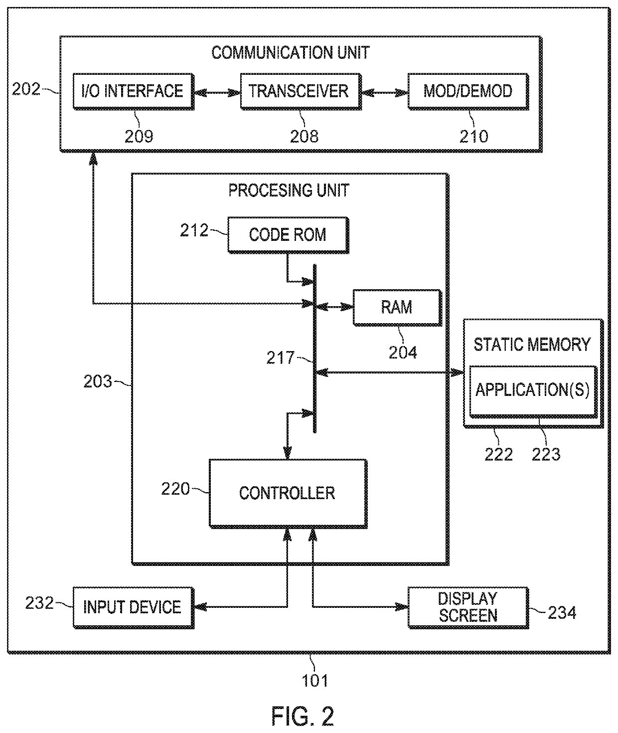
[0012]The present specification provides a method comprising: responsive to receiving, at an input device, an input requesting formation of a public-safety geofence at a given location of a cartographic map rendered at a display screen: retrieving, via an electronic device, public-safety factors from at least one public-safety ...
PUM
 Abstract
Description
Claims
Application Information
 - R&D
- Intellectual Property
- Life Sciences
- Materials
- Tech Scout
- Unparalleled Data Quality
- Higher Quality Content
- 60% Fewer Hallucinations
Browse by: Latest US Patents, China's latest patents, Technical Efficacy Thesaurus, Application Domain, Technology Topic, Popular Technical Reports.
© 2025 PatSnap. All rights reserved.Legal|Privacy policy|Modern Slavery Act Transparency Statement|Sitemap|About US| Contact US: help@patsnap.com