

Automatic identification of roadside objects for localization
a technology of automatic identification and localization, applied in the field of automatic identification of roadside objects for localization, can solve the problems of detectors taking a huge amount of development effort, training data, and additional challenges in improving accuracy, and applications require greater accuracy than befor
- Summary
- Abstract
- Description
- Claims
- Application Information
AI Technical Summary
Problems solved by technology
Method used
Image

Examples
embodiment 1
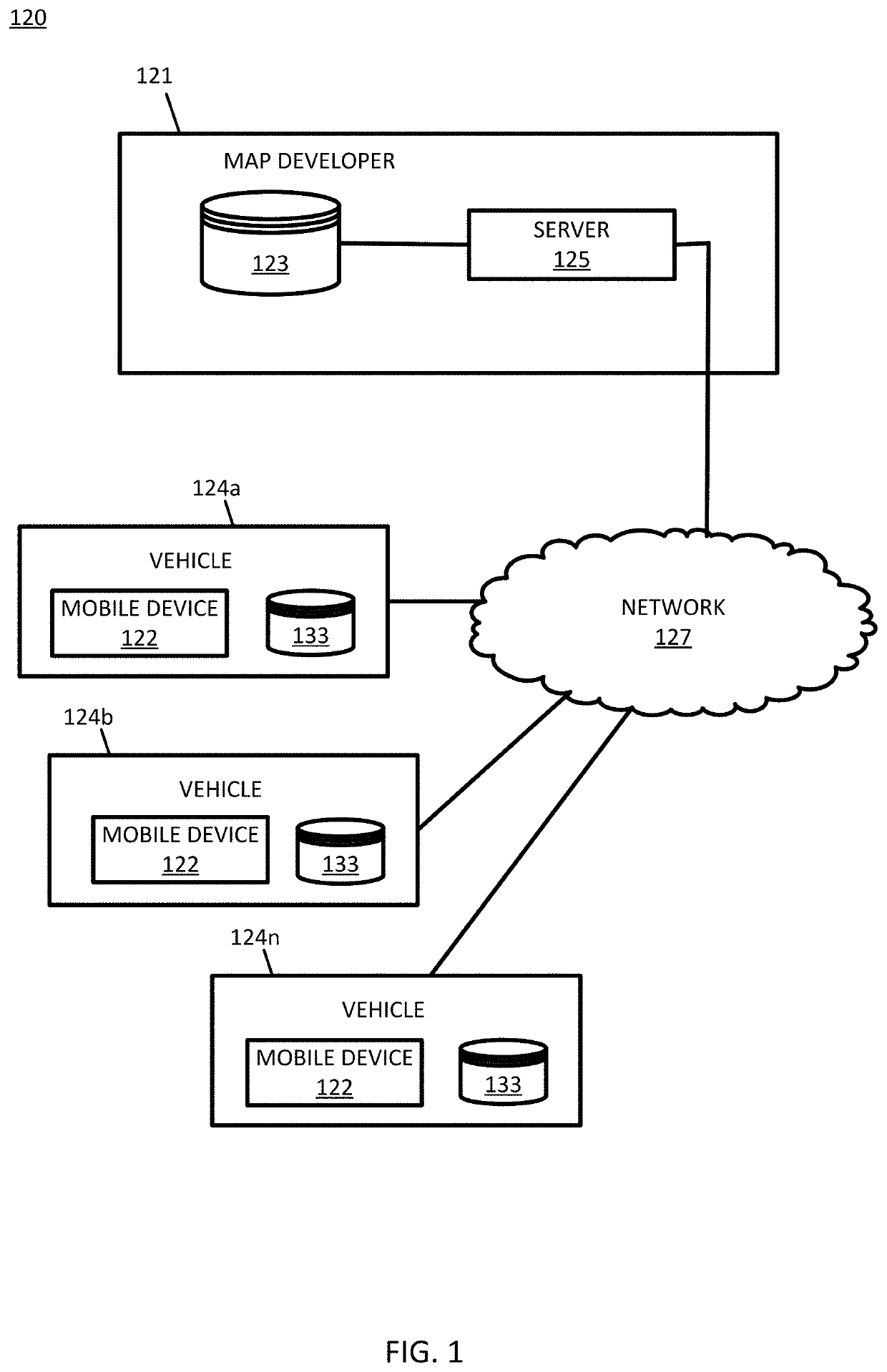
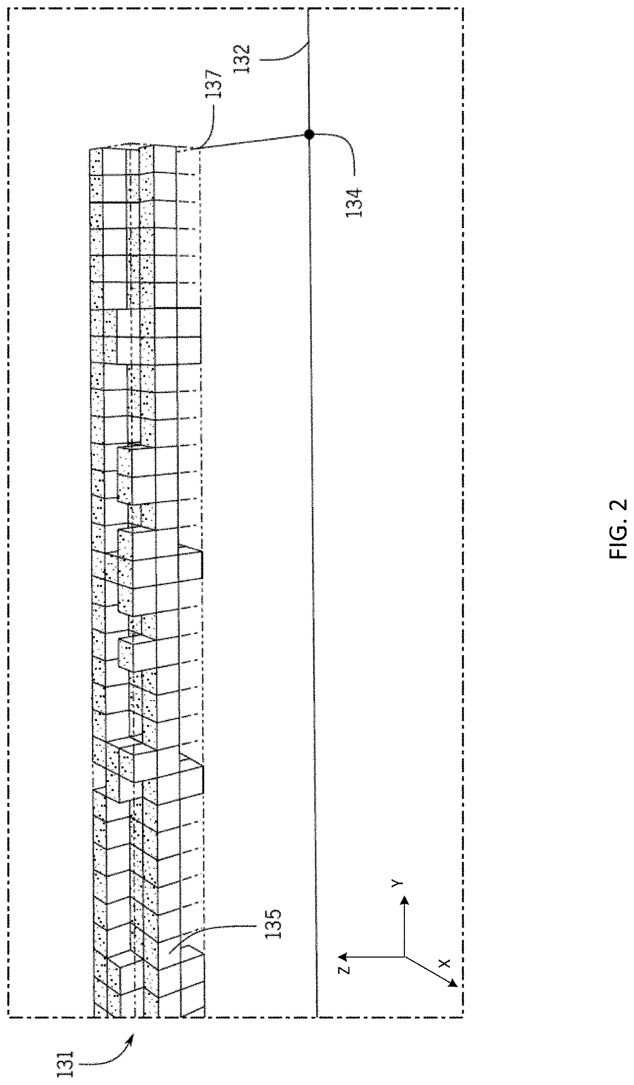
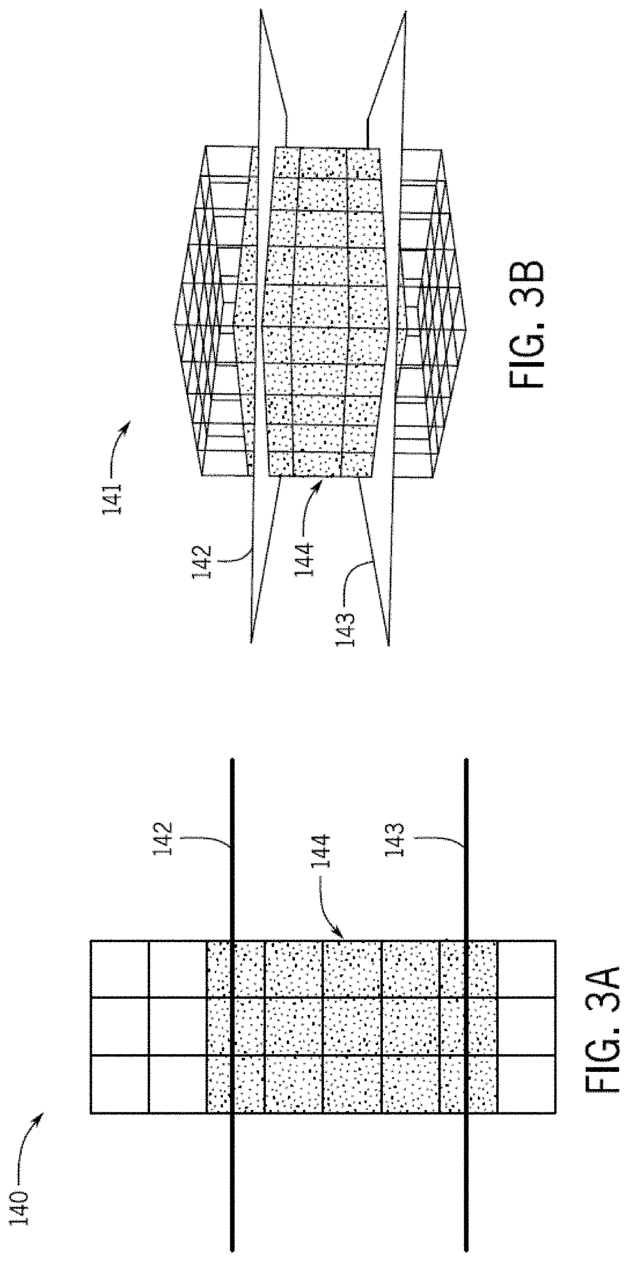
[0137] A method for automatic identification of roadside objects. The method comprising: identifying, by a processor, one or more voxel occupancy grids associated with a region of a roadway, wherein a voxel occupancy grid of the one or more voxel occupancy grids comprises a plurality of grid voxels; determining, by the processor, occupied voxels closest to the roadway for the plurality of grid voxels of the one or more voxel occupancy grids; generating, by the processor, an object polyline that connects respective pre-defined points of respective occupied voxels closest to the roadway for the one or more voxel occupancy grids; and classifying, by the processor, the generated object polyline as a roadside object.
[0138]Embodiment 2: The method of embodiment 1, wherein identifying one or more voxel occupancy grids comprises: receiving point cloud data for the region of the roadway; excluding point cloud data associated with a road surface at the region of the roadway; and identifying a...
embodiment 4
[0140] The method of any of the preceding embodiments 1 to 3, wherein extracting portions of the one or more voxel occupancy grids based on a size criterion comprises: extracting grid voxels of the one or more voxel occupancy grids based on a height of the one or more voxel occupancy grids above a road surface at the region of the roadway.
embodiment 5
[0141] The method of any of the preceding embodiments 1 to 4, further comprising: identifying a predetermined height range; determining a height above the road surface at the region of the roadway for a voxel occupancy grid; and filtering out grid voxels of the voxel occupancy grid that fall outside the predetermined height range.
PUM
 Abstract
Description
Claims
Application Information