Portable GPS map device for commercial vehicle industry

a gps map and commercial vehicle technology, applied in the field of vehicle routing systems, can solve problems such as road omission or inconvenient commercial traffi

Inactive Publication Date: 2010-03-04
TELETYPE CO INC
View PDF45 Cites 131 Cited by
  • Summary
  • Abstract
  • Description
  • Claims
  • Application Information

AI Technical Summary

Problems solved by technology

However the route is typically planned by the above vehicle information systems to provide a shortest distance or to try to provide the shortest travel time and not based on the best route as per the physical criteria and content of a vehicle.
Electronic devices that presently display moving maps inside vehicles display roads only according to their attributes such as the width of the lane or category of the street such as “Local Street” or “State Road” or “Interstate Freeway.” These roads may or may not be suitable for commercial traffic.

Method used


Image

  • Portable GPS map device for commercial vehicle industry
  • Portable GPS map device for commercial vehicle industry
  • Portable GPS map device for commercial vehicle industry

Examples


Embodiment Construction

[0038]The following description is presented to enable any person skilled in the art to make and use the invention, and is described with reference to particular embodiments.

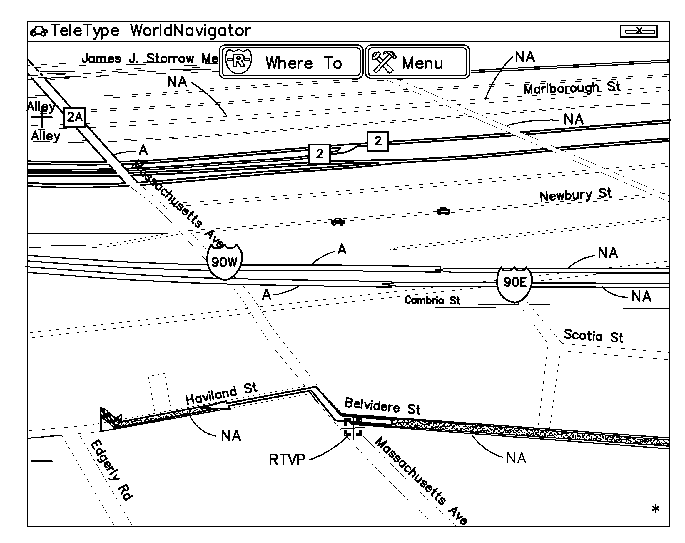
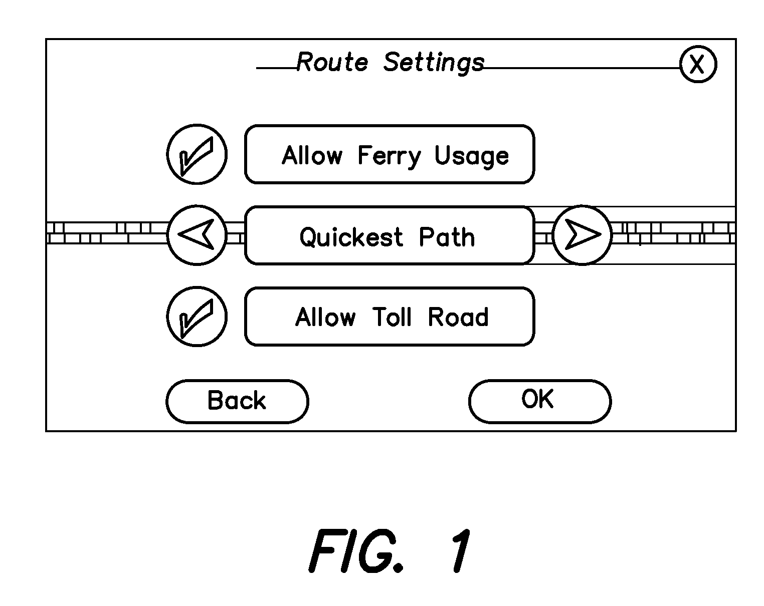
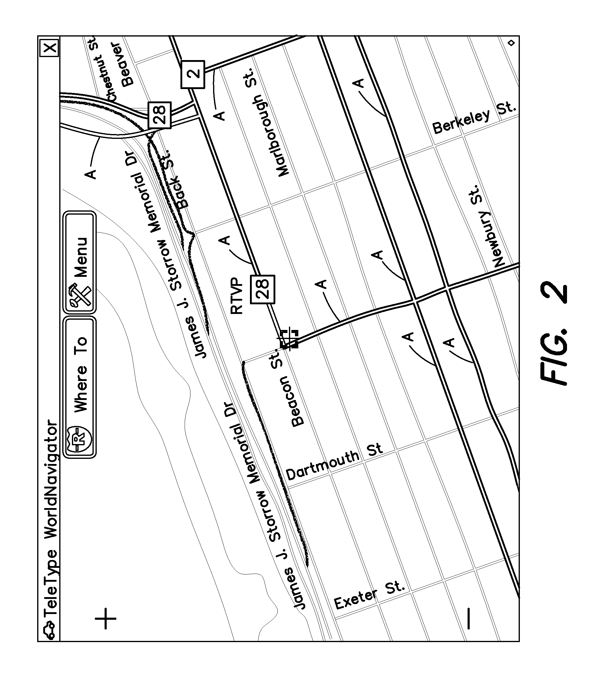
[0039]For purposes herein the term “visual identifier” means any means of rendering or displaying information such as a graphic or picture or map or figure or script or lettering or word or icon or a portion of any of the forgoing on a monitor in a manner that distinguishes the displayed information to the human eye in a readily perceptible way from other information displayed on the monitor. Examples of visual identifiers are color, texture, shading, numbering, lettering, symbols, labeling, shape, size, brightness, contrast, font, style, outlining and the like.

[0040]For purposes herein selected “characteristics or limits of the road vehicle” means the maximum, minimum and / or actual values of one or more of all of the following: height, length, width and / or weight of the vehicle, ability of the engine to drive t...


PUM


Abstract

Apparatus for determining a route for a road vehicle for a user comprising:a database of information pertaining to roads, the information comprising geographic data that includes map, location and configuration data for the roads, the information further comprising data indicative of a plurality of road characteristics or limits that pertain to the roads;a program having a first operation that compares a multiplicity of selected characteristics or limits of the road vehicle to the data indicative of the plurality of road characteristics or limits contained within the database and a second operation that computes one or more authorized road routes for the road vehicle;wherein the program includes instructions that compute one or more unauthorized road routes or portions of unauthorized road routes having road characteristics that are not complementary to or do not match the selected characteristics or limits of the road vehicle.

Description

RELATED APPLICATIONS [0001]This application is a continuation and / or continuation-in-part of and claims the benefit of priority under 35 U.S.C. Section 119 and / or 120 to U.S. patent application Ser. No. 12 / 199,815 filed Aug. 28, 2008, the disclosure of which is incorporated herein in its entirety by reference as if fully set forth herein.FIELD OF THE INVENTION [0002]The present invention relates to the field of vehicle routing systems. More particularly the invention relates to a GPS map navigation and routing device for the commercial vehicle industry that allows dynamic change of road display on a moving map device and gives route guidance and prepares road route data in a map database based on the physical criteria and content of the vehicle.BACKGROUND OF THE INVENTION [0003]The global positioning system comprises twenty-four navigational satellites in high orbit about 20,000 km about the earth. The satellites transmit precise time and position information continuously and the tr...

Claims


Application Information

Patent Timeline
Patent Type & Authority Applications(United States)
IPC IPC(8): G01C21/36
CPCG01C21/3407G06Q50/30G06Q10/047G01C21/3667
Inventor WINER, MARLEEN KARENFRIEDMAN, EDWARD
Owner TELETYPE CO INC
Why Eureka
Try Eureka