

Method for extracting planes from 3D point cloud sensor data
a sensor data and point cloud technology, applied in image analysis, image enhancement, instruments, etc., can solve problems such as general noise and redundantness
- Summary
- Abstract
- Description
- Claims
- Application Information
AI Technical Summary
Benefits of technology
Problems solved by technology
Method used
Image

Examples
Embodiment Construction
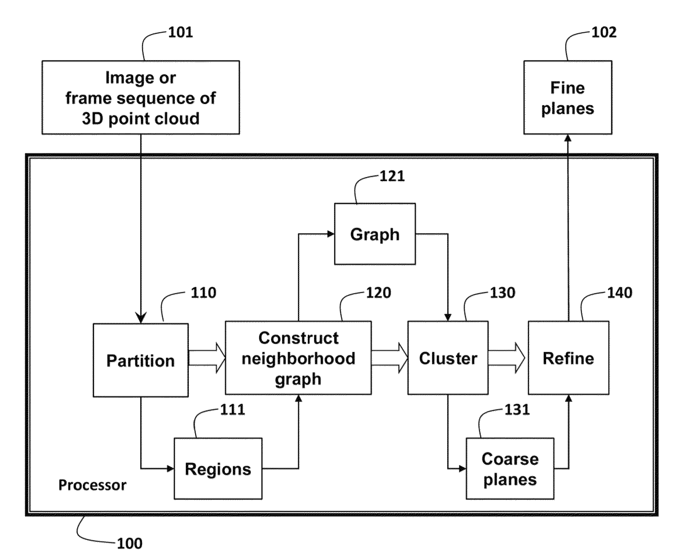
[0024]As shown in FIG. 1, the embodiments of the invention provide a method for concurrently extracting multiple planes 102 from a 3D point cloud 101 in real time. The data are acquired as an image, or a sequence of frames for real time continues operation, by a 3D sensor. Each image or frame is processed in turn.
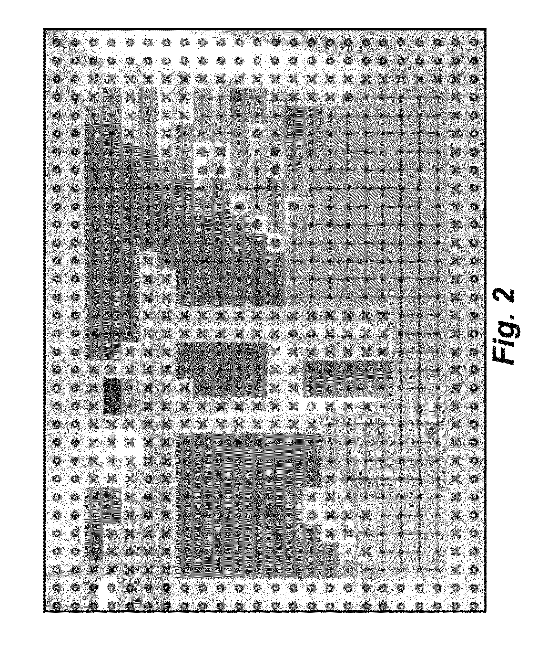
[0025]The point cloud is partitioned 110 into a set of disjoint regions 111. A selected size for the regions can vary depending on the application need, e.g., in the range of about 10 to 1000 points per region.
[0026]A graph 121 of nodes and edges is constructed 120 for the regions. The nodes represent the regions and the edges represent spatial relationships of the regions; regions that are next to each other are connected by an edge. Agglomerative hierarchical clustering (AHC) 130 is applied to the graph. At the beginning, each node is a cluster, and then pairs of clusters are merged systematically. Clusters of nodes after the clustering correspond to coarse planes 131. Th...
PUM
 Abstract
Description
Claims
Application Information