Surveying procedure and system for a high-rise structure
A technology of the highest, coordinate system, applied in the field of survey and system of high-rise structures, which can solve problems such as complex and difficult instruments
- Summary
- Abstract
- Description
- Claims
- Application Information
AI Technical Summary
Problems solved by technology
Method used
Image
Examples
Embodiment Construction
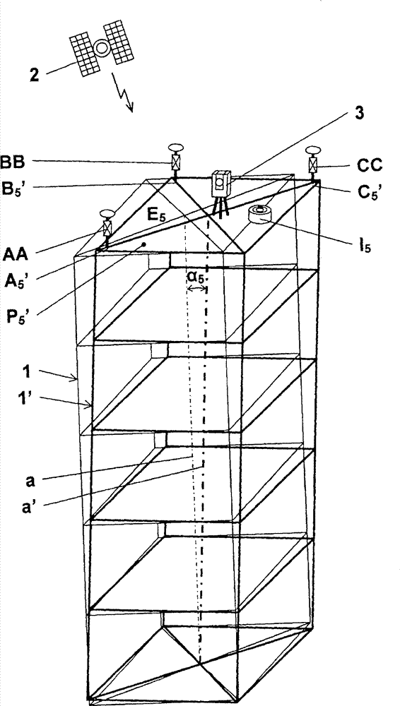
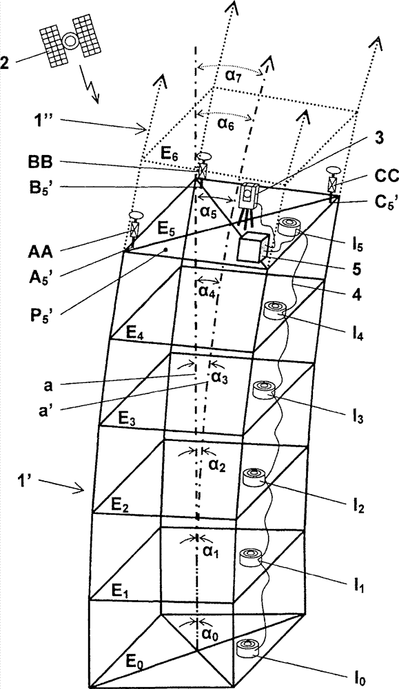
[0015] figure 1 shows a structure 1', i.e. a partially erected building, in its actual tilted state, with a straight actual line a' relative to a theoretically untilted structure 1 with an ideal axis "a", whereas figure 2 Structure 1' is shown in a tilted state with 5 The curved actual line a' simulated for the structure 1" to be built. In the following, the figure 1 and figure 2 will be put together to describe.
[0016] The invention relies on the use of at least three receivers AA, BB, CC of a satellite positioning system 2 to determine three reference points A 5 ', B 5 ', C 5 ' (more specifically, a reference point equipped with a reflector) on the current building top floor of an untilted structure 1 or a tilted structure 1' under construction located within the satellite reception area E. 5 superior. For example, each receiver AA, BB, CC is mounted on a reflector and placed at reference point A 5 ', B 5 ', C 5 ’ on the pillars. A particularly suitable satel...
PUM
 Abstract
Description
Claims
Application Information
 - R&D
- Intellectual Property
- Life Sciences
- Materials
- Tech Scout
- Unparalleled Data Quality
- Higher Quality Content
- 60% Fewer Hallucinations
Browse by: Latest US Patents, China's latest patents, Technical Efficacy Thesaurus, Application Domain, Technology Topic, Popular Technical Reports.
© 2025 PatSnap. All rights reserved.Legal|Privacy policy|Modern Slavery Act Transparency Statement|Sitemap|About US| Contact US: help@patsnap.com


